 Paddled the Hontoon Island Loop today, Sunday, September 12, 2010. Put in at Blue Springs State Park, paddled down the St. Johns River around the northern tip of Hontoon Island at Hontoon Island State Park (above), return via the Hontoon Dead River and the northernmost of three canals that connect the HDR to the St. Johns. I have not made this trip since May 1, when I wrote: "This May Day was the first day the weather forecast had a 90 degree high. The crappy time of year has arrived. The forecast will be low to mid 90's from now through October." That forecast has turned out to be correct. I think there has been 1 day below 90 degrees since May. 92 now, at 5:15.
I arrived at Blue Springs State Park a few minutes before it opened. Five or six cars in line ahead of me. The Park opened, and I drove in, parking at the best spot for launching. No, I won't tell you where that is. Gotta keep some things for myself. Grabbed the snorkel gear and camera, and headed for the "Diver Entrance". Swam up to Blue Spring.


 Dove into the Spring, then drifted down the Run. A lady swam up from the swim dock, and a kayak paddled up the Run. Other than that, I had it to myself.


I've had reports of manatees in the Run the last couple of days. None this morning. I was in the kayak at 9, and paddled up the Run to the swim dock.


 Into the St Johns River, I paddled across the River to the island opposite the French Avenue ramp. A manatee surface on the side I came from. I thought of paddling back for a closer look, but thought I may see more manatees later. Of course, I did not.


 Only 3 boats on the way to Hontoon Island State Park. I was the only paddler.
  I did not see the turkey when I took the photo of the great blue heron.
 More boats around the north tip of Hontoon Island. There are homes on this section of the St Johns, and a marina. I entered the slow flowing Hontoon Dead River, "Dead" means no current, and began paddling south.

 More floating vegetation on the surface of the HDR than I have ever seen. The result of a very wet June, followed by a hot summer. That's my guess.

 Only a few boats in the HDR. All but one observing the Slow No Wake Restriction. The law breaker, an airboat. Something I don't recall seeing before on this section of the St Johns/HDR. Thank goodness. Into the canal, which was algae covered about half the trip back to the St Johns. Fine with me, keeps motor boats out.


I took my one break of the day in the canal, landing to stand, pee, refill the water bottle and grab a sandwich. Once past Hontoon Island State Park, there are no good places to land on this trip. Unless you take a detour into Snake Creek. I did not want to paddle any further than I had to, in order to finish before the afternoon heat.
Emerging from the canal into the St Johns River, I saw the first paddlers of the day. I went past the launch area, past the mouth of Blue Springs Run to check out the area around the island for a second time.

 Back to Blue Spring State Park, where I paddle to the swim area before turning around and landing at 1:45. I had the road bike with me, to ride the paved trail just outside the Park, but it was to hot to ride. With the Sunday crowd, I almost didn't swim either. If there was a parking space in the parking lot near the swim area, I'd go in.


There was. So I got in at the diver entrance, not the metal dock you can see in the photo just before I landed, and swam up to the Spring.
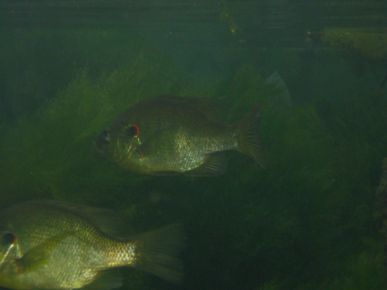


 As I swam against the current, I thought, won't see much, all the people walking have stirred up the bottom, making the water cloudy.


 So, I can hear you asking, why am I seeing so many fish?


Becasuse, I got out of the middle of the Run, where people were stirring up the bottom, ans swam along the edge, where toppled trees offer excellent habitat.
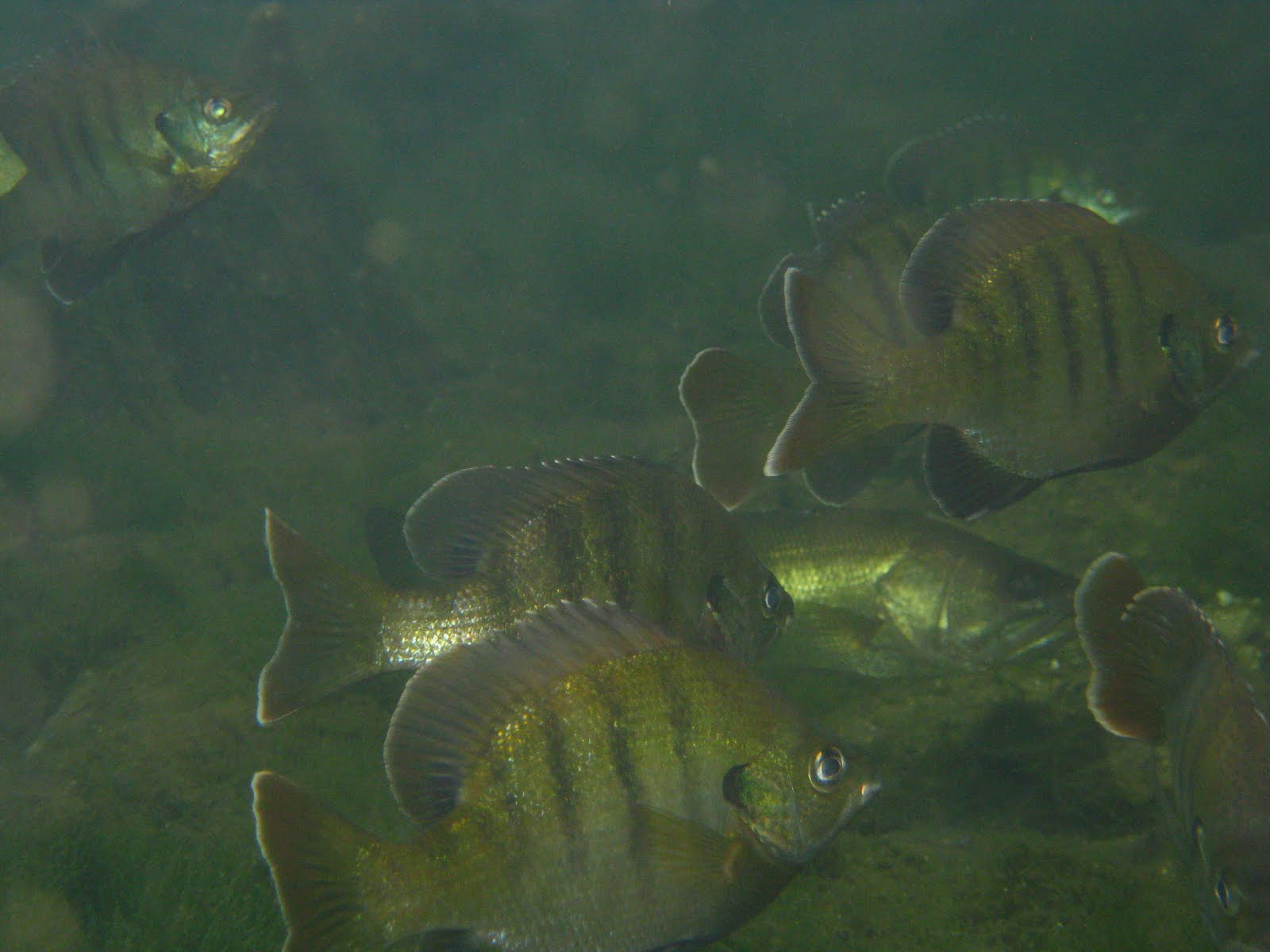


A good, cooling, cleansing snorkel with the bass, bluegills, sunfish, bowfin, mullet, tilapia, and gar.

6 comments:
So the canal was not blocked. I missed it and now cannot understand how. One of your pics looks familiar. The one that shows a tree inclined over the water. Is that the entrance of the canal? Next time will enter it from the St. John. Sorry about the manatees.
DK, if the tree you are referring to is the one between the blue heron and a great egret, that was about 40 minutes from the northernmost canal.
Dave, the picture is the second one after the Great Egret.
Man, there were tons of alligator gar. They are a blast to catch, if you're looking for a fight.
Beautiful fish pictures!
When I was there about a month ago, the southernmost canal was not accessible from HDR due to the aquatic vegetation clogging that area. I've never seen it like that...but the manatees should have plenty to eat when it gets cold.
DK, that tree is in the canal.
FB, people come from all over the world to see the gar in Blue Springs Run. Wait, that's manatees.
Joanne, thanks for the compliment, and for confirming my belief the water plants more prevalent than ever
Post a Comment