This may take a while. Used up two camera batteries. Came home, plugged the camera in the TV, to review the photos, deleting the bad ones. Plugged camera into the laptop. 219 pictures. Don't worry, I won't post all of them.
I had not made up my mind on where to paddle this morning until I was preparing to go. Narrowed it down to the Homosassa River and Salt Springs Run. I had only paddled all of Salt Springs once,
September 20, 2008.
I'm glad I returned. The launch fee at Salt Spring Marina has gone up, $5 now.
I was in the water about 10 after 9. I used my new rack, carrying the kayak on its side. Worked fine. Only problem is I can't load the kayak the night before, as it won't fit thorough the garage door. Not that it fit sitting flat. Well, it barely fit. Last week I finished the job of tearing off the bottom metal piece of the garage door.
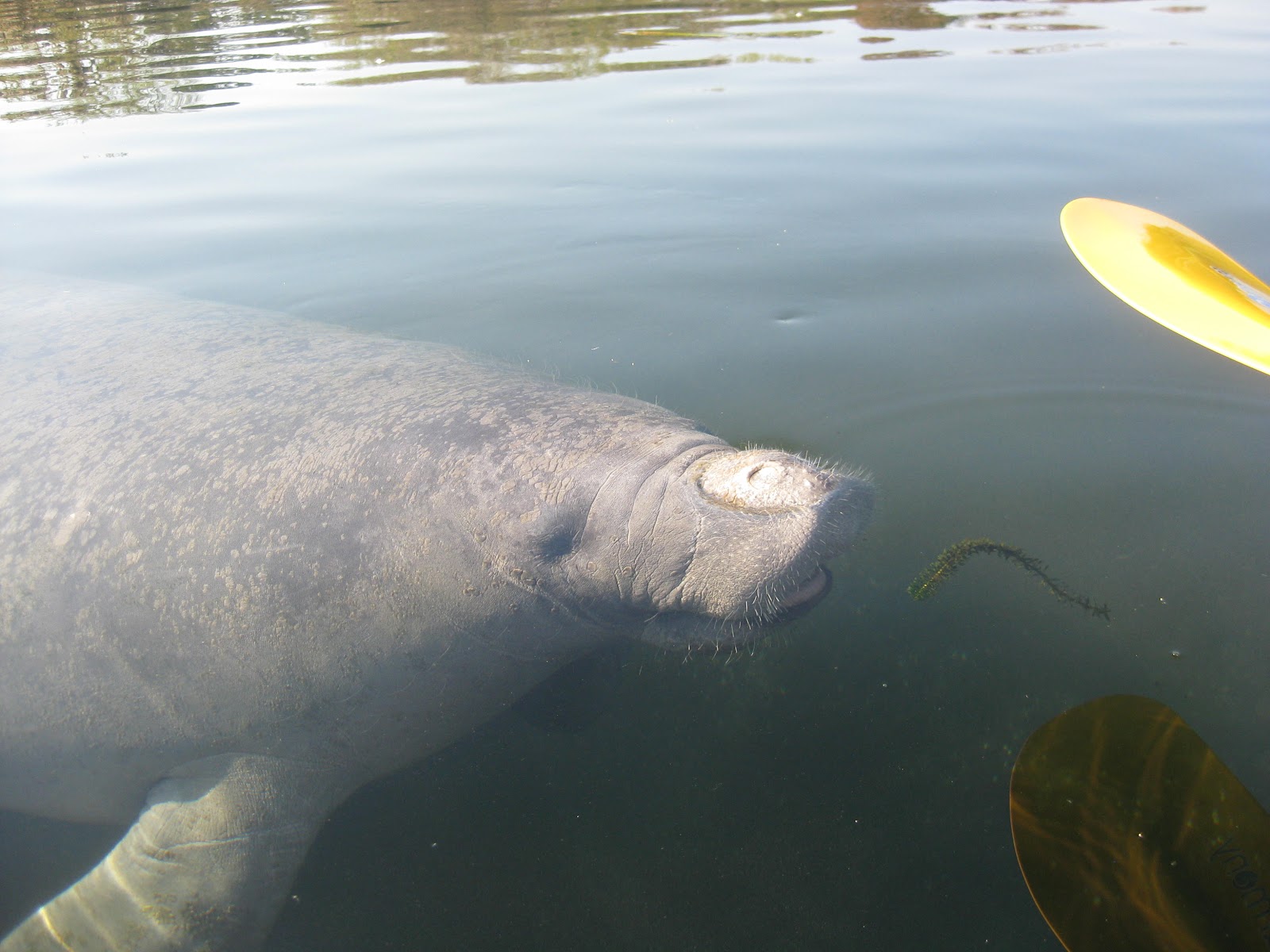
Salt Springs Marina is on the right side of the Run if you are at Salt Spring. A landing for the Salt Springs Campground is across from the Marina. I began paddling to the Springs. Never got there, as I thought I saw a manatee off the campground landing.

There were three manatees
One decided to do barrel rolls under my kayak. Or, maybe was showing of its manicure.
. I submitted to temptation, and touched one, briefly.
Not a bad start. I'm going to do a critter count, beginning with the manatees, 1.
Great egret 2, in red maple.
Anhinga 3.
Several picnic tables along a canal. I did not see fire rings, or grills, but they must be
camp sites. I know where I'll stay if I ever camp here.
Great blue heron 4.
Tri color heron 5
Green heron 6
Red shouldered hawks 7
Salt Springs Run is a broad, river-like water way. Shallow, especially near the banks. My last visit, I did not see a lot of wildlife. Which may be why I haven't been back in 3 years. Today's wildlife abundance had me regretting my absence.
Blue wing teal 8. Had to go to the
Cornell U site for the ID.
Coots 9. The first of many.
Observation platform at the end of the Salt Springs Trail. The only man-made structure down stream of the marina.
A beautiful day.79 for the high, minimal wind. The wind picked up in the afternoon, but was at my back. Perfect for the upstream paddle. But that is still a ways off.
Osprey 10.
Cormorants 11
Alligator 12
I saw two more manatees, no photos.
I told you there were a lot of coots. I saw a channel on my left and set out to explore.
Had to turn back. Don't know if the creek has a name. It does now. Dave's Creek. I paddled as far as I could, which was the tree above. Spotted turtles, a gator, a great blue heron, and this anhinga on my 25 minute detour.
More coots on Salt Springs Run.

Easy pickin's for local gators.
After my other visit to Salt Springs Run, I wrote there are two high areas on the left that are the only places to land. This trip, I saw three. Perhaps one of the three was underwater back in August 2008, when Tropical Storm Fay had rivers high throughout Central Florida. I took a break at the first at about 11:25.
It is a shell midden. See the snail shells? Still used today. I saw a homemade fire ring. Seems like an ok place to pitch a tent. Somebody did when I passed it on my way back. Camping is allowed. I cut and pasted from the Ocala National Forest website. "Dispersed camping means primitive tent camping wherever you like throughout the forest. Primary access is via our trail systems for OHV, equestrians, paddlers, and hikers. However, there are some specific restrictions to disbursed camping:
Cross country travel, damaging natural resources and blocking traffic is prohibited.
During general gun season, all camping is restricted to designated camping areas and campgrounds.
Groups large enough to impact natural resources must obtain a special use permit in advance"
Looking up Run from the midden.
The second midden. A "midden" is a Native American trash pile.
I reached Lake George at noon. Lake George is a bulge in the St Johns River. A 46,000 acre, 14 miles long, 6 miles wide, bulge. The second biggest lake in Florida. Only Lake Okeechobee is larger. The area along the shore is a Slow No Wake Zone. I came out of Salt Springs Run and turned right, south.
Ibis 13
On a windy day, this inland sea could get rough. No such problem today. The only drawback is the near shore area is shallow. Great for wading birds. Not so great for getting closeups of said waders.
Or raptors.
Snowy egret 14
Bald eagle 15. I hoped to see an eagle. I've seen them at the end of the Lake George Trail, at the Silver Glen Springs Recreation Area. Silver Glen is about 10 miles south of Salt Springs Run. I paddled for a half hour. I thought the piers in the distance could be piers that are visible from the Lake George Trail.
On second thought, and looking at a map, they may not be.
I saw a bald eagle fly through the trees. Had to be the second one of the day, as the one I saw earlier was still in its tree.
Glossy ibis 16.
The shore was so full of birds, some had to find other spots.
Back to the Run about 1 pm. The Run at the mouth is narrower than it is up stream.
You don't see it here, but there was traffic on the Run. The area from the mouth is an Idle Speed Zone. For a half mile or so. Sometimes I think Idle Speed is worse than full speed- at least from my selfish perspective. Full speed, a wake may rock you, but they are gone. Idle, you get fumes and noise for an extended period.
Not sure what the nests are. Look too small for eagles or osprey. Too big for great egrets, which, for their size, have delicate nests. Heron nests, maybe?

Closer view of the overlook at the terminus of the Salt Springs Trail
Back to the Salt Springs "Marina" at 2:50. I did not land. Had to see if the manatees were still around. From the boats gathered, four or five kayaks and canoes, and a couple power boats, I figured they were.
Even more than the 3 in the morning, at least 5, maybe 7. But more human traffic, so I landed.
The above picture should answer Dark Knights query. Below is the yak on the new rack.
I had thought of landing at the campground landing, and walking to the Springs. But, a worker in a golf cart drove up, so I landed at the Marina and drove over. I like locations that have scenic entrances. This is the way out of the Marina. Saw a deer here once.
Thirteen minutes later, I had the first picture from inside Salt Springs.
Salt Springs has several vents. So, with a group gathered at one, I could check out the others.
I snorkeled about, taking photos of mullet, bass, blue gills, sunfish and more. Wondered where the blue crabs were. Possibly a seasonal visitor? Then I saw one.
I snorkeled for 30 minutes. What a day. Manatees, and a bald eagle from the kayak. A multitude of fish, and a blue crab in the Springs. But, I was not done. Stopped at the Yearling Trail for a walk.
I had hiked the Yearling Trail after my 2008 paddle to Salt Springs Run. At the time I wrote the Trail is a guaranteed scrub jay spot. So of course, I had seen any my last several visits. A major fire in 2009 may have had something to do with it. This visit, the scrub jays were back.
The American Heritage referred to are foundations of a late 19th, early 20 century community whose inhabitants inspired "The Yearling".
I did not see any yearlings, or adult deer. But they had been around. Lots of deer scat.

I love the Internet. Not only is it a platform for Dave's Yak Tales, but I can identify sh...stuff. Looks like bobcat poop to me.
For more pleasant pics, the Florida scrub jay.
I had a pretty good day.


 There were three manatees


 I love the Internet. Not only is it a platform for Dave's Yak Tales, but I can identify sh...stuff. Looks like bobcat poop to me.
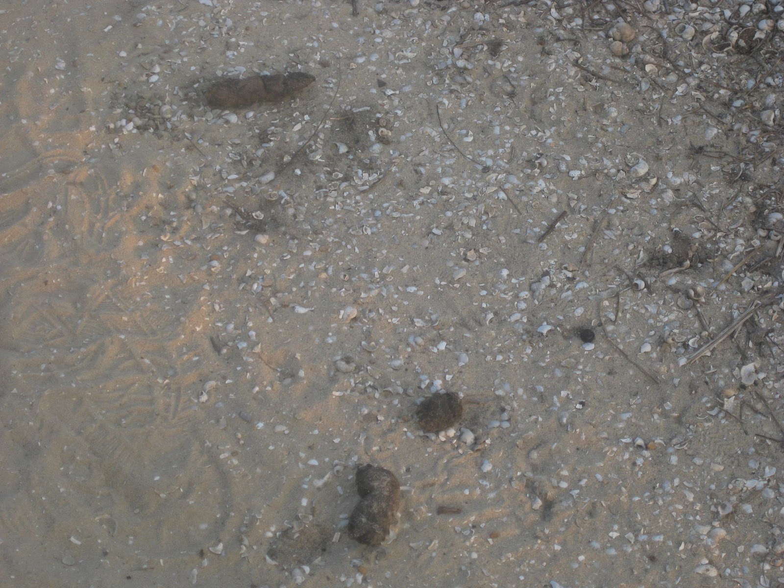


7 comments:
Nice pics. Seemed to be a sweet paddle. How is the put in there in Salt Springs? How long is the paddle to Lake George? Is there the same problem with airboats as in Juniper Creek?
Put in is flat, dirt, close to aprking lot.
About 4.5 miles.
Airboats. Too many. One.
I have swam in Salt Springs before, but never kayaked the run. I've always been told it wasn't good for kayaking because there were too many power boats.. which is usually the last thing I want to share the water with when I'm in my kayak. Did you encounter that?
Octohawk, I have heard the same thing about power boats. During my two visits, the traffic was not to bad. About a quarter of the Run, the start, and finish, is an Idle Speed Zone. In the Resume Normal Safe Operation area at least half of the boaters slowed down when they saw me. The Run is wide, so it is easy to anticipate the wakes.
I'm sure its much worse on a mid-summer Sunday afternoon, but that's telling you something you already know.
Master Dave,
I just made an attemp to create my own blog and wanted to invite you. It is a work in progress and any feedback is more than welcome. Here is the link
http://viewfrommykayak.blogspot.com/
Looking forward your Alexander Creek post.
DK
DK, you now have the first comment on your blog. These are kind of a pain in butt, I am constantly cursing blogger, but I'm afraid I've created a monster with my Tales. If I was beginning today, I think I'd just put all my photos on Facebook.
Facebook? I already did that :) but only my family can see the pics. Since we take so many pics in each trip I distribute them between Facebook and Green Wave. Facebook has the ones that wifey and I take from each other while paddling.Also, take a look at Photobucket. I place all my pics there and then you can share them in any web site.
Post a Comment