Went to Haulover Canal after work Saturday, October 22, 2011. I wrote on the prior Tale I was thinking of the Wekiva River. I also wrote I could change my mind. A marine forecast for a light chop in the Intra Coastal waters changed it. Plus, after not seeing any dolphins in Kings Bay, on the Gulf side of the Florida peninsula, perhaps I'd see one on the Atlantic side. A saw a dolphin, and two manatees, in the Indian River as I got out of the car at Haulover Canal. By the time I was in the water at 1:35, they were gone.
As usual, I set course to Mullet Head Island. Saw a manatee, or maybe two, during the one mile crossing.
The marine forecast was incorrect. A strong north wind created wavy conditions. Even on the west side of the Island, which is usually calmer. I wondered where the spoonbills were.
They, and a trio of white pelicans were on the east side.
Along with brown pelicans, cormorants and more. Can't get to close, the Island is a sanctuary. I paddled back across the Indian River, through the natural canal south of Haulover Canal.
To Bairs Cove.
I counted 15 manatees. Smart. Not me, the manatees. All in the east end of the Cove. Away from the boat ramp.
Manatees and motor boats mixing is not good for manatees, as evidenced by the scar on the manatee above.
My manatee watch ended when a dolphin swam by in the Canal. I paddled out to get a photo, all I got was a tugboat.
I followed. Saw more manatees in the Canal. Wind and current were against me. I went through the first gap on the north end of the Canal, where water was flowing through faster than I have ever seen. Choppy in the sheltered area west of Mosquito Lagoon. Which I did not enter. Exited the not so sheltered area at the easternmost gap and let the current take me back.
Back to Bairs Cove. Most of the manatees were gone.
But a dolphin, the one in the first photo, came in.
Too bad I didn't get the pic of the trout, knocked into the air, into the dolphin's mouth. Followed the dolphin into "Dolphin Cove"
I followed it through the Canal, into the Indian River.
Landed at 4:10, my day far from over. It now costs $5 to enter Blackpoint Wildlife Drive. And to use 3 boat ramps, including Bairs Cove, which I use on occasion.
http://www.fws.gov/merrittisland/FeeSummary.html An annual pass is 15. I went to find one. Maybe some of the revenue will go to filling the huge pot holes in the road on the side of the canal where I launch. Perhaps the U.S. Fish and Wildlife Service is considering doing something. There's a traffic counter-gas station dinger thing across State Road 3, and another on the dirt road on the north side of the Canal. So perhaps changes are coming. The Bairs Cove side of the Canal was paved a couple years ago.
I drove to the Playlinda Beach entrance of the Canaveral National Seashore. The booth attendant said he did not have the new annual pass, I had to go to the Apollo Beach entrance. That's where I enter when doing the Mosquito Lagoon paddle. A couple months ago a volunteer there knew nothing about the new pass. This sign really had me muttering about government inefficacy.
Don't most people visit on weekends? But my faith was restored, the Playalinda Visitor Center is open to 5 on Saturdays. Walked in at 4:59, a friendly volunteer sold me a pass, but not before going through all the exceptions that could allow me to enter without one. There's a nice boardwalk behind the Visitor Center.
Hammock, savanna, freshwater ponds, in a about a quarter mile walk. Nice intro to the Merritt Island National Wildlife Refuge.
Next stop, Blackpoint Wildlife Drive. May as well start getting my money's worth out off the annual pass.
Blue and tri colored herons from the Drive. About a mile in is a newish foot trail, the Wild Birds Unlimited Trail.
I'd say the short trail, with two overlooks, with spotting scopes, is in a good spot.
Before I began kayaking, Black Point was my favorite spot to see wildlife.
Back in the car.

Stopped at the observation tower.
Back on the ground.
There were a lot of these birds. Yellow, not bright, breast. Savanna sparrow?
From a nearby "Birds of the Marsh", info board.
The above sign is for Tom G. Who wondered what the dikes at the St. Marks National Wildlife Refuge were for. I don't know, but said they could be for mosquito control. Like at Merritt Island.
Back in the car.
Last stop, eagle nest.
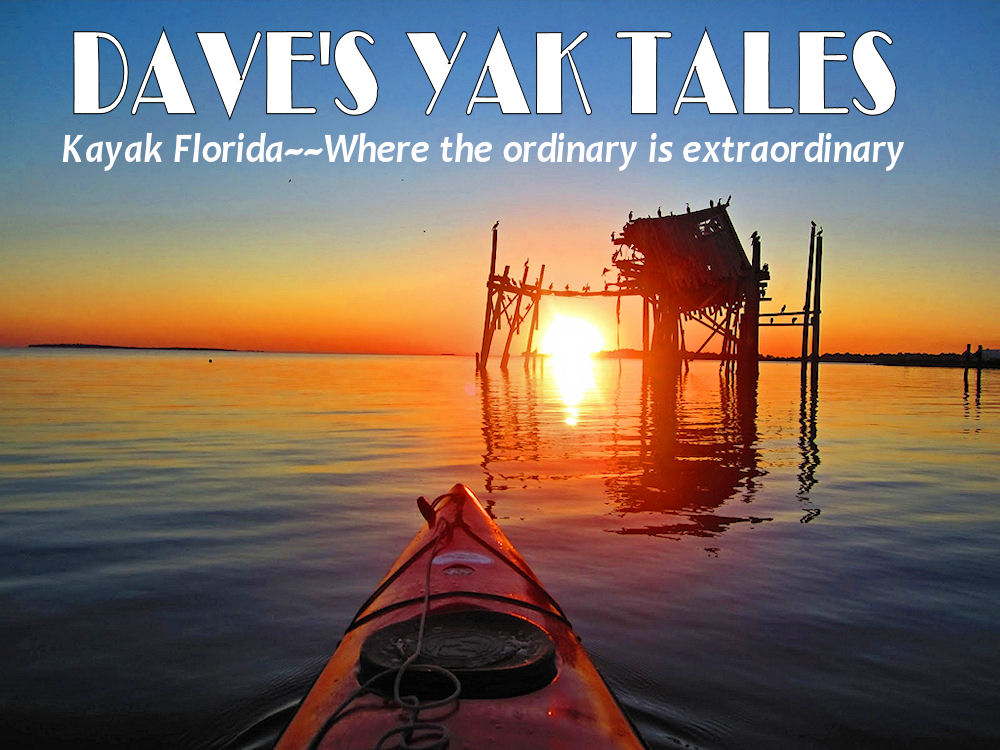
No eagles seen through the tube that points to the nest. I should stay last stop in the Refuge. Had to stop when I saw the sun setting over the Indian River.
Last pics, driving across the Max Brewer bridge.


 Stopped at the observation tower.


1 comment:
Every time I see light chop it can be assumed that would be worst than that.
Back to the pics, I do like your sunset pics. Amazing!!!!
Post a Comment