
After breakfast in the small unit--good thing we are good friends, and both have 6 siblings, so we know how to carve out an indvidual space in tight quarters - actualy, we ate on the patio-, we headed to the Wacissa River. In the water shortly after 10.


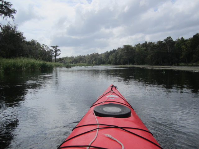

Paddled into pretty good wind. And current. Stopped for a break at a spot on the left side at 12:45. Wonder where the trail goes.


Back to the Wacissa River.


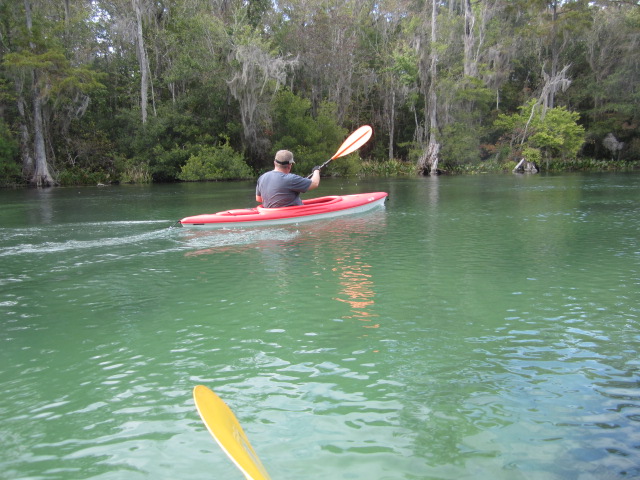
Landed at 2:15. Next stop, the Wakulla River. Not the State Park, but just outside. Putting in at the Wakulla County Road 365 bridge. I had noticed a "Manatee Area" sign on Friday.
In the water at 3:30. Can't go far up River.


Well, you could duck under the barbed wire on the bottom of the fence. We did not.


We drifted down the River, pushed by the Spring flow. And wind. 30 minutes down stream, I spotted a satellite tagged manatee.


The manatees swam up the River. We paddled the same way. The trio disappeared as a noisy group, some paddling, some on rafts, some swimming, came down the Wakulla River.

How canoes were invented. Lightning hollowing out trees.


We landed at 4:40. Next stop, St. Marks National Wildlife Refuge. Entrance south of US 98, $5 fee per car. If memory serves, the paved road through the Refuge is 7 miles long. Passing waterways, canals and wide open spaces.


Tom asked me what the canals are for. I assume, like the Merritt Island Wildlife Refuge, they are for mosquito control. So far, I've been unable to find the answer.


The Refuge road is Lighthouse Road. For an obvious reason. It ends at the St. Marks Lighthouse. Built between 1829 and 1831. Moved to its present site in 1843 due to erosion, it has remained there despite hurricanes and the Civil War, when retreating Confederates attempted to blow it up. I'm a lighthouse fan. They combine history, architecture and great views. I think it fascinating that the St. Marks Lighthouse is still close to the water. In other locations, St. Augustine comes to mind, years of beach buildup have "moved" the towers inland.


The above views aren't from the lighthouse. Not open to the public. They are from a nearby observation platform.
The Refuge has many trails, including a short one near the lighthouse.


Lighthouse views from an oyster bar that extends into Apalachee Bay.


This is great Refuge. Spoonies, a lighthouse, and a bald eagle. And we didn't even get into the water. I think I'll be back.
And when I too, I'll have dinner again at Ouzts Too Oyster Bar On Highway 98, as the song goes. Turn left coming out of the Refuge. I turned right, and we were almost to Highway 14, the road to Ecofina River Park when Tom said, "Dave....." On the other hand, if we had arrived earlier we might not have seen the deer and fox on 14 as we drove back after dinner. Half a dozen steamed oysters for me. Raw for Tom. Always was a risk taker. We both had the grouper, shrimp, and oyster basket.
4 comments:
How did you like the Wascissa? We are only about 100 miles from there and thought about kayaking it.
Lori, if I were that close, I'd paddle it, and the Wakaulla 4,5,6 times a year.
We have paddled the Wakaulla and really liked it, we put in at TNT Rental, and paddled up and then back. We had the best time. On the Wascissa where did you put in?
The park just of County Road 59
Post a Comment