Quite a day at the National Seahore, Saturday, sunrise to sunset. Lots of photos to share. After deleting most of the bad ones, and I get a lot of empty water pics while photoing dolphins, and there were five dolphin encounters, I downloaded 278 pictures. Don't worry, you won't see all 278.
I woke up, looked at the clock, 5:30. Hmm, if I get going I may see the sunrise over the Atlantic.
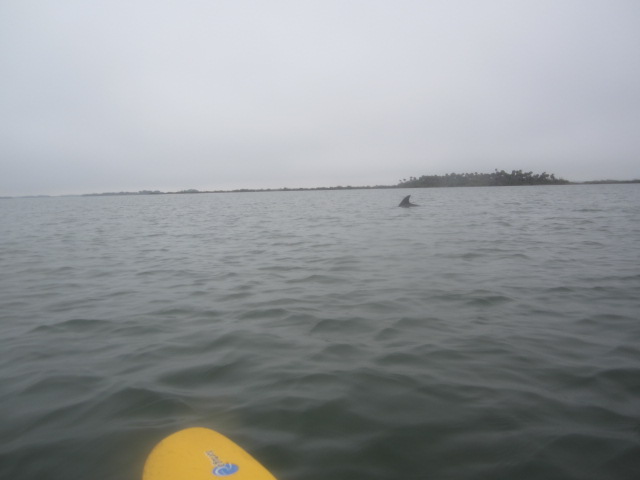
I might have made it if the kayak were already on the car. But, it was drizzling when I got home Friday, so I dd not put the kayak on the roof ahead of time. I stopped at Bethune Park, a mile from the Seashore Entrance, to see what I could see. The black dot in the above photo is a dolphin. There were several off the beach. This is the only dolphin photo.
Cloudy at 7:10. Too bad I did not check my camera setting before taking the pictures. Into the Seashore, I thought the sun looked nice coming over the saw palmettos.
I saw I had the camera set on low light. The above was taken in super vivid. At least I think it was. Not very vivid.
Just one car in the Lot 7 when got underway at 7:30. Lot 7 is the long time designated canoe/kayak launch site. But, as I drove past Lot 6, I saw it now has a paddler icon.
I paddled towards Orange Island. Here's a
map. Go to page two. Lot 7 is just to the north of Eldora on the map. Subsequent events made me wish I had a better map.
Both of the Orange Island primitive campsites were occupied. By motor boat campers. Wimps. As these sites are closest to the kayak launch, if I were in charge, they'd be held for paddlers only, and only released to power boats late in the day if no paddler made a reservation.
I paddled among and around the islands between Orange Island and Shipyard Island. I hoped to access the Shipyard Island Canoe Trail from the south. Here's a
Map. Which I had with me. But when I say I paddled around the islands, I paddled around the islands, and wound up looking at the Number 2 campsite. So, I paddled into the main channel. I would enter Shipyard Island at the marked entrance, across from the boat ramp.
Hooded merganser. Female.
Cormorant. Undetermined gender.
More cormorants.
Blue heron. Juvenile.
This dolphin was off the Number 2 campsite. If not for going around in circles, I would not have seen it.
As I approached Turtle Mound, I thought, the fishing has been good here for eons. Why else would the largest shell midden in the US be where it is?
http://volusia.org/history/turtle.htmFishing must still be good as I often see both humans and dolphins trying their luck here.
Into the Shipyard Island Trail.
Open area in the Island.
Belted kingfisher. My plan was not to do the entire trail, but exit near the two campsites on the northwest side of the island, and if empty, take a break. I've done it before, without benefit of a map. This time, having a map only confused me. Only I did not think so at the time. I had the second map I've linked with me. At Marker 14, I thought this would be the place to exit. So, I did.
Landed at what I thought was one of the Shipyard Island campsites. It was empty, so I stopped for lunch. Had been recently occupied, the ashes sizzled when I poured water on the fire.
Another site used by power boaters, not paddlers. I could tell by the marks in the sand. Several lines, a boat bottom, not the single line a canoe or kayak would have made. I got back in the kayak, the plan to paddle across the channel and see if any manatees were hanging out at Bethune Park. The Mosquito Lagoon side of the same Park I stopped at to start the day.
To my surprise, I did not see private homes and the Bethune Park dock, but the Eldora State House. I had paddled from Shipyard Island back to Orange Island without realizing it. Now I know it must have been the channel near Marker 17, I paddled out of, not the channel at Marker 14 when I stopped at the Shipyard Camosites. Never trust me for navigation.
You could say my sense of direction is "loony"
Two loons, just the third I've seen in Florida. Saw one my last Ceder Key trip. A Yak Tales reader told me what it was. As mentioned in that Tale, I had only seen breeding loons in August, in Wisconsin. Black heads and red eyes.
I was paddling towards Castle Windy, a shell mound, thinking it had not been a great day for wildlife.
When I saw another dolphin and these ducks. I do not know what they are. But I'm sure my crack staff does.
So much for not much wildlife. I spent the next 45 minutes dolphin watching.
There were five in all. Working the channel that goes out from Eldora and the main channel. An intersection, where, I suppose, lots of fish travel back and forth.
I had one close encounter. A boat went by, the dolphins submerged. The wake subsided, and two dolphins surfaced, right in front of me. An eye to eye encounter, a powerful slap of the tail, got me wet, and they dove under the kayak. I got a picture of the bow.
I could have taken more photos, but it was time to take a break.
Coming into land at Castle Windy. The white behind the picnic table is mostly thousands of discarded oyster shells.
After landing I made the 1/2 mile transcontinental trip. That's what I like to call the Lagoon to Ocean trek.
My favorite short walk. Especially when the mosquitoes aren't out.
Canaveral National Seashore has 24 miles of pristine beach. Add on NASA lands to the south, and is 47 miles of sand without a condo in sight.
Back to Lagoon. Note to self. Bring shoes if I plan to walk. Sunday, I found out I tore a spot of skin off my left heel walking in wet aqua sox. At the picnic table, on of the group, who, I had seen coming to the Lagoon as I headed to the Ocean, asked why I didn't think they'd take my kayak. I pointed to his Wisconsin hat and said I knew I could trust him. He is from Marshfield.
Have I written it was a beautiful day?
Male and female mergansers.
Landed at 2:55, almost 7 and a half hours after I shoved off. Of course, my day was not done. Hopped on the bike.
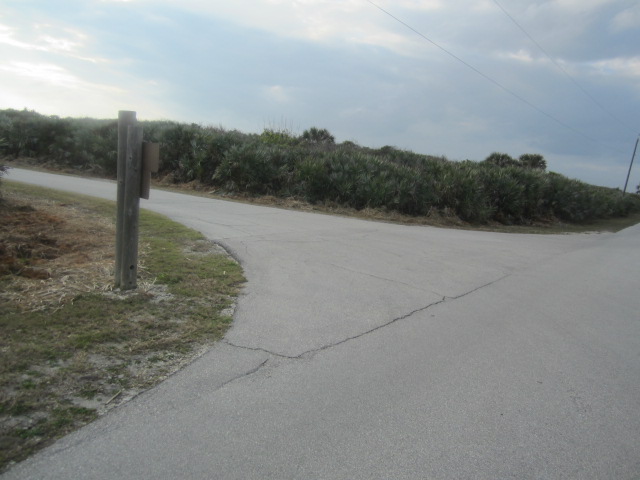
Eldora Road.
Don't know if the main road has a name.
Call it "Seashore Way"
Or, "Lagoon Way".
The road ends, the beach continues for miles if you want to walk.
Boat launch on the Lagoon side. I need to try it same time.
A couple was reading a plaque on the boardwalk about brown pelicans, as they flew over head. "Looks like the four o'clock show is a few minutes late"
Back on the bike.
I decided to stop in each beach parking lot and see what I could see.
Back on the bike.
Road kill.
Next stop.
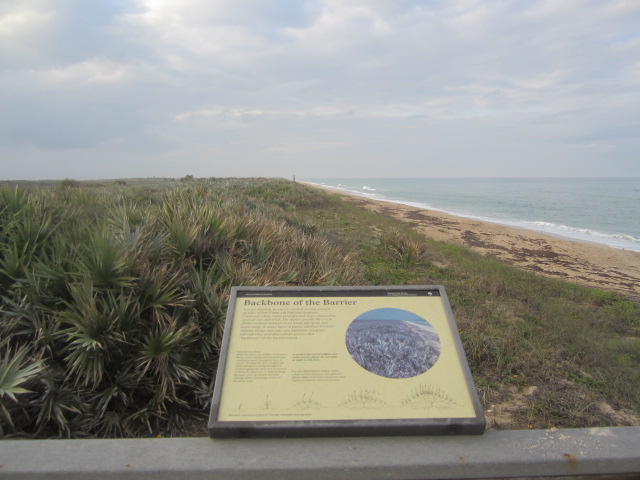
Ruddy turnstone. How do I know?
Handy dandy informational plaque, of course
The folks on the board walk were looking at something in the water. I did not see what until I was walking up the ramp. Dolphins.
Several. No good photos, too far away. I do not recall seeing dolphins in the Atlantic before today. If I did, it was BI. Before Internet. As if after, I could probably find a email about it.
Eldora Road is one way, so I had to make a final beach stop.
Back on the bike.
I mentioned the paddler icon at Lot 6.
One person, must be the kayak launch.
Lot 6 launch site.
A short trail leads from parking lot to the Lagoon. Can't park next to the water as at Lot 7.
Angler going to try his luck. A short bike to Lot 7 and my car
Two paddler icon, Lot 7 must be the canoe launch.
.
A final picture before leaving the National Seashore.
I may have left the National Seashore, but I stayed on Mosquito Lagoon. Stopped at J.B.'s Fish Camp, a mile down A1A. The place was packed. But, I got the best seat in the house. End of the bar.
I could watch the crowd in the dining room.
Observe the food prep area.
View the patio and setting sun. J.B.'s website advertises $5 a dozen steam crabs and oysters in February. I was going to have both, but was told they were not available. So, I had seafood gumbo.
And a half pound of rock shrimp.
The gumbo was not warm. But, was quickly replaced. Another advantage of sitting at the bar. Midway through the meal, I got off my stool to catch the sunset.
And so ends another day in the Sunshine State.


6 comments:
What a day !! WoW.
Awesome! We weenied out this weekend fearing the wind would be a factor.
Dave, how long does it generally take to paddle form the ranger station/put in to the East Winds and County Line (sites 13, 14) at the CNS?
Mike, I have no idea. Let me guess. You are camping, arriving after work, and want to know if you can make it before sunset. My advice, do a test run, before heading out with all your gear.
Well sort of Dave, yes. Thanks for the input. How early do you think i should start the test run? By the way, finishing off the day at JB's - good choice!
Tomorrow. Or, whenever the opportunity arises. I am suggesting, just go to the Seashore, paddle to the campsite, and time how long it takes. Then you will know. Add time for a fully loaded vessel. Of course, if you are traveling from afar, that may not be feasible.
Post a Comment