


.

This bird as not with the group. I had left my secret spot. This one was across from an overlook on Wildlife Drive.

Just past the overlook, the narrow passage opens up. In winter, the water level is kept low, for wading migrants. Lots of birds, but hard to paddle, especially at low tide. This time of year, plenty of water, fewer birds. But, I've seen spoonbills on islands in the "lake" on past summer paddles. So, off I went.


Always nice to find what I am looking for,.


There were more birds than 'just" spoonbills.


Great blue heron and great egret eluded my lens.


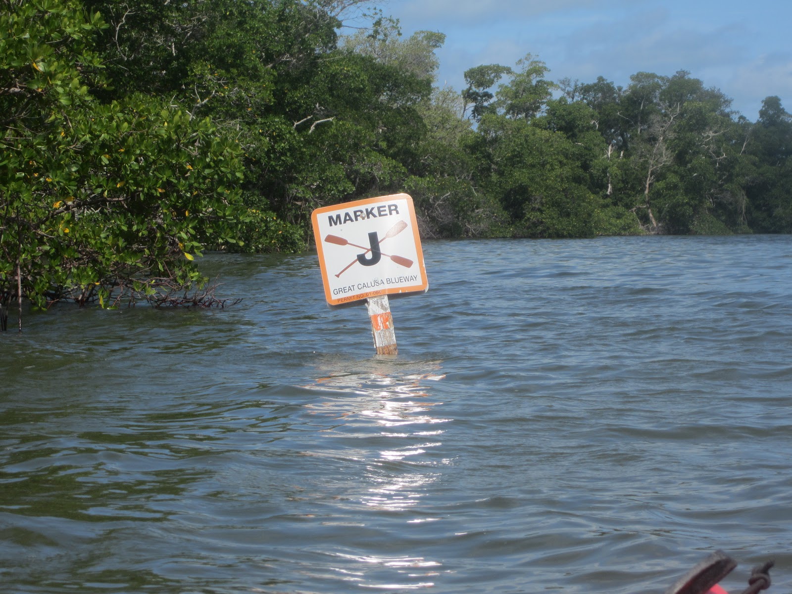
I wonder what this sign says?

What I want it to say.
I made it my turnaround point.


The lone spoonbill was still posing for whoever came out on the overlook.

Good Sunday morning. A few more photos as I drink my coffee. Had waffles and a hardboiled egg and OJ as my free breakfast. Brought two slices of bread to the room to make a sandwich for later. And an apple and a muffin. Breakfast and lunch included in the rack rate.

In the winter the flow is out of this water control structure. Today, it was in. The road is on top. No entry to the other side. I went against the current into a series of "lakes" and then, San Carlos Bay.

"Lake" My term. Don't know what the correct term is. bay, perhaps.

This is San Carlos Bay. Or is it Pine Island sound? My maps are in the car.


Coffee cup is empty. Time to pack and yak. Causeway to Commodore Creek is the plan. See ya tonight.
I'm home from the whirlwind Sanibel weekend. 9pm I;ll see how much more I can post before bed time. I was in Pine Island Sound.

Here's the Map that's available at the entrance station when you pay your 5 bucks.
I paddled past the end of the Wulfert Keys Trail (a powerline right of way) into the narrow waterway to to west.


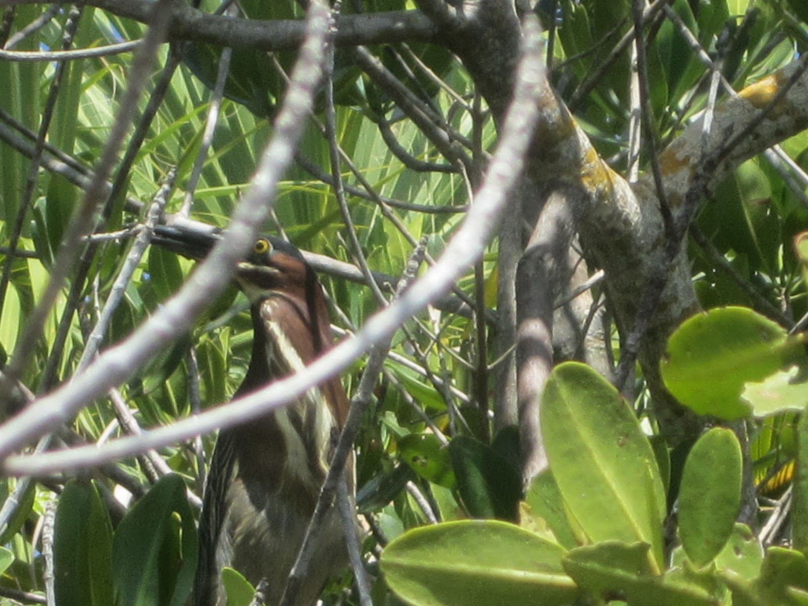
I'm guessing this clump of twigs is a nest. Green heron, maybe, from the birds in the area.


To protect seagrass. Careful paddling here at low tide.

Fort Myers, the Causeway, Woodring Point, left to right.


Landed at 12:15. The rock pile is a new feature. Erosion control? Narrowing the launch/landing site.

3/4 tank and 230 miles. Worth every one. I left Ding Darling, and came back in. Too fat and lazy to bike the entire Wildlife Drive, 8 mile round trip. Instead, I biked off road, on the Indigo Trail.

It was National Trails Day. The $1 hiker/biker fee waived. The signs were for the "Animal Olympics" Photos and facts, and a challenge at each post. Such as, a bobcat can ponce X feet, with the distance measured out.

Red bellied woodpecker. The trail is 2 miles, and ends just before the observation tower. I walked to the tower, as Wildlife Drive is one way for bikes, and cars.


Had I not been walking I may have missed this


Horseshoe crabs.

Tower views.

I tried to spot the spoonbills on the island with the tower's scope. Did not see them.


Cross Dike. Links Wildlife Drive to the Indigo Trail.


Mangrove buckeye. ID thanks to a "Butterflies of Florida" poster in the Visitor Center.

Out and back, a ride just over 4 miles.
At the Visitor Center I commented to a volunteer about the relatively low crowd at the Refuge. Thinking the weekend after a holiday weekend, with some kids still in school, would be the last uncrowded weekend until after Labor Day. (and before Christmas). The response, it was a normal summer days attendance.
Next stop, my brother's condo. Not inside, as it was rented, but for a place to park. Lighthouse from the boardwalk to the beach.

The volunteer at the Refuge said the beach would be busy.


Three dolphins, two large, one small, were off the fishing pier. They remained in the area the entire time I was there.


Sea turtle nest. If the hatchlings come out while the tidal pool is still there, they may think. "This is the Gulf? BFD"


Ruddy turnstone

Sandpiper

What about guests?

I was tempted, but did not jump in.

It was hot, but not 100. This must be in direct sun.
I left, 6.5 miles across the Causeway to LaQuinta


A nearby Publix provided sustenance, a Cuban sandwich. Although, the store needs to get its act together. I was asked what bread I wanted. A silly question. Cuban bread. They did not have any. Then why are Cuban sandwiches on the menu board? We make them as subs, Cubans are in the "Grab and Go" section. But those aren't pressed. Those are on Cuban bread, why not have the bread on the counter? I had Italian bread. Pressed, of course. I could have got a premade one, and asked it to be pressed, but those were smaller. Took the sandwich back to the room, plan to eat half, than half after the sunset paddle. Somehow, the whole thing disappeared.

As I wrote on Saturday (its Monday as I compose)Bunche Beach is 1.3 miles due south of the LaQuinta. A first visit, so I don't know if low tide is always this low. The moon was full.

No way was I launching at the designated spot.

Looks very muddy at low tide.
A beach wedding was just ending as I was getting ready. "You are all invited to the Olive Garden on 41" That did not excite the guests to rush to the cars so I could get a better space. Parking is on both sides of the road, $1 and hour. I put $1.75 in and was off at 7:15.

Bridge to Fort Myers Beach to the east.

Sanibel bridge to the west. I paddled that way.


Hard to get good photos with the tide so far out. From a distance, I thought I saw people paddle boarding. Good balance on the rough water. No paddle? Not boarding. Walking on the very broad exposed beach.

Choppy for bay, I thought. Then I realized I was here the San Carlos Bay, Matanzas Pass, and Gulf of Mexico merge, the Gulf beyond Point Ybel. aka Lighthouse Point.

The moon.


Now, the moment you've all been waiting for. No, not that moment, the Tale is not quite over.


Sunset moment(s)


A future ad for the Great Calusa Blueway. Needs a kayak.

Bird and kayak? Sorry, can't do it.


Sunny side

Moony side

After a day like this, I feel good inside.
3 comments:
So it was you. Saw a vehicle like yours, with a red yak on top and a bike in the back just when entering Periwinkle Way. You were heading South, to the lighthouse I assume. What a coincidence!!!
So I guessed correcty when you mentioned going some place on your "bucket list". And I wrote "You an Mary will enjoy Sanibel"
Yes you did. I will be kayaking probably on alternate days. Not sure if will go out tomorrow because my back is still bothering me. Today visited the lighthouse with the family.
Post a Comment