This Tale will have a lot of osprey in cypress tree photos. But only one with ospreys, so it gets the coveted lead off position.
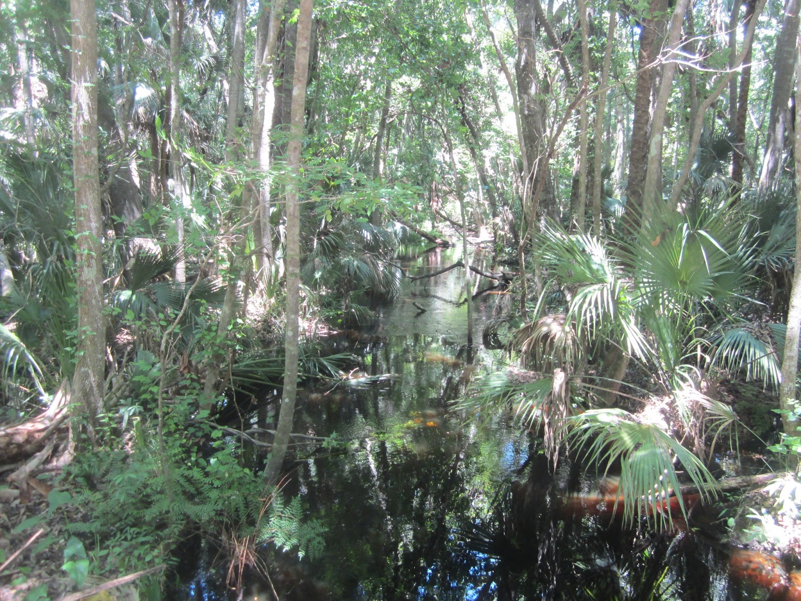
Under way at 9:40. The Blackwater Creek's edge is about 20 feet from the drop off. If you have been to the Lake Norris Conservation Area, you know what I am talking about. Footing is firm, until you have to step in the Creek. The short paddle up the Creek to Lake Norris can be challenging. There a lot of downed trees. I hoped recent rain would let me float over most of them. I was able to, with a few bumps here and there. Runoff has the Creek dark, so I often did not see a log until I hit it.
I had to get out once. In the above photo I am on a log. The two logs above prevented me from taking a perpendicular approach to it, and pushing myself over. I did not want to get sideways, and tip. So, I got out, found as firm a footing in the mud as I could, pulled the yak over, re entered, and as on my way.
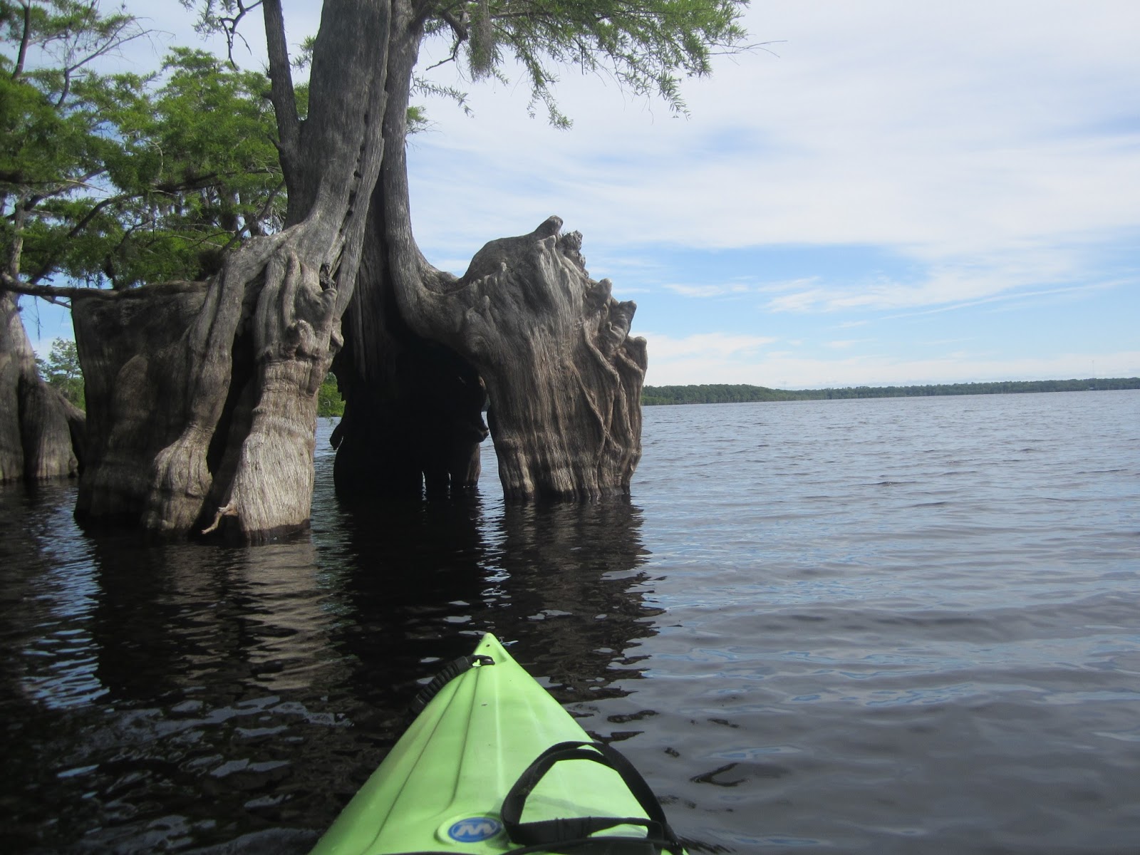
The reward, Lake Norris.
Home to cypress trees
And osprey nests.
Vulture. From past experience, I hoped to soon see nesting great egrets. They are gone. Checking the Yak Tale archives, I have seen the nests in February and March. It seems early May is too late.
I had made a left when I entered the lake. An armada of kayakers paddled towards me. More than I have ever seen on Lake Norris. All to cool to wear lifejackets. Or sign it at the launch. After them, just one other person. An angler competing with the ospreys.
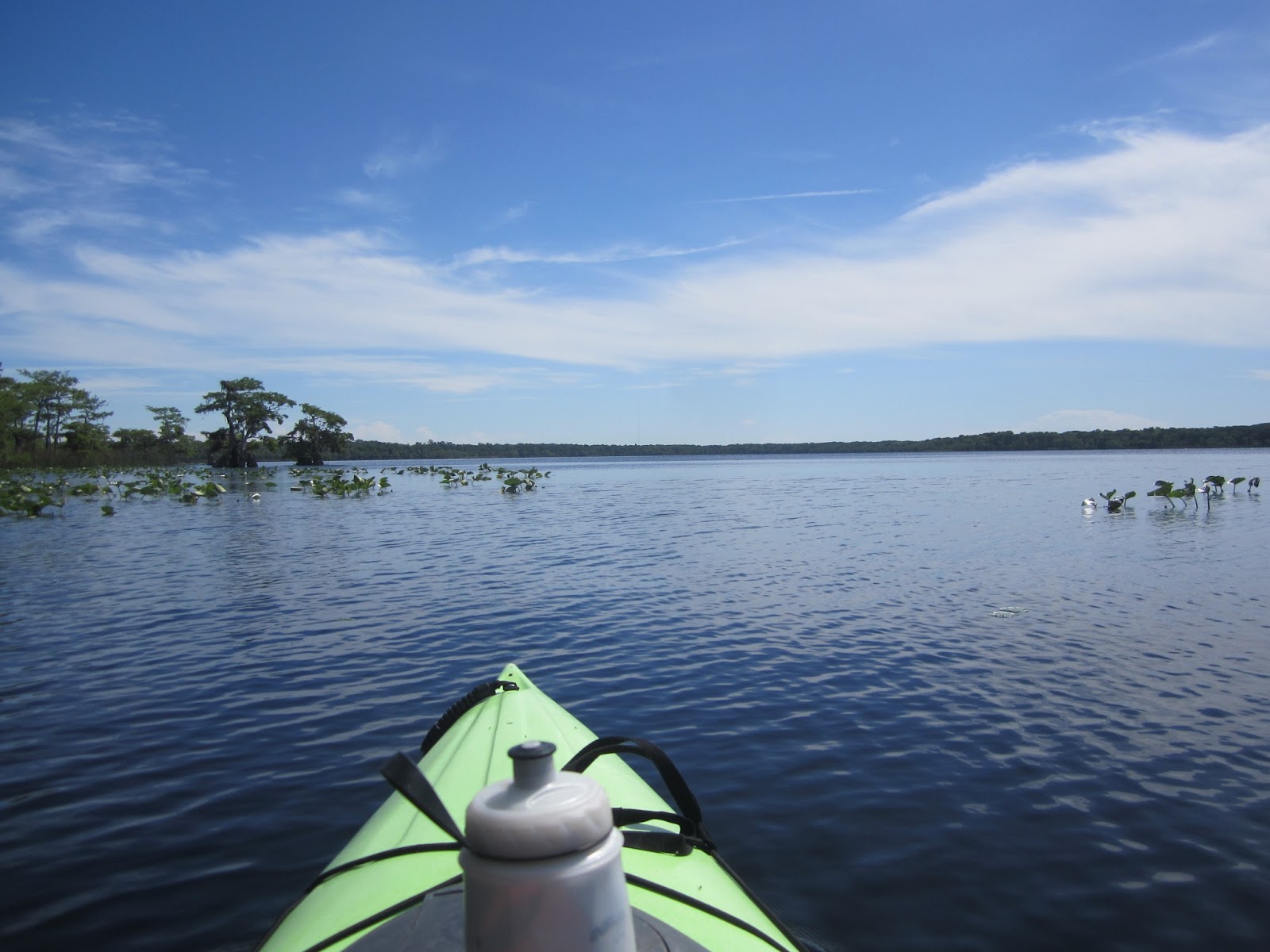
Lake Norris is large. I paddled only a quarter of its edge before turning back at 11:40
Lake Norris is mostly wild shoreline. There 10 or so houses on one side of the Lake, a Boy Scout Camp on the other. 90 percent of the shore is pine trees. The cypress form a second "shoreline"
It was windy. The cypress trees provide a natural windbreak
One of three great egrets that flew over the entrance to Blackwater Creek . Saw a prothonotary warbler, unable to get a photo.
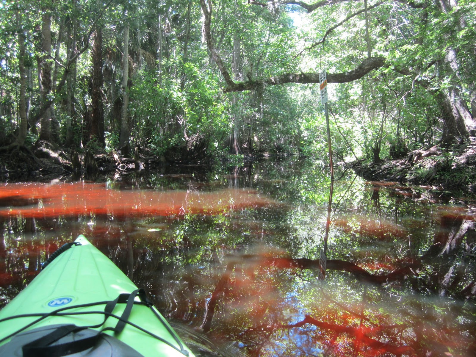
Back in the Creek
The Creek is marked with orange blazes. Not needed when the Creek is within its bank, like today. May come in handy when the Creek spills into the swamp. But, why orange? The same color as the Florida Trail.
The sign is across from the launch. It was 1:20. I kept paddling to see how far I could go.
Still passable
Still passable
Not passable. 10 minutes down Creek from the launch.
Landed at 1:40
Went for a walk.
I miss the old wooden gate. Close it, or else the cows might escape. You know what happens when cows leave the pasture?
They get pasteurized.
I did not walk far. One of my brothers was in town, I told him I'd meet him late in the afternoon.
Dedicated photographer.
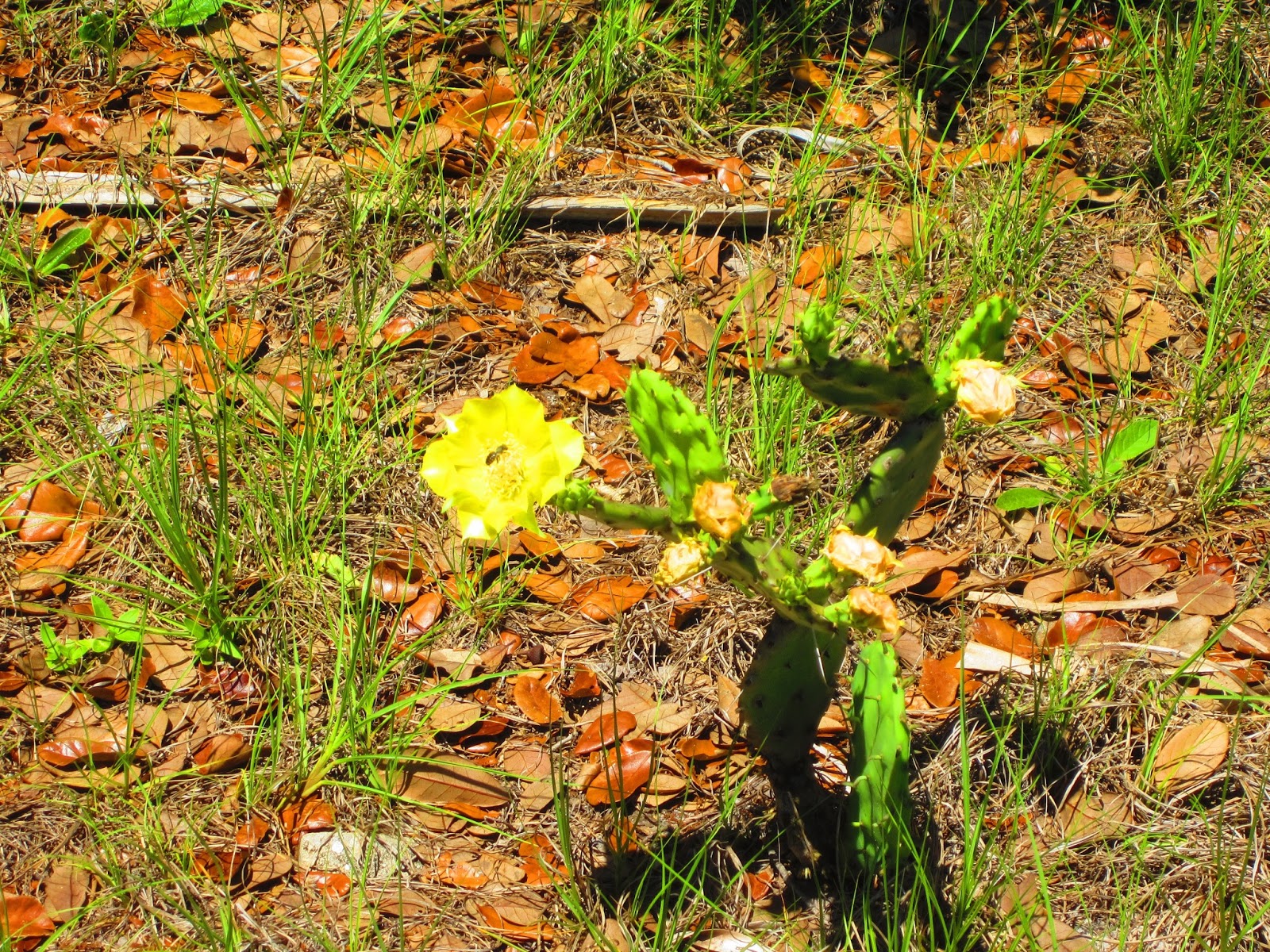
Cactus flowers
A 30 minute walk. I hoped my other kayak would be ready. It was not. Picked it up tonight, Monday. $150.00 repair. Went home, a quick shower, than went to International Drive to see my brother. We went to the Cocoa Beach Pier.
As a guy who can't stand up on a paddle board, I was very impressed by the gentleman above. Able to paddle over the breakers, then ride them back in. By paddling, was able to get out quicker and farther than the conventional surfers.
There are five places to get a drink on the Pier. 4 have food. We only stopped at 3.
https://www.facebook.com/photo.php?v=4822234677715
Same vid, for those of you not on FB
http://www.youtube.com/watch?v=e8bHpSpKt2Q&feature=em-upload_owner
And so ends this Tale. Hopefully it answered the questions a certain someone who could not wait for the entire Tale was asking. ;)


3 comments:
Was the launch area muddy? Were there any trees down across the creek?
I haven't been there in ages.
Where is the Lake Norris paddle run put in? I have never done that one. Do you put in at Black Water Creek and just go up stream?
Lake Norris Conservation Area, Lake Norris Road.
Post a Comment