

After a 57.5 mile drive I was on the beach at 6:58. Bethune Beach, just north of the Canaveral National Seashore.


I turned around at 8:20, after looking at the entrance of the Shipyard Island Paddling Trail. Still closed.


Posing on docks. The great egret at J.B.'s Fish Camp\

I like the open air, thatched roof addition better than the 3 story monolith.


And, manatees


Landed at 9:35. Put the battery charger in an outlet on the side of the restrooms, and took my time loading. And, toured the Park.


Manatees from the street


Saw more manatees from the dock. But,I places to go. Namely, Katies' Landing, on the Wekiva River
Left Bethune Park at 10:20. 48 mile drive, the Wekiva just shy of 11:30.


Went down River


I use my former favorite paddle. Much lighter than what I currently use, but water gets inside. I added duct tape, Wednesday, and it seemed to work. Not so today. Every 5 minutes, or less, I had to take the two-piece paddle apart and drain it. Or, just have it leak on my lap. Pain in the butt.


Did not see alligators. Heard some. Babies, chirping.


Irritated by the dripping paddle, and motorboats, I turned back just past the illegal campsite. It was 12:40


Lots of lovebugs meet their maker. Photo on the windy 9 mile drive from US 19, just south of Crystal River, to Ozello. Time, 4:20. Would have arrived sooner had I driven slower. Pulled over on 44.
Allegedly going 72 in a 60mph one. Got a warning.


Peck's Old Port Cove.


Chowder, $2.93


The boat ramp is less than half a mile away


Off the beaten path, unspoiled


This would be a good place to have a chart. Or, go on guided tour. Countless islands, channels, and oyster bars. Adding to the confusion, the boat ramp is on the east side of an island. On Florida's west coast.


Located the boat ramp, and set out to another channel


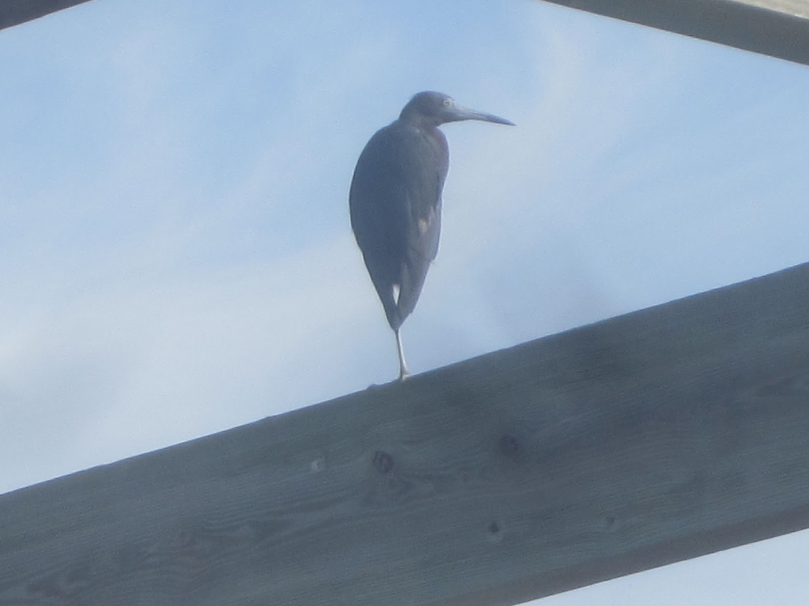
Shell mound. Houses are on top.


A trio


I followed them as they hunted.


Landed at 7:25


Sunset, 7:42. A great day. Sunrise, sunset, a warning for 12 mph over-another 50 yards, I would have been 17 over. Thought it would a good night to buy a Powerball ticket. Did not win.
Next Ozello trip, I need to stop at the Island Outpost. Like many small town Florida bars it has a "Biker Friendly" sign. That would be motorcycles. But, that is just half the sign. "Biker and Kayaker Friendly" "$1 beer".
I shall return.
5 comments:
You have a lot of energy. Paddling at the CNS and then the Lower Wekiva, and I have the feeling (based on the post title) you were not done yet.
I have nothing better to do.
I still have that light weight paddle for sale.
What a day! Will you do it again soon?
"Will you do it again soon?"
Maybe. But ending somewhere with a view of the sun setting over open water. Fort De Soto comes to mind.
Joanne, I would love to buy the paddle, but, I just bought a new watertight case. The on/off and shutter buttons had broken off the old one. Still watertight, and still able to take pictures by pulling up and pushing down the small metal posts once covered by the buttons. Have to pull up because they stay depressed unless I grab them and pull back up. Which is a pain while paddling, and worse while snorkeling. So, after a month or so, I just ordered a new one. $159.74 on Canon's website. Best deal I could find.
Post a Comment