Sunday, December 28, 2008

Rock Springs Run

I finished 2008 with a splash at Rock Springs Run, Sunday, December 28, 2008. This is also where I paddled on New Year's Day, 2008,so it is appropriate the last paddle of the year was here. Not to mention about another 20. I'll have to do a count. 12-30-08-just counted. 24 Rock Springs Run trips in 2008.


I launched at 9:00, steam rising. Didn't see that on Sanibel.


A lot of algae on the surface of the lagoon, as you can see.


Here is a bird I did not see at Sanibel, a limpkin.


Nor did I see any deer in southwest Florida,


This big eared yearling, near its mother, was one of three deer I saw. I saw as many paddlers, all in kayaks as I went up Run for two hours, turning back where the woods close in again past Big Buck camp- where folks were camping. The other two sites were empty. I took advantage, stopping at the Indian Mound site. This is where the splash mentioned at the beginning of the Tale took place.


Instead of putting the yak back in the water, getting in the water myself, and stepping in, I decided to push straight off the rooted bank. That way I wouldn't get wet. Wrong. I balanced on the edge, pushed off, the bow went under a bit, as expected, I expected it to come up, it did not, and I rolled over. Either to steep an angle, or the stern caught a root, or both. Looking at the bright side, it cleaned the salt water out of the yak from Sanibel, and was refreshing on a hot 80 degree day.


As I gathered my things and dried off, renters from Kings Landing began to go by. I would not have seen them had I launched successfully. Perhaps 6 canoes.


As I neared the Wekiva, there were more people than I have ever seen paddling up the Run. Inspired by Dave's Yak Tales ?


The blue heron was back on the Wekiva. I thought of paddling downstream, but three boats were ahead, so I decided to call it a day. Besides, it was my fifth straight day on the water, which beats my record of four. The way back to Wekiwa Springs was more crowded than I have ever seen it.


Somehow, an alligator hidden in the vegetation ignored the hubbub. I would had missed it but a kayker pointed it out to some canoers- "behind the blue heron and turtles".


Surprisingly, I did not see any gators down at Sanibel.


Nor could I enjoy a refreshing dip in a spring in southwest Florida.


For some reason, there were not many people in the Spring. Fine with me. The water was clear, more pan fish than usual in the pool.

I had a great time the past two weeks exploring places old and new near Sanibel, but is is nice to have Wekiwa Springs, the Wekiva River and Rock Springs Run close to home.

See ya next year.

Saturday, December 27, 2008

Ding Darling

Saturday, December 27, 2008. My ninth Sanibel area paddle in 15 days. I was thinking of doing this paddle Friday, and Cayo Costa today. But as I lay in bed Thursday night I recalled that Wildlife Drive is closed on Fridays. It worked out for the best. After packing, locking up the condo, having a locksmith saw the lock off my bike- the key would not work- dropping of the keys, stopping at the bank, joining the excess after Christmas traffic, yikes ! I wasn't in the water until near 11:00. No way would I had made it to Cayo Costa and back before dark.


I searched for spoonbills. they were not in the two places I saw so many my last visit. I did see a few, but far off, binocular range. Very few pictures of any birds.


Perhaps I was not looking deep enough into the mangroves.


The osprey with the big fish is a good one, here's second view.

I spent about 4 hours in the mangrove tunnels, bayous, bays and open water of Pine Island Sound. 4 days of paddling in and near Sanibel Island, nine trips in two weeks. I counted my blessings as I drove back to Winter Park. I guess those blessings were used up as I listened to the Seminoles chop my Badgers in the Champs Sports Bowl.
The Green Wave Forum did not have a Ding Darling report. Until now.

Cayo Costa State Park

Day Three of my Christmas weekend, Sanibel paddling adventure took me to Cayo Costa State Park on December 26, 2008. Six miles to get to this island State Park from Pine Island. The southern tip of Pine Island is about two miles from Sanibel across San Carlos Bay. By car, over the Sanibel Causeway to Fort Myers, over the Calosshatchee to Cape Coral, northwest through Cape Coral, across Matlacha Pass through the town of the same name to the hamlet of Pineland near the northern tip of Pine Island, is considerably longer. Almost an hour's drive.


My Great Calusa Blueway, Pine Island Sound-Matlacha Pass map indicated two launching spots. Pineland Marina, and the Pine Island Land Monument. I found the latter, which had five cars parked. I had the sixth, and final spot. The monument is this adjacent Calusa mound.


It was low tide. Egrets fed in the mud flats as I walked a long way before the yak would float with me inside. The map showed the route to Cayo Costa running west by northwest between several islands. One, Useppa, I knew had large homes, so that would help distinguish it from the others when I came to it. The map showed a boating channel and something labeled " Wilson's Cut" I saw what appeared to be a tour boat headed west, what appeared to be a marina, likely the Pineland Marina, and an artificial channel- riprap leading to the Marina. That had to be Wilson's Cut. I was on my way, pushed by a 10-15 mile east wind.


Wildlife viewing opportunities are not as good in open water as they are on a narrow creek. The exception was the flock of white pelicans. At low tide many areas of Pine Island Sound were quite low. After I passed Useppa Island, I saw another island with a few structures and a large metal water holding tank. Was this Cayo Costa ? Seeing no brown Florida State Park sign, I gathered it was not and kept paddling. Oyster bars surrounded this island. On the return paddle, the bars were under water.


In one shallow section, a dorsal fin. Not a dolphin. Could it have been a small shark ?


I arrived at Cayo Costa about 11:45. Vultures and this osprey perched in the trees of this long island, located between North Captiva Island and Boca Grande Pass.


It was still a long paddle up a long bay, Pelican Bay, to the Park's landing area. I saw a group of paddlers coming out of a channel south of the distant docks. Was there a paddle craft landing there ? I went in, there was a dock on small cove, but it was private. So, on to the Park docks.


I talked to the other paddlers, one said he saw an alligator in the cove. Later a ranger told me a manatee lives in the cove. I wonder if that is what the paddler really saw, just the nostrils out of the water, perhaps.


I took this path/road to the beach. A section closer to the Pine Sound side has a many live oaks. It seemed like a very long walk. I noticed some areas where the the dirt on the side of the trail was disturbed. Looked like hog rooting to me. When the park tram, a tractor towing a long trailer with benches along the sides stopped, I gladly hopped on, joining the other passenger. The trail is not even a mile, .9 mile according to a sign I noticed later at the landing area. A second sign warned against feeding wild animals as "raccoons and feral pigs can carry disease" I was correct about the hogs.


The unspoiled Gulf beach is worth the trip. There are tent camping site just off the beach and a few "rustic cabins". They look like trailers to me.


I began the walk back, this time a Park worker in golf/utility cart asked if I wanted a lift. Sure. Nothing beats the service at an isolated, only accessible by water, Park.


I had lunch in the shade of a sea grape tree, then was back in the water. I though of revisiting the cove to see if I could spot a manatee or gator, but that would require extra paddling and now the east wind was in my face. I wondered how the same forecast that predicted 10-15 mile winds could also have a light chop. In addition to the seas, I kept a eye out for power boats, using caution when crossing boat channels. Still, I failed to time one crossing correctly, coming to close to a wake and took on a bit water over the bow.


The wind was perfect for sailors.


I landed at 4:30, no long walk across mud flats to the car now. It took three hours to make the crossing.


Lovers Key, Mound Key


December 25, 2008, Christmas Day, I visited two Florida State Parks, Lovers Key and Mound Key. Lovers Key is located just southeast of Estero Island (Fort Myers Beach). Lovers is one of four islands that comprise the Park. 2.5 miles of Gulf beach, Estero Bay on the other side, natural and man made water trails in between make Lovers Key a prime paddling location. The main man made watercourse wends through Black Island. In the 1960's and 70's a canal was dredged to prepare the island for development. Fortunately for me, the islands were not developed, but were purchased by the State of Florida in 1983. The canal is now a 5 mile, 2.5 out and back, paddling trail.


I was in the water shortly before 9 am. Dirt parking area, canoes and kayaks stacked nearby. Kiosk with a large trail map and individual maps for the taking.


Snowy egrets and a long billed curlew fed. The latter makes its debut on Dave's Yak Tales. Two rosette spoonbills flew overhead. The trail map indicated an exit from the trail at the 0.75

mile point. This leads to a shallow cove. Cross the cove, paddle under Estero Blvd., and you are in Estero Bay. I had a second map, the Estero Bay section of the Lee County Paddling Trail, aka, The Great Calusa Blueway. Looking at the map, Mound Key, is north east of Lovers Key, with a group of islands in between. I paddled to what I thought was the largest of the islands. A dolphin hunted in Big Carlos Pass. I paddled on, to the left, condos, docks and hotels, on my right a green island oasis. Out of the channel I entered a wide bay, dotted with islands. This did not seem right. I unfolded the map, and figured I had gone the wrong way. My problem was assuming the bridge over Big Carlos Pass ran from north to south. Wrong. It orients east to west.


I was able to get back on track, or trail, and knew I was in the right place when I saw Blueway Marker 22, which on the map is at the start of a narrow channel between two islands. Marker 23 is not on the map, but served as a reference on the return.


Like the paddling trail through Black Island, Mound Key is mostly man made. It's a bit older- by a few thousand years. What began as oyster bar with a few mangroves turned into the capital city of the Calusa when the Spanish arrived. At 32 feet, the tallest midden is the highest point in southwest Florida. The first picture is from the summit. I landed at a small, shell strewn beach on the southeast corner, then traversed the island to a second landing on the northwest side.


Unlike the mounds left by the Timuncan people along the St Johns River basin, which are mostly snail shells, or the mounds along the Atlantic, comprised mainly of oyster shells, there are a lot of whelks on this Gulf mound. An old cistern shows the island was inhabited after the Calusa perished.


As I walked the up and down trail across the island, I was surprised to see bales of fencing wire and a "No Trespassing Sign". A bit of Internet searching revels 9 acres of Mound Key are owned by someone named McGhee from Fort Myers. He/she wants 15 million according to an article from 2006, That is supposedly the price the land would go for if developed. Excuse me? How do you develop land on an island that is an archelogial site ? I say offer the greedy swine twice what he/she paid for it and condemn it. Developers make me puke. As long as they can make a killing they don't care if every last gumbo limbo is chopped down for a highrise condo.


One other boat stopped at Mound Key while I was there. Hopefully it will stay that way. A natural, historic place accessible only by water, the entire site owned by the people of Florida.


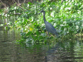
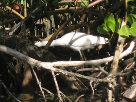
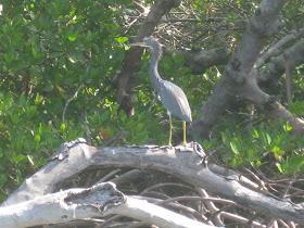
I returned to Lovers Key, no detours, and paddled the entire in Park trail. Paddlers were out, 10 or so. A angler told me to keep an eye out for a manatee. I did not see it. Here are a variety of herons I did see.


I landed at 3:30


After loading the kayak, I drove to the main parking lot and walked to the beach. A tram service is available, but the walk is short and interesting, crossing a tidal lagoon through the mangroves. A lot like John MacArthur State Park near West Palm Beach.


Here are two beach views, looking north, and south.


Final beach picture, back on Sanibel.

Sunset, storm and Sanibel stoop.