 February's final paddle came on the Santa Fe River. The Santa Fe River has appeared on the Tales before, in conjunction with kayaking the Ichetucknee River. Today was the first exclusive Santa Fe River kayaking adventure since the inception of Dave's Yak Tales in October , 2007. I need to define "exclusive... kayaking adventure". The day continued with visits to snorkel Troy and Ichtucknee Springs. I'll get to that later.
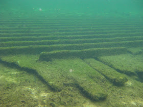
This trip matches Myakka River State Park for the longest drive from yakdave HQ. About 150 miles. I left just after 6 am, the above photo of Rum Springs, just downstream of where I launched, was taken at 8:45.
The Santa Fe River is known for its many springs. The largest concentration are in a 10 mile stretch between US 27 and State Highway 47. I paddled that stretch, up from 47, and back, in April, 2007, BDYT. Before Dave's Yak Tales. From that trip, along with reading more about the Santa Fe, viewing maps, and a brief visit up and back from 27 in October, 2007,
http://davesyaktales.blogspot.com/2007/10/ichetucknee-and-santa-fe.html, I knew that most of the Springs are within a few miles in either direction of Columbia County's Rum Island Park.
Which has a boat ramp. Ever better, a dirt area in front of the "Boat Trailer Parking Only" area.
Saves wear and tear on the bottom.
Rum Springs is on the north side of the River. I paddled by a group camping. I don't think camping is allowed on Rum Island, I assume they were just outside the park, on unposted riverfront land. "Unposted" means no "No Trespassing" or "Private Property" signs. Such signs are present on the south bank, just downstream of Rum Island, for Blue Springs Park and campgrond, a private facility. Admission, $10.00 I paddled past,and soon saw the first tents at Ginnie Springs.
Ginne Springs is a Spring, one of seven on the property along south side of the Santa Fe, a campground with (I think) 200 sites, a world class dive destination and a place for local yokels to get drunk and stupid. I think I visited 6 of the 7 springs, plus one, July across the River. No picture from the kayak was as good as the one from Rum Island Spring.
So, I got in the water to further explore the first three springs, Devil's Ear, Devil's Eye, and Little Devil.


 The tanks were near a stair case leading to the Little Devil. Why they were there, I don't know. I'll guess a class was in progress and students were using different tanks. O2 instead of nitrox, perhaps. Like Blue Springs, Ginnie has a $10 admission fee. From land. I anchored in the River, downstream of the Devils, then snorkeled up River.


As seen in "Thunderball". Underwater action filmed at Silver Springs. My snorkeling was done after I had reached the end of the Ginnie Springs property and turned around. It took me a while to find a good spot to anchor, as the current was swift and I did not want to trespass. As evidenced by hte above photos, I was successful.


To Poe Spring. This is the short run from Poe to the Santa Fe. In October 2007, the limestone was underwater.

I ate lunch at this dock along the Santa Fe.
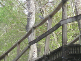
One of two at the Park, this is the one near the Spring. Limpkins across the River.

Finished lunch and headed back to Rum Island. A beautiful day, high 78. The wind picked up, reaching a steady 20 mph at 3 and lasting until 5. Not quite so strong at 12:30 as I paddled into the west wind. Other paddlers were on the River. Lots of canoes and kayaks with the logo of Adventure Outpost, a local rental outfit. Others were from the Santa Fe Outpost. A few motorboats, only one going fast.
Turtles, unless under water, don't go fast. The Santa Fe is full of turtles. This group was generous enough to share with a great blue heron. Alligators, on the other hand, are scarce. i did not see any.
I went past Lily Spring. People were camping on the bank near the mouth of the run to the Santa Fe. I choose not to paddle in, visit the several small springs and chat with Naked Ed. Next door to Lily is Pickard Spring. Unlike the welcome Naked Ed presents at Lily, Pickard has "No Trespassing" signs. But, it is directly on the River, I paddled across the boil.
Springs on the Santa Fe River come in all sizes, from first magnitude gushing at least 64 million gallons a day from deep caverns to little outlets seeping from the bank, like this one on the north bank just upstream of Rum Island.
I landed at Rum Island, got the yak on the car, then snorkeled. There are several vents just off the bank.


In 5 hours I visited over a dozen springs, swimming in five. People in the area are passionate about these natural wonders.

Here is the website referred to on the sign.
http://www.oursantaferiver.org/
Remember, when paddling most spring fed rivers, the local water supply comes from the same source, the Floridian Aquifer. The only reason to buy bottled water is to have a bottle to fill from the tap.
It was 2:30. I had come a long way, so I had to explore some more. I went to Troy Springs State Park, about 20 miles northwest of Rum Island. Several scuba divers deep in the 1st magnitude Spring.


I next considered a visit to Peacock Springs State Park. Seemed to be 20-25 miles away. But, in the wrong direction. With 20 mile average wind, I decided more driving was not a good idea. Besides, I could stop at Ichetucknee Springs State Park, on the way back. Well, not exactly. I had to go 4 or 5 miles out of my way to enter the north end of the Park. First time I entered the north end by car. My usual egress is by kayak.
I first went to Blue Hole Spring.
The name fits. Many bass, and other pan fish.


I was alone at first, but soon four young men appeared and began jumping in from the railing. I suggested that they may want to keep one eye up the trail in case a ranger appeared, as I doubted climbing the railing and leaping in would be met with favor. Wisdom passed, I walked the same trail to Ichetucknee Spring.

I think the stone staircase enhances the site, but the real beauty is below the surface.


The Ich was the eighth spring snorkled on the day. I guess that made up for not seeing any alligators,or deer, or otters, or manatees, or bald..... wait, a bald eagle soared over the parking lot as I got in the car.
I have posted a report on the Green Wave Forum. A few more pictures, many of the same ones, and directions to Rum Island. http://www.clubkayak.com/greenwave/treports.asp?trip=331


