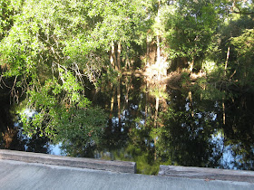
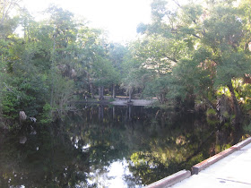
 This is not a kayaking Tale, but a biking Tale. Off work at 5:30, stop at home, make a sandwich, put the bike in the car and drove 21 miles to the Seminole State Forest. Began pedaling at 6:40. This brochure has a basic map to help you follow along.
http://www.myfwc.com/docs/Brochures/09-10_SeminoleForest.pdf
I paid the $2 entry fee, and parked at Bear Pond. A few people were at the fishing pier. I hopped on the bike, and rode through the gap in the fence that allows hikers and bikers access to the forest without a permit. As I think of the 4th of July, I may get a permit that weekend. No better place to be a busy boating holiday. Sand Road appears to be crushed limestone, or some other white rock. Open savanna/prairie at first, then more forested. I did not take any photos until I arrived at the bridge crossing Blackwater Creek.


I crossed the Creek, came to Grade Road, and turned left.
The photo is the end of Loop Road, where it meets again with Grade Road. I made a brief detour off Loop at the beginning to check out the Moccasin Springs Camp site. I rode to the parking area but decided not to bike down the slope to the site along Blackwater Creek. I saw bear tracks on Loop Road, but no bears. This seems like a good place to see deer. As a State Forest, there are multiple uses, including logging. I'm guessing that explains this cleared area.

Twice, brown, upright birds, 12-18 inches high, peaked out of the grass than scurried into cover before I could get a photo. I'm thinking grouse, but don't see it on the Forest bird list.
http://www.fl-dof.com/state_forests/sf_pdf/seminole_bird_list.pdf
I was quick enough to get this gopher tortoise.
 Back to Sand Road and the kayak launch site at the bridge.
I saw one other person as I biked. A guy in a pickup, coming towards me, early in the ride. My guess, he was fishing at the kayak launch. If so, good job as the picnic table area was clean.
 Not by the vultures, they were further down the road.
For a moment, I thought I saw another car in the distance. Or was it a bear, or a deer? The road curved, and it was gone. But, a few minutes later.

Ride stats. 10.09 miles. 1 hr 6 mins 39 secs ride time. Ride time is only calculated when the wheel is turning. One thing I don't like about this odometer, it does not retain the info for long. So, I took a picture.
 Plenty of light at 8:15 am. Tomorrow is my late day at work. I'll do a short Lake Maitland-Minnehaha paddle. A reliable source tells me Rock Springs Run is getting sprayed this week to cut back exotic plants. Not to mention, its already past 11 pm. so a short paddle on the lakes is the place to be.


A nice diversion from the water...looked pretty serene..not too crowded nice.... Acadia national has an amazing network of the crushed limestone type of trails similar ... originally designed by one of the Rockefellers or someone like that for horse and buggy and such/..lots of water flora and fauna along those too!
ReplyDeleteJohn, when I think of biking on crushed limestone, I think Wisconsin. Glacial-Drumlin Trail, for example.
ReplyDelete