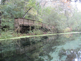
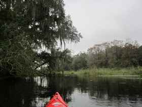
The buoys direct tubers to the "Last Takeout" Dock. My launch site.
I had paddled the Ich since last October, when I paddled it twice during a three day weekend. Working against the swift current, fed by eight springs, I thought, "this is so nice", when something splashed in the water. An otter. The rest stayed on the bank.
The rest of the herd, or whatever you call a gathering of otters, did not go in the water, but ran into the woods. Not before I got a video.
Water coming out of Mill Pond Spring. Named for a 19th century grist mill, remains below.
Returning to the Ichtucknee.
Up River from Mill Pond and Grassy Hole Spring, the Ich enters an open area of "emergent vegetation, including wild rice" quoting a kiosk in the State Park. Fine bird territory.
Turkey in tree.
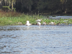
Wood storks
Coots
Devil's Eye Spring
Devil's Eye is really Devil's Eyes, as there are two spring vents.
Coming out of Devil's Eye(s), two black crowned night herons flew across the River. I went back down stream a bit to see if I could get a photo. No luck. I heard something in the vegetation. Different sound than a bird. Deer? No, more otters. They were here.
Looking at Blue Hole Spring from the outside. I would soon be on the boardwalk in the background.
Approaching the State Park dock, 10:05. Where I saw the first people I had seen all morning. On second thought, second, a Park worker waved from his truck as I was launching. A family, waiting for dad to come back from parking the car. Nice, curious kids. "Is that a waterproof camera?" "Are your shoes waterproof" "Did you see spiders? I don't like spiders" I told their mom I felt like I was answering the questions my nephew would be asking if I had gone to Sanibel. I grabbed the snorkel gear. "Are you putting your flippers on here?" "No, that would make it hard to walk up the steps". Headed to Ichetucknee Spring.
Just me and the fish.
Saw three deer on the way.
I took a lot of underwater photos, but most are blurry. Maybe due to the overcast skies?
Looking out at the River. Where I had looked in from the other side, an hour earlier.
Back to Ichetucknee Spring.
What happens if I fail to wear a PFD.
Back in the kayak at 11:40. A guy launching with his buddy steadied my yak as I got in from the dock.
Lots of these yellow flowers, sunflowers? along the banks. Thanks to one of my readers, I know the red plant above is a fire spike.
Fall in North Florida. Red kayak, red maple.
I had not seen any vultures on the way up the Ich. Lots on the way down
Belted kingfisher
I returned to my starting point at 1:15. And kept going. This is a short paddle, just six miles. Could I continue to the Santa Fe River?
To the Santa Fe, yes. Getting back, where the water rushes under the dual bridges of US 27 and the railroad would pose a problem. I have paddled against what you see above, twice, but not when the flow was so swift. I turned around.
Landed at 1:30. Just 12 other paddlers on the Ichnetucknee. Only 4 who I saw on the water. 3 were at the up River launch, 2 at the Midpoint Landing, 3 at the Last Takeout, my launch spot. Speaking of spot, another Florida Springs supporter in the parking lot.
Reminds me I need to renew my tag.
The Ichetucknee is a long drive for a short paddle, so I always add something to it. This time, I stopped at the US 27 bridge across the Santa Fe River.
This map is new for me. List the springs, sinks and swallets on the Santa Fe River. I like the other name for swallet. Suck. In several spots along the Santa Fe, the River is sucked underground. In one spot, the entire River disappears. I decided to paddle up River from the bridge. I had never gone very far this way before.
The Santa Fe is very shallow upstream of Highway 27. I had to get out and walk across the limestone bottom, twice. I told myself I would not get out a third time. Then, I first heard, then saw, why it is shallow.
Water rushing out of the River. I found Alligator Swallet, suck, siphon. The photo doesn't do it justice. Nor does this video.
The water that is sucked out here, reenters the Santa Fe River near the US 27 bridge. That's why it is much deeper downstream of 27. I headed back down River.
One of the spots I had to get out and walk.
Back to the launch at 3:50, I kept going down the Santa Fe.
Past Riverhenge.
Not a single boat on the River.
I landed at 4:35. A closeup of part of the kiosk. Interesting information.


Very cool otter pics and video!
ReplyDeleteNice no Perfect Day , hmm like to do that one day at ichetucknee!! Did Wekiwa, Hontoon, Bluesprings
ReplyDeleteWekiwa link :
http://rick-mandy-2011.blogspot.com/2011/10/dag-19-wekiwa-springs-state-park.html
Thanks for the superb blog !!
Rick
A group of otters is called: a family, a romp or a raft. Always wonderful to see pictures of Florida paddles!
ReplyDeleteI hope the 3 of you like the now completed Tale.
ReplyDeleteRick, nice to know I have another Dutch reader. Nice pics on your Wekiva post. They tell the story, as I can't read the Dutch. Or is it Flemish?
Ppaddles, thanks for the info. "Romp of otters" I like that.
There is nobody who makes better use of their time than you, Dave. Stay away from Cannon Sink, though.
ReplyDeleteI'm wanting to camp at O'Leno State Park again and paddle the Itch, and also wondering about paddling upstream from the park which I've never been able to do--water levels always too low. I know Lars Andersen does that stretch when there is enough water.
I have paddled upstream from 441 to River Rise where the Santa Fe comes back up after going under at O'Leno.
Hi Dave,
ReplyDeleteIt's Dutch, Mandy and me live in Amsterdam - Netherlands. We will visit Florida again at 10th till 27 April.. Maybe Kayak around Hontoon Island Or take the Rock Springs Run at Wekiwa.
Kind Regards
Rick
So, it IS possible to go upstream past the bridges and the rushing water downstream of the tuber take-out. I've tried 3 times and failed.
ReplyDeleteDoc, here's a report about going all the way to the Santa Fe. And back. http://davesyaktales.blogspot.com/2008/04/ichetucknee-and-santa-fe.html You'll have to cut and paste. I also made it all the way up the Ich, launching from the HWY 129 Bridge on the Santa Fe. That wa smy first visit, pre Yak Tales. But, water conditions have to be right to do it.
ReplyDeleteThanks Dave! That was a great adventure up, down and back up the Ich. Water levels are really bad right now on the Santa Fe and Suwannee, but I'm going to enjoy this Saturday back on the Ich.
ReplyDelete