I paddled south in Salt Run to where the spoonbill had been. Emphasis on had. Not seeing it, I turned around. Here's a map so you can have an idea of where I paddled. The big blue on the right is the Atlantic. The outlet, or inlet to the Ocean is the St Augustine Inlet. The dead end waterway to the south is Salt Run. To the north, the aptly named, North River. To the south, the Matanzas River.
There are high dunes on both sides of Salt Run. Above is the west side of the Run, with a kayaker for perspective. I'll have photos of the east side later. Chance are the kayaker launched from the public next to the St. Augustine Lighthouse.
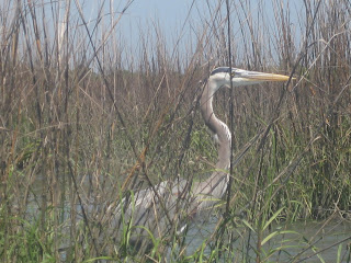
I saw a, or perhaps the, spoonbill. Flying back to the State Park.
Plant your seeds in the mooring field, and someday....
Female hooded mergansers.
The cormorants were on the other side of Matanzas Bay. The spot where the Inlet, Salt Run, North River, and the Mantanzas River meet is Matanzas Bay. Caution required. Lots of fast boats. I saw a break and quickly across.
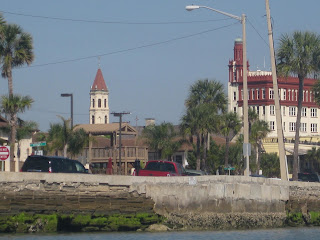
The Bridge of Lions was being refurbished the last time I paddled under it.
I did not see the splash at the side of the above sailing vessel. Wonder what it was.
The seawall dates to the 1830's. New for a City founded in 1562.
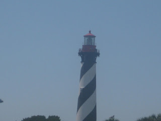
Lighthouse from the Matanzas River.
I turned back at 10:40, the State Highway 312 Bridge in the distance.From Sanibel to Titusville, drawbridges are being replaced by faceless arches. Kudos to the people of St. Augustine who worked for years to save the Bridge of Lions. It may cause traffic to back up, but you cannot buy art and history.
The above is walkway to a waterfront restaurant. The Santa Maria. I did not see the Nina nor the Pinta.
I think the Bridge needs a lion at kayak level, but that's just me.
Back to the Castillo San Marcos.
Paddled back across Matanzas Bay. Before I reached the channel, BOOM!! Cannon fire from the Castillo. A rough crossing, lots of wakes.
Several jellyfish were on the shore.
Could have used this for the opening photo.
Back on the water.
The tide was in, I was able to paddle into the salt marsh for a short time. Took me out of the wind, which was strong, out of the south . In my face.
I began the climb.
Widows and displays on landings are welcome to a old fat guy.
One day, I need to read 'Bartram's Travels. They were the first English speakers to visit and write about natural Florida.
In my travels, I have seen both the Bodie Island, and Currituck lighthouse. Climbed the Curritck, after kayaking with brother Pete. Saw the Bodie while fishing with the family.
Salt Run, Atlantic Ocean.
My kayak.Not to the top yet, taken from a window.
Now, I'm on top of the lighthouse. Salt Run, St. Augustine Inlet, Atlantic Ocean.Matanzas River, St. Augustine.
I can see my kayak far below.
Looking up the eight flight form ground level. Seems like more on the way up.
The Keeper's Quarters is a museum. Three floors of exhibits on lighthouses, St. Augustine history, shrimping in St. Augustine, shipwrecks, and more.
There is a short nature trail on the grounds. And several salvaged and replica boats. A lot to see. I got my 9.50's worth, spending over an hour at the lighthouse and museum. Some group must have had an event scheduled later in the day. A pig was spinning over hot coals.
Back on the water.
Paddling into the salt marsh with high tide.
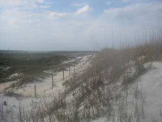
Dunes on the east side of Salt Run. The Atlantic crashing on the other side.
I paddled to the end of Salt Run, then back to the launch site. Kept a wary eye on some kite boarders trying to set sail. They spent more time in the water than on the boards. I landed, and with the tide in had a shorter walk to my car. Loaded the yak, took off the bike, ate an orange at a picnic shelter.
Hopped on the bike, pedaled to the beach, about a half mile, with the thought of riding on the sand. There are two access points, a long boardwalk over the dunes, and a flat boardwalk from a concession. I rode on the flat boardwalk, it ended in soft sand. I rode back, locked the bike, and walked. First to an over look atop the dunes.
Then to the walkway across the dune line to the beach.

Walked on the beach back to my bike. Next time, I'll carry it across the soft sand to the hard sand. Anastasia has four miles of ocean front.
I needed a bite to eat. Alas, the concession closed at 4:30, it was after 5. This is a problem in Florida State Parks. Food concessions shut down early. Back on the bike, to the Ancient Dunes Trail.
Do you see the pink colors. Paint on every root someone could trip on. Unbelievable.
I can see why the steps have paint. I climbed more stairs Saturday then I do in a month. Back to the car, final photo of the day.
And that is the last photo. I used up two batteries. So, no photo of the baby back ribs, Brunswick stew, onion rings, and garlic bread at the Daytona Pig Stand. I pulled off I-95, intending to get some fast food to go. When I saw the sign, I could not resist. Must have been the pig roast I saw at the Lighthouse.












2 comments:
Heading there in a few weeks with the bike and yak, this is very helpful!!
Have fun!
Post a Comment