Dave's Yak Tales

Cedar Key Sunset

Sunday, April 24, 2011

Econlockhatchee River

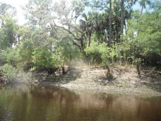
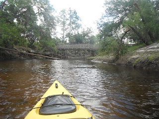
Happy Easter.  I kayaked the Econlockhatchee River this afternoon, Sunday, April 24, 2011.  Down stream from the Seminole County Road 419 Bridge, eight miles to the Snowhill Road Bridge. Got a late start, in bed until almost 9. Had to fill the bike tires with air.  When I got to the takeout, after dropping the kayak off at 419. the front was flat. Changed it. Would not center so the brakes would not rub. Took a while to fix that.  Good news. The bike route has a little jog, Old Chuluota Road, that takes you off the busy roads for a short time.  It has been in bad shape, loose, rocky, pavement.  I was thinking of not taking it with no spare.  But, the guy ahead of me on a road bike went that way. I followed.   It has been freshly paved.  Back at 419, a group was prearing to launch.  I took a walk in the woods,  communed with nature, natural fertilizer, came back and slowly prepared to get on the River. Launched about 11:45.


A second paddle with the Fuji XP20 did not change my opinion of it.  Still sucks.  Hopefully, the next Tale I'll have a different camera or will have ordered one.

 Snowy egret, at max zoom. One reason I don't like the camera


 One of two portages, below.

Three weeks ago, the Econ was so high, jet skis were going all the way to the Flagler Trail bridge, according to this report on the Green Wave Forum. Today it was low. As mentioned,  I had to portage twice.


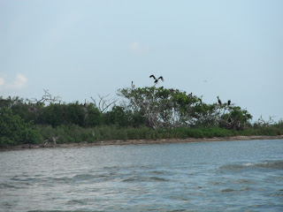
 No eagles in the nest, or anywhere that I saw.

View finder in the upper left hand corner, another reason to return the XP20.


Took a break at the Flagler Trail Bridge.

 I was taking the great blue heron photo, and I missed a nearby otter.  My first thought, "small gator". Until it ran up the bank, not down.  A big otter.  I did see four of five alligatgors.  All in the water.  Birds, in addition to those shown, includig the tri colored heron below, wood ducks, and cardinals.  People, the group who launched before me.  Another group, who launched when I dropped the yak off, two guys fishing in a tandem kayak.  Near the take out, people fishing and sunning on the banks.  One reason I paddled the Econ on Easter is that is in a State Forest, not a State Park, and there are no rental concessions on the River.  So it does not get the traffic of a place like the Wekiva River.

Approaching Snowhill Road, 3:46 PM.

Saturday, April 23, 2011

Haulover Canal

I had a bad week, so bear with me while I vent. First, I did not get my usual Wednesday morning paddle in.
Second,  I picked the wrong day to forget my wallet. Monday, I left it at home.  I got home, looked on the kitchen table, not there, into the dining room.  Where's the computer?  I was robbed.  Came in through the bedroom window which I had closed, but not latched.  A polite crook. The mudderfocker closed the window behind him.  I only figured out how he got in when I saw the screen propped up against the outside of the house.  At first, and all the time the police officer was here I thought all that was missing was the computer and wallet.  After the cop left, I realized the camera was gone.  And another, non-working one.  Try pawning that, asswipe.  Obviously, I bought a new computer.  Every day I realize something else I need to replace from the wallet.  Today, it was my AAA card.   Got a new camera too.  Do not like it at all.  A Fuji XP20.  Waterproof to 16 feet. $199 at Best Buy.  But it has minimal zoom. A minimal owners manual.  It has a CD marked "owners manual"  After wading through reams of useless crap, I still haven't found a picture of the camera showing what each button does.   I sent a complaint email to Fuji.  The battery is different from the one the Canon used, so when it ran out after only 3 hours today I did not have a spare.  Final complaint.  The camera must have been designed by a one handed, right handed, engineer. The viewfinder is at upper left hand corner.  I got lots of finger pictures.  Thank goodness Best Buy has a 14 day return policy.  I wanted to get a Canon underwater camera, the D10, but no one had it in stock. I think I will just order it, to whatever model replaced my stolen SD1100, for which I assume I will also need to buy a new underwater case, and return the Fuji.
Another reminder of the robbery this morning.  Looked for a backpack to put in a change of clothes.  It's gone.  The scumbag used it to carry my property.   If he's caught, I first want everything back. Then,  $5000.00 for my time in replacing ID's credit cards, ect., and mental anguish.  Then, he should have both hands chopped off so he can't steal, both feet cut off so he can't run, and put in a cell with a feeding tube of gruel the rest of his like.  I don't support capital punishment.

So much for my troubles, here's the Yak Tale.  Into the Indian River at 10:15, usual destination, Mullet Head Island.
A huge tour group had just launched.  Good thing for me, they were not going in my direction.  A nice collection of spoonbills on Mullet Head.

 Camera designed by one handed idiot.  Hard to hold with both hands without getting a finger in the way


The camera has a 5x zoom.  My stolen one had a 3x zoom, but got much, much closer.
One good feature, it does capture moving objects well.


In addition to the big yak tour, there was a lot of traffic in the Canal. The banks were backed with anglers. Easter weekend.  But, out of the Canal, no crowds.  I explored two side canals, looking for manatees. Unsuccessful.


Trying the camera underwater.


Into the main Canal. No dolphins in "Dolphin Cove"  Frisky manatees in Bairs Cove.

New pier at Bairs Cove. Speaking of new, I crossed the new high rise bridge, from Titusville to the Merritt Island Wildlife Refuge, for the first time today.
   It replaced a draw bridge.


 Another complaint about the camera. Slow shutter speed.  A manatee would surface, I'd press the shoot button, the manatee would go under, I'd get a picture of the water. I put the camera on "Continuous"  Able to get better pics, but I think that drained the battery.


There is a barge with heavy equipment  in the Canal, just east of the drawbridge.  Asked a fisherman if he knew what was going on.  "Working on the bridge, bringing up rocks for the bottom". Kind of what I thought. Dredging.
I paddled through the Canal, pausing to watch manatees at the Overlook, not to mention those traveling the Canal, made the usual detour out of the Canal on the north side, then back to the Canal exiting into the Mosquito Lagoon.   Paddled south, hoping to get a good view of Endeavor on the launch pad. Wind and chop in my face, so I did not paddle very far.
Far enough to see a nest building bald eagle soar overhead.
 I think the Space Shuttle is in the distant, wider tower, on the left.

Not sand.  Dried seaweed.


I was able to coax a few more pics out of the drained battery.  The camera would take one photo each time I turned it on, until it died for good.  Could have got some very nice manatee pics back in Bairs Cove if I had a decent camera. For which I will be looking.  Then I won't be such a whiner on a day when I saw osprey, cormorants, blue heron, green heron, great blue herons, sting rays, great egrets, mullet, black drum- nice catch at the launch site- clams- I picked one up, but as I don't have a fishing license, put it back, ibis, pelicans, rosette spoonbills, bald eagle, and lots of manatees.

Landed about 3:15.

Sunday, April 17, 2011

Good-bye Cedar Key


View from the balcony, or rather, the perch, at my lodging, Pelican Perch, at 7:26 am, Sunday, April 17, 2011.  Not the above picture, below.
That's not water, that's mud. Went back to bed. Not to sleep, at 7:58, went down for a closer look.

No kayaking for a while.  I figured by time I showered, ate, packed, I'd be good to go.  Breakfast on the balcony, of course.  Easy to find the bridge across Channel # 2 from up here.

I've been looking for info on the "Number 2 Channel"  Here's a Map from the Cedar Key Chamber of Commerce. Natures Landing is on Depot Street. On Saturday I paddled through Back Bayou, through the Number 2 Bridge, to Cemetery Point.  Interesting, to me, to see the route after the fact.

 I'm going to miss the rosette spoonbills flying by. Mykka River State Park may have a Canopy Walkway.  I prefer the Cedar Key Sit and Stay.  Killed some more time by putting an entry in the condo log.  Pen and paper, how quaint.  I think I was the first one in this log, labeled Log 2, I did not see Log 1, who did not write about the cleanliness of the place. I mean, it was clean, but logs are to write about boating, fishing, and what else you did during your stay.  At least they were on family vacations on Wisconsin lakes when I was a kid.
Breakfast and log entry complete, I walked out to the nature trail and dock at the edge of Channel 2. the "Main Channel" on the map.
 It's hard to tell, but it is mud behind the lower tri colored heron in the photo above, the upper one is standing in a trickle just coming into the inlet that dead ends at my condo.  I sat down and watched the great egrets and pelicans fly by. Regrets, no egret photo.

 This is the view from the finger docks in the middle of the inlet, looking towards the channel.
I walked to the Gulf to see how that looked.
That's about how it was when I landed on Friday. Time stamp is 9:53.  I figured by the time I got to launching it would be fine.
A clam boat coming in.  One that docked just before had a boat full of bushel baskets, full of clams.
I had a 1:30 check out, but left early.  Final look from the balcony, 10:56.  A sheen of water over the mud.
After dropping of the key at the local Real Estate office, I was on the water at 11:24.  Destination, Atsena Otie Key, about a mile and a half across the water. Waves were rolling, but smooth. If that makes sense.
Atsena Otie was the original "Cedar Key"  Began as a Army depot for the Seminole Wars, later a pencil factory. Which was destroyed by a hurricane and tidal surge in 1896. Ruins can be seen in the interior of the island.  I have yet to explore inland.
 I did not disturb the birds.  A bleeping airboat.  I made fists with both hands, extended both middle fingers, and placed them in my ears.  Practical sign language.  I kept hearing the contraption, on and off, as I paddled.  Thanks for ruining everyone's day.


I've been searching the web trying to find the origins of this pier.  Anybody know?


Several kayakers were on the water.  Atsena Otie is popular for fishing, picnicking, sun bathing (amazing that people still lie out in the sun. Guess they haven't heard of melanoma) and exploring.


The duct tape was holding, a little moisture was coming in, but not to bad.  However, I decided against paddling more open water to Snake Key, and Seahorse Key.  About a 5 hour paddle.  Did not want to do something that strenuous and then drive home. So, I decided to just circle Astena Otie.   Something I did last September.  At low tide, in the rain.  Not the most enjoyable paddle I've ever had. Today was much better;
Here's a Map , from the Suwannee River Water Management District, of Atsena Otie to give some perspective.  It is not accurate.  I entered one, and exited another, channel on the west side of the key.


Calmer on the southwest side of the key.


I found out why the air boat kept stopping and starting.  A large group of people were on the island, near the aircrap.  More than would fit on it.  So, the owner had to make several trips in his machine.  Waking the dead each time.


I explored the interior of the island from the north end.  I've never been in this area before.  Did not know until today that, you can, at high tide only, I'd guess, paddle through Atsena Otie.  Something for my next visit.


Cruise around Atsena Otie Key complete, I headed back towards Cedar Key.  If price were no object, I'd take the top floor right unit. Gulf, and channel views.

 Black crowned night heron taking off

Tide was in.  I have photos with most of this wreck out of the water.  I was able to cross the channel into an area where I grounded Saturday.  Looking for spoonbills.  No luck as I paddled a maze of mangrove lined channels.


Snowy egrets.

 Plenty of water in the inlet in front of "my" condo now.
Posted the above pic for the poop.  See all the white on the leaves?  This is where the black crowed night herons hang out.  Once again, not one stayed around.  They saw me before I spotted them, bursting out of the mangroves. And I'm quiet.

Back to the Gulf.


Crystal River nuke plant on the horizon.


 The most photographed building on the Cedar Key waterfront.
Cormorant tenant.


The seas increased. Time to head to shore.  A final look at the condo. The pitched roofs.
Landed at 3:00, and saw that horseshoe crabs can read.


A wonderful weekend. Even though I did not paddle as much as I would like due to wind and illness.  I'll be back. Mayne Memorial Day weekend.