I'm going to Wisconsin Tuesday through Sunday, so I thought I should get a salt water paddle in. I should be in Milwaukee now, for my Uncle Dave's funeral Monday. But, its a bad time to take another day off work. I'm sure the church will be packed. My Uncle practiced law in Milwaukee for 51 years, starting with my Dad and my Uncle Bob, then Milwaukee County District Attorney, then United States Attorney for the Eastern District of Wisconsin, and since 1973 as head of the litigation department at a major firm. More important, he was a good family man, not just to my Aunt Carol and my cousins, but all of his extended family. I'll end my family memories with a comment Uncle Dave made about Richard Nixon. "He wasn't all bad, he appointed me U.S. Attorney" said with a twinkle in his eye. I'll seque back to kayaking by saying Nixon did two good things. The other, stopping construction of the Cross Florida Barge Canal.

I launched from Lot 7 at the Canaveral National Seashore about 9:20. Usually, I turn right, paddling south towards Turtle Mound. Today, I changed direction, turned left, paddling past the Eldora State House, above, towards Castle Windy, another Indian mound.
Saw a manatee just past the dock where the oysters beds are being re nourished.
Feeding in shallow water. I continued on.
There is a little cove where I've seen manatees before. I stop in whenever I paddle up this way. It had been a while since I've seen any. I entered, counted to 45, saw none, so I drifted out. A few seconds later, one surfaced, then a second.
The pair was not doing much, just coming up for air every now and then. So, I left, thinking I'd stop again on my way back to see if more was going on.
I reached Castle Windy, and thought, I often see dolphins near Turtle Mound, and I've seen them here. Mounds are where they are for a reason. Good shelling and fishing. And a dolphin swam by. The second of the day. The first was near Eldora. Which I'm sure was built where it is for the same reasons the shell mounds are where they are. A dorsal fin is barely visible in the next photo.
I paddled on, now in waters I have not paddled before. Prior visits to Castle Windy have come after paddling north for a few hours, then paddling south in Mosquito Lagoon. Today, my thought was to paddle for two hours, or until I got to the boat ramp at the end of the road through the National Seashore.
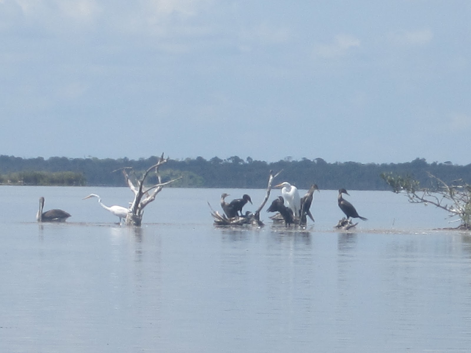
I usually don't post vulture pics, but I wasn't getting many photos as I paddled along the east edge of the Lagoon. I saw plenty of great egrets across the water, on the many islands that dot Mosquito Lagoon. Perhaps I'd cross over and paddle that side on my return.
Turns out, I saw plenty of birds. First, I saw an opening. It led into a little "lake".
Further on, I "discovered" another Indian shell mound.
Unlike Turtle Mound and Castle Windy, this ancient trash heap has no name that I can find. So, under the powers granted to me by myself, I name this spot, Dave's Hill. I had my usual thought about middens being where the fish are when two dolphins confirmed my hypothesis. Unable to get a picture, but my following them led me to a bird filled island.
Including the roseate spoonbill that opens this Tale.
The spoonbill's flight was short.
I decided to paddle around the island.
The photo above is the last south view I took. 11:19. two hours after I began. Did not see the ramp at the end of the road. There is a patch of white against the distant green. I wonder it that's the ramp. I think the road extends farther then shown on this
map, as I also think the island I was paddling around was between Plantation Island and the main barrier island. Satellite images show the road extending farther.
Great and cattle egrets, great blue and tri colored herons, roseate spoonbill, ibis, cormorants, pelicans and more on and off shore the island.
"More" was ospreys. About half a dozen.
I had been paddling into the wind on my way out, now it was at my back. And I was on the back of another dolphin.
I know they all look like the same photo, but there is a dolphin in each of the last 4 pictures.
Approaching the cove where I saw the manatees, I wondered if they were still there. A audible splash answered my question before I even saw the cove.
Twice the action as earlier. Four, maybe five manatees getting quite, how should I put it? Frisky.
A couple times two of the manatees would take a break against the mangroves, rest up, then go back and rejoin the fun. At one point, concentrating on the manatees making a ruckus, I thought I ran aground. Nope, ran amantee. I think it was messing with me as it gently raised the yak a little as it swam underneath. Or maybe just clearing a path for its partner, on the first ones tail.
I landed at 1:50. Then, as I had biked a sand road in the Ocala National Forest on Saturday, I figured I may as well bike a sand beach in the Canaveral National Seashore on Sunday.
I rode a mile into the wind, and back. Nice hard surface. The tracks you see are from a Seashore gulf cart or golf cart vehicle. In the mile of beach there were posts marking sea turtle nests about every twenty yards.
Multiply that by 24 miles of beach, that's a lot of eggs. Not a sea turtle. Gopher tortoise on the side of the road as I drove out of the Seashore.