Dave's Yak Tales

Cedar Key Sunset

Wednesday, October 28, 2009

Lake Maitland and Minnehaha

This morning, Wednesday. October 28, 2009. I was going to paddle from Fort Maitland Park south across Lake Maitland to Lakes Osceola, Virginia and Mizell. But, as I prepared to leave home, I heard that the launch of the Ares X-1, the rocket that is supposed to replace the Space Shuttle, had a 9:15 launch window. I did not want to miss a chance to witness history by being in a canal linking the lakes at lift off. So, I went north, to Lake Minnehaha, figuring I would be in open water at 9:15. I was in the water at 8:30, paddling past the usual Lake Maitland anhingas.


No one was one the Lake. the flat surface disturbed only my me, the anhingas, and a pair of otters.
After swimming, popping up occasionally across a good swath of the Lake, the otters disappeared into shoreline vegetation near the canal leading to Lake Minehaha. I thought they might go overland and join me in the canal, but that was the last I saw of them. The wood duck anhinga portrait in the first pic is from the canal. Here is another.
I'll aways have the covered bridge photo. The utilitarian Howell Branch Road bridge in the background.
Another anhinga duck trio as I entered Lake Minnehaha. Mallards this time.
I usually paddled counter clockwise around Lake Maitland. Today, to get a better view of Ares 1-X, I paddled clockwise, which put be on the west side of the Lake. I would be looking east at 9:15 when 50 miles away at Cape Canaveral, the rocket was set for lift off.


I wonder if the bell owners neighbors told him to put the pole up to stop the clanging. The morning, which began calm, became windy.


At 9:20, I saw a contrail to the east. Plane? It was quite vertical.
I saw a brief glow in the sky, and thought, that's it ! The Ares rocket. Even the anhingas were looking up.
Well, as you know, or perhaps not, I did not see the rocket, which went lifted off at 11:30. I may have seen a T-38 jet, flying around the launch area. The following is from NASA's launch day blog. Astronaut Providing Weather AssistanceWed, 28 Oct 2009 09:39:08 AM EDT
Astronaut Chris Ferguson, pilot of space shuttle mission STS-115 and STS-126 commander, is piloting a NASA T-38 training jet around the launch area to provide his weather observations. Weather still appears to be the determining factor in today's liftoff.


I wonder if the glow I saw was just the sun hitting the jet. It was just a brief flash.


Back to other flying objects. Wood ducks.
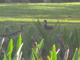
Osprey.


Back to the mallards and anhingas, 42 minutes to circle Lake Minnehaha.
I thought the light coming through the Howell Branch Road bridge would make a good photo.
I think the camera agreed. The covered bridge is aways scenic.
Out of the canal, I paddled east, along the south shore of Lake Maitland. The south wind increased, a moderate chop on the largest lake in the Winter Park Chain. I was looking for Howell Creek, which for some reason, I have a hard time locating. Once past the Isle of Sicily, it was time to turn back. I'm in a small bay near the canal here, out on Lake Maitland, much rougher.


I landed about 10:50, a nice 2 plus hour paddle, even though I did not see the launch. Probably was in the shower when it occurred. Before leaving Fort Maitland Park, I picked some fallen kindling sized wood and put it in the car. I have reserved the Buffalo Tram campsite on the Wekiva River Saturday. The Rock Spprings Run sites were already spoken for. Wood gathering is not allowed. I won't be posting Saturday, look for my first camping Tale Sunday

Sunday, October 25, 2009

Haulover Canal

Sunday, October 25, 2009. More than twenty spoonbills on Mullet Head Island. Five dolphins feeding in the Indian River as I launched. Manatees in all the usual places. But the highlight may have been after the paddle, on the Scrub Jay Trail.

Where one of the bright blue birds landed on my head. I'm glad I had a hat on, as I felt its feet getting a grip. Then a few pecks, and finding this nut tough to crack, and nothing inside, flew away.


My kayak excursion began at 10:15 as I launched from at the end of the dirt road on the north side of Haulover Canal. As I got out of the car at the edge of the Indian River, a feeding dolphin came as close to the shore as I have ever seen. No more than five yards from the wrack line, ten from where I stood. Four dolphins in the pod. When I got in the water, I noticed a fifth, a young one along side, I assume, its mother. No photos. They were in the middle of the channel, not a place I want to hang out, although there was not much boat traffic. I moved on, crossing the mile of water to Mullet Head Island. As forecast, a moderate chop, once I got out of the little cove near the launch area, but nothing came in the yak.


Once behind the island, where conditions were calmer, I put the spray skirt on. And took pictures.


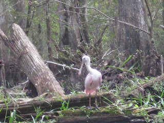
Seeing one rosette spoonbill the day before on the Hillsborough River was nice. Seeing a large group was even nicer. Mullet Head Island is a bird sanctuary, so I was limited to long distance shots, behind the "Blue Goose" signs. Which as Yak Tales readers know, make excellent osprey perches.
More spoonbills, along with brown pelicans and cormorants, on the east side of Mullet Island.


I paddled back towards the Canal, and south across the entrance. Where a single dolphin hunted. I went on, to my two secret manatee spots.

They were not under this sign, although I did see one just past it on the way to the canals where I often see manatees.


Both spots had a couple. I had to wait a bit for them to surface. Patience is a virtue. Moving on, I entered Haulover Canal from the side channel. No dolphins in "Dolphin Cove" Several manatees in Bairs Cove. All inactive, coming up only briefly. Bairs Cove has a boat ramp, and several anglers were getting out. 1:00 PM, morning fishing over, time for football. The engine noise keeps the manatees under longer.

I left Bairs Cove, careful not o run over any manatees, and paddled east towards the Indian River.


More people watching for manatees at the Overlook on the north side of the Canal than manatees, one that I saw, in that area. People need to get on the water. Scratch that, that would only make my favorite places more crowded. But then this site does nothing to discourage people. Heat ! bugs! alligators! Illiterate power boaters! There, maybe I've scared some people. "Illiterate power boaters" refers to those who do not understand "Slow Speed, Minimum Wake". How a person who can't read can afford a boat worth tens, even hundreds of thousands of dollars, I can't understand.


I did not go all the way to Mosquito Lagoon, exiting the Canal through a gap on the north side and entered the area sheltered by a chain of islands. This offered some protection from the wind. But not a lot, so I reentered the Canal, and returned, wind at my back.

Manatees still in Bairs Cove. Power boat traffic abated, three kayakers watching the sea elephants. I moved on. Can anyone tell me what these little orange legged birds are?


Paddled into the Indian River. Considered another visit to Mullet Head Island, but the wind and waves changed my mind.


Landed around 2:15-2:30. A few months ago, a shelter was put up at the launch area. Along with trash receptacles. The latter are nice, I did not have to carry the balloon and styrofoam pulled from the water home with me. The shelter now has panels describing the islands and advising what not and not to do to make sure all the birds don't leave. Such as, keep your distance and keep your mutt of the beach.


Speaking of birds, I stopped at the Scrub Jay Trail on the way out of the Merritt National Wildlife Refuge. Based on experience, I know these endangered birds, endemic to Florida, are found on the left, or end side of the sort loop trail. I walked along, not seeing any scrub jays. A the turn in the loop, I turned around. And as you know, spotted the birds.


The scrub jay on the head is something I've seen before. This January 2008 Tale has a photo I took of one on a guy's hat. http://davesyaktales.blogspot.com/2008/01/haulover-canal-and-more.html


I was not so fortunate to have anyone with a camera nearby. I pondered how to lift the camera, strapped hanging around my neck, over head, cap, and bird. All that pondering made the bird take flight. As I walked to the car, a woman, tri-pod in arms, walked towards me. I told here about the lost opportunity.


I made a final stop. Driving the seven mile Black Point Wildlife Drive. In my pre-paddling days, I thought this was one of the best places to go within a reasonable drive. Now, being on the water, I'm spoiled. Just took one photo. of a tri colored heron. I was out of the car when I took the photo. There is a relatively new, 2 or 3 years now, 1/4 trail on a dike with two blinds. Also walked about a mile on the five mile Cruishak Trail.

No spoonbills. They all must have been on Mullet Head Island. One alligator. Easy to spot as the car in front of me stopped in the middle of the road, both people went out and went to the bank. I'm stupefied by stupid people. Pull over, so others can pass, use your car as a blind. Now, dear reader, you know what to do.
.

Saturday, October 24, 2009

Hillsborough River

I almost went to Rock Springs Run again today, Saturday, October 24, 2009. But, when I called Friday afternoon, all 4 primitive campsites, three on the Run, one on the Wekiva River,were booked. As of Thursday, I'm a camper. Or at least I have a tent. I hope to sleep under the stars somewhere next weekend. Today, after work, I drove west, to the east side of Tampa, and the Hillsborough River.


At the Trout Creek Park launch, two mats of water hyacinth drifted down River. Made me wonder how things would be in the area near Nature's Classroom, which usually has a lot of vegetation. This would add to it. Two kayakers at the launch told me the River was blocked. I put in, and paddled upstream to see for myself.


A kayaker came down River. "I heard you can't get to far this way" "Yeah, its blocked" I kept going. If it was blocked, I'd turn around and go further down the Hillsborough, past I-75, than I ever have before. Next, a group of six to eight kayakers came down the River. I had a feeling they made it through. "Did you blaze a trail' "Yes, stay to the left" Arriving at Nature's Classroom, water hyacinth stretched across the River. But there was an opening, on my left. But not the one to go through. It doubled back to the channel, which again became blocked. Another opening, a dead end. But, I saw where others had paddled through the weeds, and made it to open water.
The River broad from Trout Creek to, and just beyond Nature's Classroom, narrows as you go up River. Nature's Classroom, by the way, is where Hillsborough County sixth graders get three days of environmental education.http://www.naturesclassroom.net/index.cfm/fuseaction/About.Home

I suppose turtles are studied.
And alligators.


Close up of the above gator, biggest of the afternoon,


One canoe, headed up River, and one kayak, down from the "blocked" section to Morris Bridge Park.Morris Bridge being the take out for 95% of people on the River, most in red, Canoe Escape canoes launched from Sergeant Park. Speaking of red, I had not see any rosette spoonbills my last couple Hillsborough visits. Saw one today. I call it, "Linda Blair"


Many more interesting birds. Tri colored herons and snowy egrets, to name two.


The Hillsborough is wonderful for bird, and alligator, watching.


I encountered about 10 paddle craft coming down River.


I knew that the last group from Canoe Escape launches from Sergeant Park at 2 pm. It was 3:41 when I saw the paddlers above. More important, two photos of belted kingfishers, a bird that does not stay perched for long. A few more red canoes went by, and I figured no one else would be coming down River. I passed a place that looked like it would be a good spot to take a break. Two kayaks, non-rentals were already there. Waiting for the renters to get down River, I bet. I paddled up River another ten minutes or so, turning around at 4.


I was past the canal that enters the River from my right, as I paddled up stream. A bit over half way from Morris Bridge to Sergeant Park. Six plus miles from Trout Creek. 2.5 hours upstream, so I figured 2.5 back would get me where I began at 6:30, 17 minutes before sunset. I took a break at the spot where the kayakers had been a few minutes before.


Wildlife is so plentiful on this part of the River I thought of only taking photos when two or more birds, reptiles, or whatever were in the frame.


But, then I would have missed another belted kingfisher. And more.

I returned to the rosette spoonbill, and friends.

In addition to the pictures spoonbill, ibis, and tri colored heron, was a wood stork. The stork flew off, I inched closer, quietly, not quiet enough, as the birds burst into flight. The kayakers I saw just before I turned back wer eon the other side of the bend where the birds had been. "Sorry about that" I said for flushing the flock. "That's okay, we've seen plenty". Thhe birds, including the spoonbill, landed a short way down river,on the opposite bank, across from a good sized alligator.


I am often asked if I'm afraid of alligators. I am not, but I respect them. Not sure if this blue heron does.
As it non chalantly steps behind a gator across from Morris Bridge.
I passed Morris Bridge at 5:15. I had also passed one of the canoes I had apassed on the way up River. They asked where "the end'" was. I repleied it depends where you are going, but for them, it likley was 5 to 15 minutes away. Once Morris Bridge Park, I saw no one for 4 miles, or until I arrived back at Trout Creek Park.


If the Hillsborogh River were as close to my house as the Wekiva and Rock Springs Run, I might consider it the best place I paddle.


I landed at 6:35 pm.