


Good thing I don't have a boat


According to something I read, the mouth of the Econ is .09 miles up River from C.S. Lee Park.


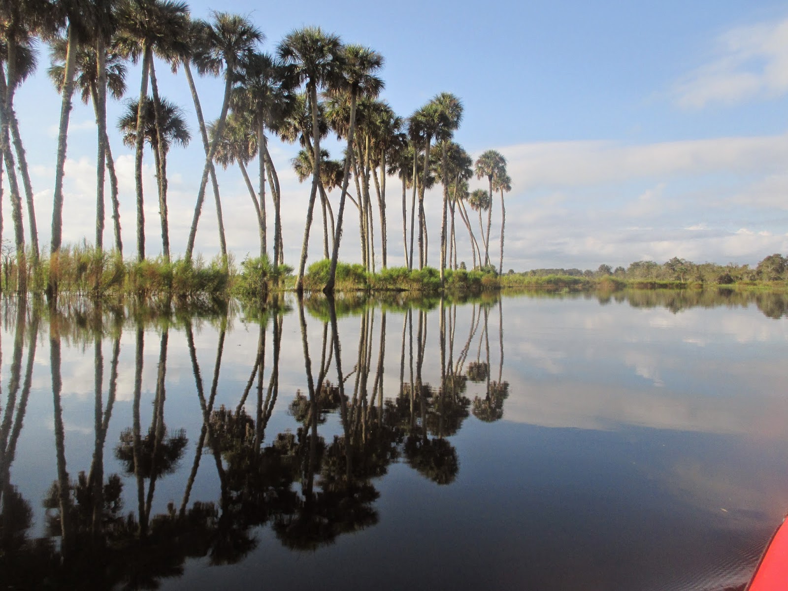
As the high water has the River flowing over a wide area, as Dave paddles, its probably a mile and a half


Looking across to the St. Johns. Or the Ecjohn.


I hoped to see bald eagles, white pelicans, and roseate spoonbills. Got the eagle.


Another Saturday, another paddle through a State Forest. Little Big Econ.


I was thinking, I'll paddle for two hours, or until I see another bald eagle. At 9:57, a bald eagle flew over head. Not getting a picture, I kept paddling.


As I began to step out of the kayak, the ground appeared to move for a moment or two. Stupid vertigo. I paused, made sure my feet were steady, and slowly stood up. It went away.


From inside the shelter. According to the Florida Greenways website, it is a group campsite


Gator from the trail. Saw a deer, too.


11:09, back on the Econ. Headed back.


High water meant the usual herds of cattle and the occasional horse were far from the bank. Wherever that was.


Paddled around, not under, the shelter this time.


It was a post card kind of day. Hot, for October. 91 at OIA

That's Orlando International Airport


Saw three boats all day. Heard more. This is popular air boat spot. You've been warned.


The non floating part of the dock is underwater.


So, I figured a hike would do me good.


Lake Proctor Wilderness Area


Lake Proctor


This shelter is at a fork in the trails. Where the blue trail mets the red trail.


I came back to that shelter at least twice. Took a while to find the correct trail back to the parking lot. A fork was not well marked.


90 minute plus walk. Longer than I planned, but I need the exercise.
4 comments:
Several post cards nominees on this post. Thanks Master Dave.
Great reflection pics! But Dave, be extra special careful getting in and out of the yak while you got this dizzy thing going on... You could fall and break a bone, and you're not the kinda guy who would do well long-term in any kind of rehab place. Be careful out there!
Thank you, both. I am being careful. But, if I need someone to break me out of a hospital.....
I wouldn't worry about that. From what I currently see, hospitals aren't all that well organized...
Post a Comment