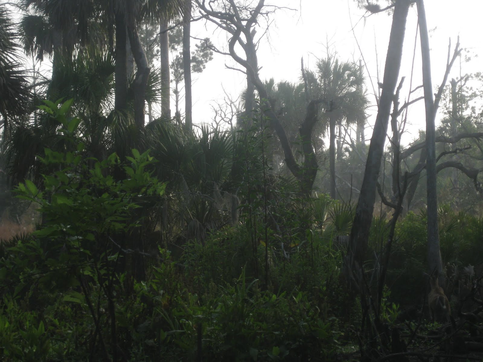
Seeing deer can be difficult while kayaking Blackwater Creek in the Seminole State Forest and Lower Wekiva State Preserve. They are present, I saw three. All ran off. I did get one photo. Can you find it?
As you may know, a permit is required to launch a kayak in the Seminole State Forest. Actually, the permit is required to drive in. If you want to walk 2.5 miles, go ahead. Or a bike-yak trailer. Hmmm....
Anyway, I like locking the gate behind me. Feels like my private paddling paradise. In the Creek before 7. Water level much lower than Easter weekend when I had to lay my head on the cockpit to fit beneath the bridge at the launch site. Good posture ok today. I began the 5 mile paddle down Creek to the Wekiva River. Slooowllly. Wanting to save myself for the up Creek return. Slow and quiet paid off for seeing deer. First one, I noticed leaves moving. No breeze at 7:00 am. Next, I heard a twig, or stick, crack. Another deer. I though about reading Indian adventure stories as a kid after that one. All the time I spend in the wild is paying off. The third deer was easy to see, in the best place to see them, a section of high, somewhat open ground on the left bank about one third of the way down Creek. The deer is in the lower right corner of the photo if you haven't found it yet.


Alligators were as skittish as deer. Saw plenty, but no pics on the way down Creek. One almost pic. A gator swam down Creek. I lifted the camera, as a second gator burst of the bank, into the Creek, just ahead of me. That would've made a great photo.


With one brief stop, I reached the Wekiva River at 9:27, according to the next pic.
 After seeing no one on Blackwater, I had to share the Wekiva with about ten boats. Mostly anglers, a couple families already setting up for picnics on the bank. All moving boats slowed when they saw me. I like that.
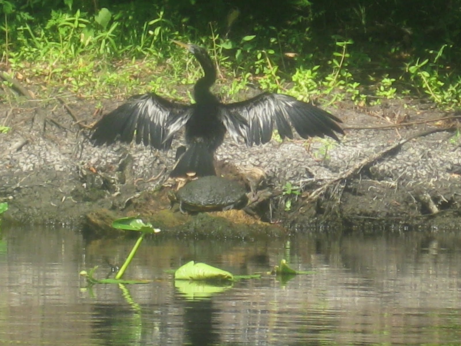 Its about a mile from Blackwater Creek to the St Johns River on the Wekiva. I may have seen a manatee. A large dark oval surface for a moment, then went under to stay. At a point where the Wekiva has three branches. I've seen manatees here before. I think this was to big for a turtle, even a snapper. I paddled into the St Johns, hoping the bald eagle I saw a few weeks ago would be in the area. It wasn't. I considered crossing the St Johns to investigate the manatee zone on the back side of an island across the River. One, two, three , four speeding boats had me headed back to the Weikva. This is the mouth of the Wekiva at the St Johns River.
 Time stamp 10:14, 45 minutes from Blackwater Creek. I returned to Blackwater Creek, the secind photo, at 11:33. Briefly explored a couple dead end channels on the way back.

I took a lunch break at noon. As I did, three guys in a jonboat, 15 horse, made their way up the Creek. Looked like three generations. I bet granpa knows the Creek very well. I saw them later, fishing from the bank. Farthest up Creek I've seen a motor. Almost to the spot where a wood bench an metal chair has been for the past five years.
Some gator pics.


 I returned to the launch site at 1:57, but did not stop. I wanted the check out the Moccasin Springs Campsite. High and dry, unlike Easter weekend.
 The campsite is a 15 minute paddle from the launch site, where I returned at 2:36, according to this photo. Just short of eight hours after I left.
 Thanks to my early start, it was still early in the day, even after a near eight hour paddle. I decided to take a hike. Last time I tried to hike the Sulphur Island Loop, I was on a horse trail for most of the walk. Knowing that, I told myself I'd pay better attention to the map this time. From the launch site, the trail is a 3.78 mile walk, according to the map I had. I figured a two hour hike, tops. The map show the trail heading west on Grade Road, then north on Sulphur Road, then off the roads, heading north, then east to Pine/Sand Road the main north-south artery through the Forest. Forest "roads" are hard packed sand and dirt. Looking forward to bringing my new trail bike here. After I pick it up in Key West next weekend.
I saw several deer. Unable to get pics, until this little fella.


 I should not have seen the fawn. Nor this cattle.
 Just as on my last attempt to hike the Sulphur Island Loop, I was on a horse trail. Which has aqua trail marks. Aqua is blue, I figured it was a shared trail. I kept walking. The road has to be coming up soon. This bend, that rise. I looked at my watch 5:00. I'd been walking two hours. Time to make the best of a bad situation and retrace my steps. Past the pasture. Saw a muddy track on my right. This isn't it. Kept walking. This isn't looking familiar. Because you were looking at the forest on the right, left on the way back. Kept walking. Finally stopped, looked at the map ans said if the sun is here, and pasture, private land is here, holy cow, I'm way off course. So I turned around. Then remembered, that muddy part, now I recall some saplings lying in the mud to provide support. That was the right way to go. I got back on track, saw footprints headed the other way. Mine. Also, deer, turkey, and bear tracks. There's a brightspot, I've been out so long dusk is coming, and the bears are out. It wasn't that late, and I could have stayed home to see a bear. Came home yesterday to a reverse 911 call from the City of Winter Park, informing me a bear had been reported in Eatonville, a half mile away. I figured it was in the woods near Lake Bell. According to this article, I was correcthttp://articles.orlandosentinel.com/2010-05-19/news/os-eatonville-bear-sighting-20100519_1_bear-eatonville-residents-joy-hill
I did not breathe to heavily, wanting to conserve moisture. My water was gone. So were my legs. Knowing I was headed in the right direction, I sat down twice to rest in the thirty minutes it took to get to the car. I wonder how far I walked in four hours forty five minutes. In worn out tennies, I have a big blister on my outer left heel, major chaffing from the built in underwear of my swim trunks. Haven't felt like this since my marathoning days. Probably feel worse, back then I was in shape.
I am beat. Almost as bad as the Magic.
Sunday post script. I returned to the Forest today, and took this photo of a trails map on a kiosk.
My intent was to stay on the blue line. I was never on it. Close, as I went west on Grade Road, then north on Sulphur. I must have gone left, west, instead of right, east, where the blue hiking and dotted horse trails meet. I then walked south, past the yellow line, past Grade Road. Turned back, heading left at the Grade Road intersection, walking west until finally figuring out how to get back.
2 comments:
Hi Dave! Looks like you had a good "scare" on your last hiking trip. Did you have a compass with you? I made the mistake of not having a compass while paddling... got turned around... each shore bank looks the same from kayak level :-O ...but eventually made it back to the boat ramp. Never leave home without one now!
My compass/whistle was safely tied to my PFD. I never get lost, I just have extended adventures.
Post a Comment