
 I was going to kayak Rock Springs Run today, Saturday, August 28, 2010. But, a check of the Green Wave Forum told me it was blocked. http://www.clubkayak.com/greenwave/treports.asp?trip=591 Time for Plan B. Myakka River. I went to weather.com. Flood advisory. .04 inches over flood stage. On to Plan C. Juniper Creek, or Salt Springs Run? 40% chance of rain to the north. Fisheating Creek? 30% forecast for showers to the south. Went to bed, mind not made up. Woke up this morning, decided to head south on US 27 to Fisheating Creek, or, for those of you who speak Creek, "Thlothlopopkahatchee". "The place where fish are eaten"

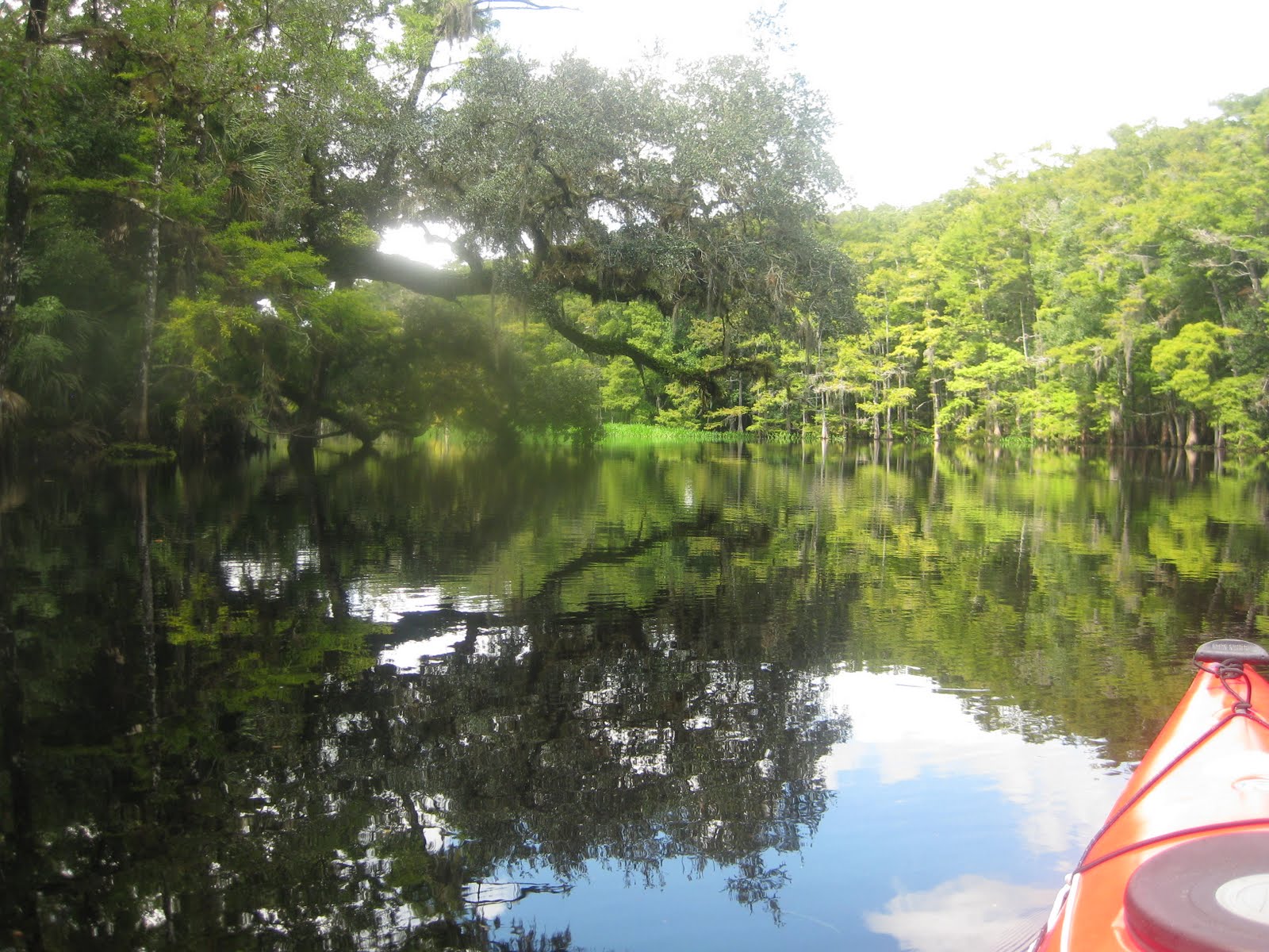
My trip odometer reads 256 as the car sits in the garage this evening. I arrived at the Fisheating Creek Outpost around 9:45. This was my second visit, the first was the Wednesday after Memorial Day, after a weekend in Key West and Oleta River State Park. That Tale has a brief history of the area. http://davesyaktales.blogspot.com/2010/06/fisheating-creek.html New since that visit is campstore, check-in building. The new building confused me. I recalled a fairly long drive to the Creek from where I paid back in May. So, seeing a road, I took it. Campground loop. Empty. Back to where I started. Another campground loop. Also empty. Back to the start. Oh, here it is. Just a few feet from the camp store. I had asked how many people had come in. "Three, they launched at Burnt Bridge" This is 8 miles up Creek from the campground. The shuttle van returned to the campground as I got ready to launch. There is no self-shuttling at Fisheating Creek. As part of the arrangement with the landowner, the Lykes family, only the Outpost concession can drive to the two upstream launch sites, Burnt Bridge, and for a 16 mile paddle, Ingram's Crossing. I learned this from the gentleman behind the counter at the campstore. I peppered him with questions, before and after the paddle. Another query was about campsites. Were there designated sites on the Creek, or can you camp wherever there is high and dry ground? I asked this because I had a map, given to me during my May visit, that had campsite icons. Camp where ever you can find high ground. As Fisheating Creek flows through a freshwater swamp, this can be a challenge when the water level are high. Which it was today. Higher than my June visit. Summer rains.


Maybe it was the high water, maybe the late start, but wildlife was scarce. I only have photos of ibis. Saw four alligators, a couple hawks, two anhingas, a cardinal, a blue heron, and vultures. May be an alltime low for wildlife while kayaking. On the other hand, the Creek is beautiful.

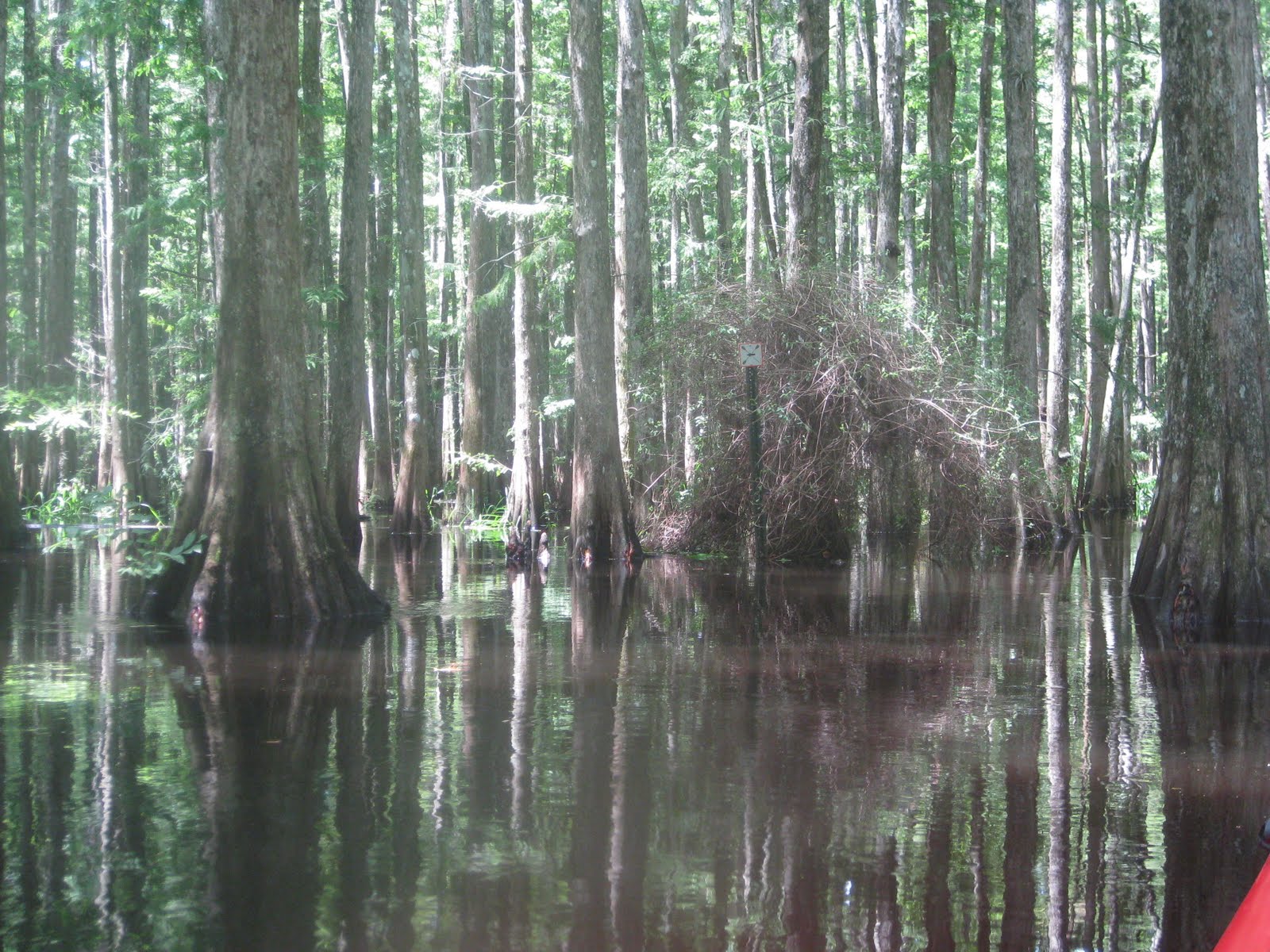
 Lemon Lake is wide spot on the Creek. Back in June, I paddled just a bit past it. Today, I wanted to see, and go beyond the paddlers coming from Burnt Bridge. A father and daughter in a canoe with a motor, (cheaters) passed, slowing as they did. Fisheating Creek alternates between open areas, and sections where you paddle a narrow channel between towering cypress trees. In an open section, I could see kayak paddles rising and falling behind the tall grasses. I must be half way. The trio stopped on a patch of high ground. Best potential camp site I saw all day. As I said hi, I heard engines, 4 canoes with motors coming down creek. Again, they slowed down, and told me two more were behind them. They also slowed. I then confirmed I was half way to Burnt Bridge, 8 miles from the launch site.
The above pic was taken on the way back. I turned around at 1:02, according to the time stamp on the pic preceding the "4 Mile" sign. Before I turned, two jonboats passed. One did not slow down. One out of 8 is a good ratio. I made my turn after the engine noise dissipated.


 "27" is mile 27 of the Creek. I must have gone almost to mile 28. Marker 21 is maybe a quartermile upstream of the launch. So, I paddled about seven mile up Fisheating Creek.


I found a patch of dry ground between the cypress knees and landed for a stretch and sandwich. Room to stand, up stream of the 4 Mile sign.


I made a second stop at the resurrection fern covered oak above. Looked to be a possible camp site. High ground, room for a tent. Bromeliads cover trees nearby.


 The last six photos were taken off the main channel. I had missed a turn. My detour and search for the correct route added 30 minutes to my day. Thank goodness for the directional signs. This is the one I missed.
 The directional arrow is on the other side.

 I may not have seen many animals, but Fisheating Creek has more bromelaids than any place I've paddled.


 I passed two kayakers taking a break on the shore. The two best potential campsites are very close to the Outpost, they were at one. Later, at the launch area I asked what happened to the third person. Turns out they were not the trio I saw earlier, but they had also launched at Burnt Bridge' along with another pair, who was ahead of them. Must have passed be while I was on my "extended adventure" I never get "lost". If I did, you wouldn't be reading this. The other spot was occupied by the young men in the motorized canoes. Who had dropped a couple of the favorite drink of rednecks. Busch Lite. I fished the cans out of the water.
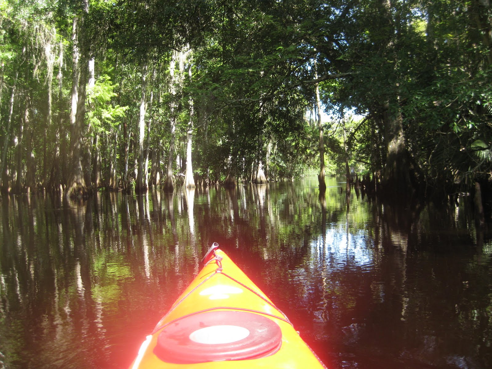


I don't think a rental canoe went out. On a Saturday. The kayaks must belong to the folks who launched from Burnt Bridge. I paddled beyond the launch, for eight minutes, until I had a glimpse of US 27 just past this railroad bridge.
 I also discovered that not all the Creek side campsites are behind sharp rocks, making it hard to launch a yak from your campsite. The two sites farthest from the ramp have nice sloping shores.


Of course, they are popular. The gentleman at the camp store said the one farthest down the Creek has folks reserving it from now into February. But some days are still available. He also told me he saw deer and hogs whsn he took a group out before 9:00 am. An early start is key. I slept a bit late today. Will tommorow to, as it midnight. Thinking Wekiva from Katies Landing.
2 comments:
Bromeliads and lots of cypress. Looks like a place my wife would like to paddle. She loves bromeliads and, at Silver River, we took several minutes taking pics of a swampy cypress area. Thanks for the report YD.
I'd take her to the Hillsborogh River. Full of cypress. Not sure about bromeliads, all the birds and gators distract me.
Post a Comment