 Happy Father's Day to all Dads, especialy Chris, Pat and Larry. Haskell kids, tell your Dad I say Hi.


This boat was berthed at the Hontoon Marina. Isn't Nevada desert ? Then I remembered, Lake Tahoe.

The only part of the Hontoon Island Loop with civilization is across from the State Park. 15 or so homes, and the Marina. I passed them, on the right, the State Park on my left and entered the Hontoon Dead River. A boater coming towards me said he saw a manatee. I paddled slowly, looking, listening, but it eluded me. Planned on the usual stop where hiking trails meet, and walking to the Shell Mound. This greeted me.

The fence and sign are new. I have two questions.
1) Why is this here ?
2) As the holder of Florida State Parks annual pass, how can I be trespassing if I land here?
I will try to find the answers later. Today, I did not land, as two people were fishing within sight of the sign. I also figured I could stop at Snake Creek. This hawk has a frog, not a snake.

An identical sign to the one above was on the Snake Creek shore. In the past I've seen metal, brown and yellow State Park signs in this area. I landed, ate lunch, then went on my way.

I saw several of these large red flowers. If anyone knows what it is, let me know. I found the answer, Wild Scarlet Hibiscus http://www.hontooncso.com/im22304/hon36.jpg
Snake Creek is narrow, shallow, winding and long. Power boats are rare, and so are paddlers. I encountered a group of canoers shortly after my lunch break. I asked if the came up from the St Johns, as opposed to coming from the Dead River, as had I. They had come from the St Johns. Which meant the way was clear. Snake Creek can get blocked by thick weed growth. The group of 8, or maybe 10 people, in 4 or 5 rental canoes from Blue Spring State Park, were the only people I saw in Snake Creek. They asked how much farther to the St Johns. A strange question, as they had come from the St Johns. I told them they were headed to the Dead River. One of the party responded, "we have map, how much further?" I told them 10-20 minutes, turn left at the Dead River, left at the a canal, back to the St Johns. Obviously this was their first trip up Snake Creek. For me, the route they were taking is a short 3 hour paddle. But then I know where the canal is. Assuming the map the woman had was the same little one littering the canoe/kayak launch, it was missing a few details. Hopefully, they made it back- but I did not see them back at Blue Spring.
I did see this limpkin when I returned to the St Johns River.

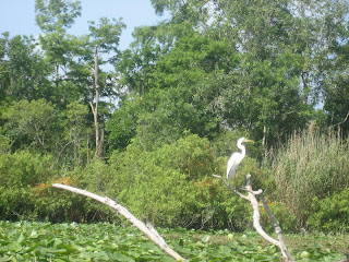
A couple more birds, herons, blue and great blue.
I saw about five gators in my four hour paddle, all in the water, like this one.

I had to take a picture of this boat, among all the boats beached just outside Blue Spring.

"Yacht Club or South Shore ?", I asked. Those are Milwaukee marinas, for my non- Wisconsin audience. Turned out to be neither, he's a local who bought it from a Milwaukean who drove it down. I told him I was surprised the guy sold it to a Viking fan- check out the towel hanging from the back of the boat. He laughed, saying, yeah. I'm a Viking fan, but I like Farve.
Don't we all.


1 comment:
You do a nice job here, Mr. Yak. Thanks.
Post a Comment