 The Space Shuttle was scheduled for a 7:39 pm liftoff today, Saturday, July 11, 2009. I'm an early riser Saturdays, and was unsure of how to keep myself occupied all day. A look at the weather forecast made me think it would not go. The Gulf Coast forecast was better, so I headed southwest to Fort De Soto. Lift off was postponed again, for the third time. Reset for 7:13 pm tomorrow. I'll be there, after sleeping in a bit, cutting the lawn, and perhaps working on this Tale to kill time.
This is the second Fort De Soto paddle on the Yak Tales. See the June, 2008 report for details on Fort De Soto. http://davesyaktales.blogspot.com/2008/06/fort-desoto.html
One correction from that Tale. It is two miles, not one, from Mullet Key (Fort De Soto) to Egmont Key.Unlike my visit 13 months ago, this time I made the crossing.
I arrived Fort De Soto about 8, but did not get in the water until 9. I had to scout out the best location to launch, and Fort De Soto is big. 5 keys, 900 acres, 7 miles of beach frontage, on the Gulf and Tampa Bay, plus more water access on Mullet Key Bayou. I put in on the East Beach near the Bay pier. It is long walk from the parking lot, across the beach. Glad I have wheels.
It took 45 minutes to complete the crossing.
 The lighthouse is not a leaning tower. Conditions in the 80 foot deep channel can get rough. I had no problems. Okay, one. Launching from Fort De Soto, I took on a bit of water. Same thing happened on the return. I'm not used to putting in big,wavy water. The lighthouse is near the northeast tip of Egmont Key. Arriving in its shadow, I then paddled south along the east shore to see what I could see.
 A long section of the Bay side beach is off limits as a bird nesting area.
 I do not think I've seen a yellow crowned night heron on a beach before.
I had read that there are ruins, remnants of a Spanish-American War defense system, now in the water, that can be snorkeled. I did not find them. Later, on the island, I picked up a Park brochure. The underwater ruins are on the Gulf side. Now I know for a future visit. I paddled just past the Tampa Bay Pilots dock, 2/3 of the way down the island.


These photos give some perceptive on the ship's size. Compared to the sailboat, and navigating the north end of Egmont Key.

 In 1980, a ship hit the old bridge, causing it to collapse. 35 people perished. This is an article from the St. Petersburg Times on the 20th anniversary. http://www.sptimes.com/News/050700/TampaBay/Horrific_accident_cre.shtml
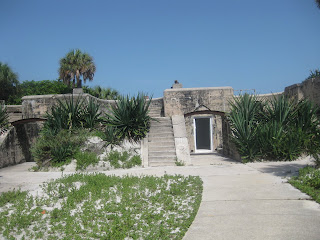
 Fort Dade was built to defend Tampa during the Spanish American War. Or begun, during the war. It was not completed until 1906, 8 years after the conflict ended. 300 people lived at the Fort , which besides guns covering Egmont channel, had a theater and bowling alley. All short lived, the Fort, and Fort De Soto closed in 1923.
 Visitors can walk along old concrete pathways and brick roads lined with palm trees.


The lighthouse, built in 1858, is an active aid to navigation, so is kept up.

then got back in the yak, returning to Fort De Soto.


I landed, got the wheels on, rolled across the beach, put it on the roof, and drove across the road for more paddling. Put in just down the puddle filled dirt path from the rental concession at Soldiers Hole.
The area was busy with folks enjoying a Saturday paddle. I saw a brief, misty spray of water on my left. Manatee exhale ? Yes. Five manatees. My last visit was the first time I had seen a manatee at Fort De Soto. To see five was great. They were active, but I was unable to get any photos. Some paddlers came by. Look, a dolphin! Obviously they are not readers of Dave's Yak Tales, or they would have known what they were seeing.
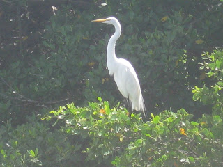
Great egret, osprey, great egret.


Humans, oystercatchers, (orange beak) and an unidentified shore bird.
I had been paddling about 75 minutes from the time , the second time, I put in. Time to head back. Saw dolphins again in the same area, now you do too.

That is the Bunces Pass Bridge in the background. It now being Tuesday, I can't recall how many dolphins I saw way back on Saturday. These three pictures are of the same great egret.

Two osprey now perched where one had been on the way out.


I landed, for the second time on the day. This time for good. Took a short, four mile bike ride, and visited my cousins.
A final view of Egmont Key, from atop one of the gun batteries at Fort De Soto


2 comments:
Hey! I can't believe that you crossed the channel. We went out there a couple of months ago, and although Egmont Island was tempting, those ships scared the crap out of us! How'd you time it? Was it just chance.
-christina
Christina, I made the crossing(s) when no ships were in sight. The big ship photos were taken as I paddled along the shore of Egmont Key.
Post a Comment