I launched from the Marion County Road 484 Bridge at 9:00 am. This is a tube takeout in the summertime. No tubers this time of year. I paddled up the Rainbow.
In addition to no tubers, the rental concession at Rainbow Springs State Park is closed. "For reasons beyond our control" according to the Park website. That takes people off the River. KP Hole Park, a Marion County facility, has canoe and kayak rentals. I saw no boaters until I reached KP Hole. After seeing two of my favorite birds.
 |
| Belted Kingfisher |
The eagle was across the River from the State Park tube takeout. Only got two pics before it took flight.
Lots of cormorants. This trio decided three's company, four's a crowd.

The Rainbow River is an excellent place to see otters. I usually have multiple sightings.
When I first kayaked the Rainbow, in 2005, I found a beautiful spring run, leading to several small springs, the Rainbow swamp springs. I'd paddle up the run, snorkel the deepest spring. A few years ago, the property was sold. A no trespassing sign was installed. It's a navigable waterway, how can a person trespass? As long as they don't land. Now, this.
I emailed the Southwest Florida Water Management District about the fence. Under Florida's Public Trust doctrine, it sure looks illegal to me. Back down the run.
Back to the River with anhinga and cormorants.
Rainbow Springs State Park.
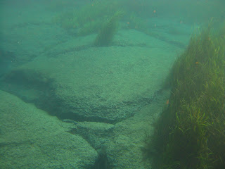
The Rainbow River is fed by many springs, like the one below. They are on both sides of the start of the River and continue well down stream.
There used to be a gap in the grass, and you could paddle over the spring in the background. Not having visited since April '09, I can only blame myself.
I landed at 11:30.
And submerged a few minutes later.The swim are just has small vents, bigger springs are behind the rope line. Just two other people in the swim area, and they got out as I got in.
Lunch with one of my favorite views.
The tagline for Florida State Parks is: "The Real Florida"
Rainbow Springs has "The Fake Florida" Artificial waterfalls, water pumped from the river, flowing down mounds of mine debris from phosphate mining in the early 20th century.
Old zoo.
Back to the Real Florida.
The Park's Butterfly Garden is looking bigger and better. Thanks to hardworking volunteers. The nature trail, beginning at the end of the garden, is about 2 miles. I just did a short out and back walk
Back to the waterfalls.
They may be artificial, but they make a nice photo. I get a lot of visitors to this site from overseas folks who clicked on a Rainbow waterfall photo I took in 2007. They must think Florida is full of waterfalls.
The Real Florida is springs.
All visible from the Park grounds. As are these views of the River, from the Visitor Center.
I backed away from the dock at 1:30.
Got the yak facing forward and headed down the Rainbow.
And off I went, over the spring and down river.
Dive flag on the yak, holding on to a long rope as it drifted behind me.
Reeling the kayak in so it would not drift into the shore or any boat traffic, letting it out to let me dive when I saw something interesting.
Varied topography.
Or would that be bottomography?
I was in the water 20-25 minutes. Got back in the kayak at the mouth of the Rainbow Swamps Springs run. Shallow, hard sand bottom. The new owner calls it "Gissy Springs" I googled it. Found some photos. Commented on the illegal gate. Got a reply. The guy claims " The original land surveys have the high water mark where the current gate is, so the landowner legally owns the springheads and the entire waterway out to the gate." Hmmm, wonder if those old surveys are available online. I'd like to see someone sue to re-establish public access.
Back on, rather than in, the water.
Otters across from the Rainbow Springs Campground.
The campground is separate from the day use area of the State Park. There is a third area, the takeout for tubers who start at the State Park. I stopped there, to untie the line I had used while snorkeling. It was dragging.
More otters.
That made three otter sightings on the day.
Saw one more otter, missed the photo. It was dragging a large mouth bass through the water. A big one. Usually I see otters with small fish, shrimp, clams. This was a about half the size of the otter.
Landed at 4:45.


15 comments:
As I read your post I was looking at my two yaks which haven't seen water in a few months. Gosh, I have to get them out.
What a gem this Rainbow River is!!!! Just added it to my Paddling Bucket List. What about the put in Master Dave? It is something like the put in at the 445A bridge at Alexander Creek or there is a parking lot?
TFB, time to get off the computer and on the water. In a kayak. I saw something on your blog about wanting a power boat. You must resist the Dark Side.;)
DK, the put in is a dirt lot, with portable toilet. On summer weekends it is overun with tubers. The alternate site is the Dunnellon City Hall launch on 484 and US 41, on the Withlacoochee. Adds about a mile both ways. Or, KP Hole Park, but that is so close to the State Park I've never considered it.
I found this about "Gissy Springs"
http://www.bluetoad.com/display_article.php?id=426443
Nicole, I've seen that article. In a glossy magazine for rich people. I'm just glad I had the opporunity to paddle up the run to what was known as Rainbow Swamp Springs and snorkel it before a timeshare mogul bought it and closed it to the public. A shame the State did not step in to purchase the property, creating a link to the two divided parcels of Rainbow Springs State Park.
I believe you are right about public access to Gissy Springs. The Federal geological laws state that any navigatible waterway cannot be blocked and open to the public. I can navigate this creek easily with a small boat and a kayak. Public should have access to the springs themselves, as long as they do not get out on any land.
You should still check it out as to the water mark regulations, though. He may have a legal point.
Kevin, I think as long as you have money, you can do whatever the hell you want. A shame.
Dave did you ever hear back from the management district about access to Gissy? We're doing assessments on that run and are limited only to the portion before the fence.
What did you find out from the water management on the run to Gissy Springs? Is it open to public kayaking because it is indeed navigable?
I never contacted the Water Management District. The gate is still there. I do not think the Right Wing zealots in power give a rat's ass about the environment, public access or anything kayakers care about.
I was on the Gissy run today and now there is a sheriffs neighborhood watch sign on the gate.
I know, J.J. I have been following, and contributing,to the discussion in Spring Hunters, too.
I was just here last week, and the gate in the pics is down. You can go further up the run, but there is a more permanent looking fence with an opening you could kayak through. I didn't know the legalities of waterways, so I didn't go through, but I could have. Maybe they installed that to deter people like myself that don't know the rules?
My last visit, the first gate was open. Paddled past it, then some downed trees blocked the run. I have not seen the second barrier. I say, if possible, paddle as far as you can, and if you see anyone, say, "Nice place you got here" (rich a$$hole).
Post a Comment