Before today, I've been on the St. Johns from south to north, at the following locations: Lone Cabbage Fish Camp, at State Road 520. On an airboat with my Mom. That was years before I began kayaking and I did not know any better.
C.S. Lee Park in Seminole County, up River from the mouth of the Econlockhatchee River.
Cameron Wright Park, near Lake Jessup in Seminole County. Launched there by mistake. Meant to go to C.S. Wright.
At the confluence with the Wekiva River.
From Blue Spring to Hontoon Island State Park.
Lake George at Salt Springs Run
I was first told about the St. Francis River in Feburary, 2006, by Joanne B.
"set out in search of St. Francis Dead River, paddling down to the St. Johns from Norris Dead River, then downstream a couple of miles and there it was, just so pretty and peaceful."
She has asked me a few times since then if I had paddled it. I had not. Then, a few weeks ago, Joanne's padldling pal Pam posted photos on Facebook from Harry and Honey Creeks. In the same area as the St. Francis. Now I had photos to go with the descciption. Time to see it for myself.
I could continue to blab, but instead will link you to the Lake County Blueways site, which I would just plagrize anyway. I printed the map, as well as this map from the Lake Woodruff National Wildlife Refuge.
I woke up at 5:30, and as the forecast called for rain, I decided I may as well get going to try to beat it.
The launch site is Ed Stone Park. A Volusia County facilicity, just east of where State Road 44 crosses the St. Johns. 3, maybe 4 concrete ramps, plenty of parking (at least at 7 am), restrooms. As you can see, a grassy area to launch the kayak.
On the water at 7:10, a short canal to the St. Johns River.
The first marker is across the River from the canal. The west bank is Lake County, the east, Volusia. I began to paddle north, down River.
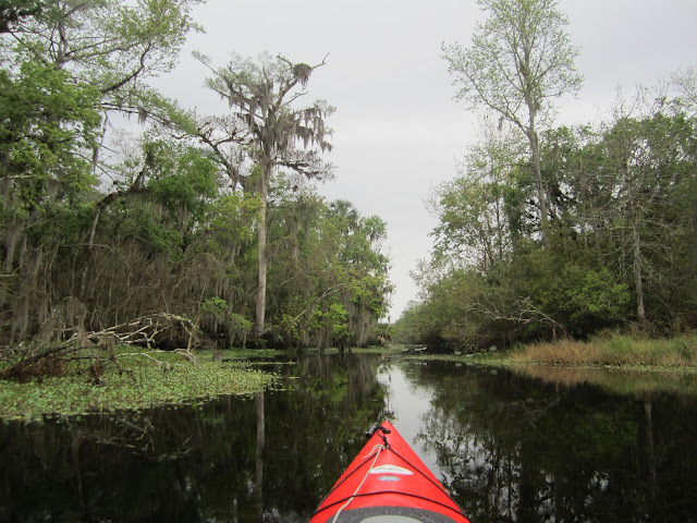
Past the St Johns Marina, a bit of a run down looking place, then, nature.
The southwest corner of the Lake Woodruff National Wildlife Refuge.
Must be nice to have a house on the water, in the midst of a National Forest and National Wildlife Refuge.
Only 2 or 3 boats out. The overcast morning, and the Daytona 500 kept the traffic down. Daytona is 25 miles east. Don't think the NBA All-Star Game had an effect. Tip after dark, and I think the average bass angler is a bigger stock car fan than NBA fan.
That's Trail marker 3, of 6. The signs are in logical, and helpful, spots. This one is at the far end of an island. Marker 2 was at the other end. The Trail goes the long way around, but puts you in a slow speed zone.Ospreys are nesting. I think I'll go to Lake Norris next Sunday. Home to hundreds of osprey nests.
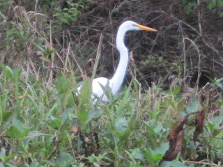
Three for one. Ibis, blue heron, coot.
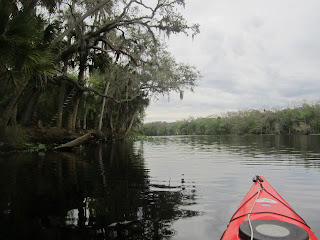
St. Francis River.
I don't think the above is part of the late 19th century town of St. Francis.
There were no places to land on either the St Johns or St Francis, until I came to the above spot. Good timing, as it began to rain.
I landed, turned the kayak over, and walked around.
Has to be the St. Francis Trail I think the high ground is artificial, and old road. To much of a coincidence that equally high ground is on the opposite bank. Had to be a bridge here.
The rain stopped, I got back in the water.
Wood pilings and a culvert. Yup, this high ground is man made.
With all the osprey, I wasn't sure if this distant bird was osprey or eagle
Eagle. My camera sees better than my eyes.
The St. Francis is short. According to the map, a 3.22 mile round trip.
Rain came down again as I reached the dead end of the St. Francis Dead River.
I again stopped at the St. Francis Trail. Stood under a palm tree and had a sandwich. This would be a good camping spot, and people do, from the fire ring marks on the high ground. Need to find a place to keep the car. Ed Stone Park is open sunrise to sunset.
Closeup of the nest in the opening photo
From what I've read, the town of St. Francis was at the confluence of the St Francis and St Johns. Supposedly there are pilings from a hotel, long abandoned. Perhaps this is one of them. I'll have to explore further on a dry day.
If the belted kingfisher on the Paddling Trail sign were clearer, it may have lead this Tale.
Stupid rain. But, we need it. And it did keep people off the water. Stupid Dave left his poncho in the car. My windbreaker is useless as raincoat. A cool rain, in spots, steam was rising off the River. Meaning it was warmer than the air. Might I met a manatee?
One of these osprey chased off a bald eagle that came too close to the nest for comfort.
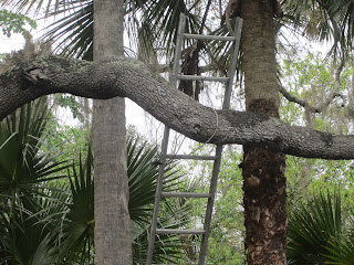
Whoever put this ladder up is smart. Locked it to the tree.
This is the dock for the house I pictured early in the Tale. I paddled into the residential canal.
Nice launch site if you happen to live here.
Tuesday morning. I'm at the Orange County Courthouse. Not a defendant,. Jury duty. Nice to have internet accesss instead of reading old magazines
The Norris Dead River enters the St. Johns from the east. I went to check it out.
Norris goes into Lake Woodruff. Looks like long paddle. I just went for a few minutes, then turned around and came back to the St. Johns.
A houseboat from Holly Bluff Marina stopped, its occupants on the roof, looking at something. I went over to see what they saw. Manatees. Three.
I got a photo of one. They were staying under the surface for lengthy periods.
I wondered what this closed to the public area was. It is the River Forest Group Campsite. According to the Ocala National Forest website, it is closed for renovations.
St Johns Marina.Back to the start of the paddling trail.
State Road 44 bridgeI landed at 1:40. Ed Stone Park has 4 restrooms, 2 male, to female. Nice to go into one and take your time changing into dry clothes without someone banging on the door.
It took me 6 years to get here, but I'll be back. Lots of areas to explore. More of the Norris Dead River, two more named creeks, Harry and Honey, several unnamed waterways, canals, and more.


4 comments:
LOL, maybe now you'll listen to me? Will it take you 6 years to launch at Wekiva Falls and go 3 miles up the Wekiva and 3 miles up the Little Wekiva?
Norris Dead River is one of my favorites. We usually launch at Highland Park Fish Camp and go down to the St. Johns and back, exploring the lakes on the way. Planning soon to shuttle from SR 44 bridge to Highland Park Fish Camp, which is one of those old Florida places you have to love.
Thanks to you both. It will not take 6 years for me to visit this place...I promise. I did not know about the Little Wekiva thing.
"Will it take you 6 years to launch at Wekiva Falls and go 3 miles up the Wekiva and 3 miles up the Little Wekiva?"
Yes. But only because I'm cheap and to save 5 bucks would launch at Wilson's Landing.
Cheap? No, just young and strong. We're old and feeble. We do a 12 mile paddle and you'll be doing 14 more or less. We did go from Wilson's Landing once, but it was in the heat of the summer and that last mile of no shade liked to have killed us.
Post a Comment