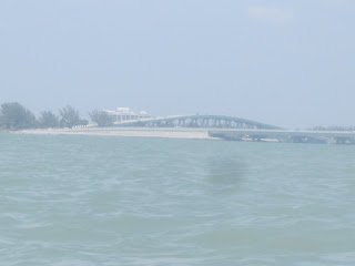
Under way at 9:50. From the causeway island closest to Sanibel. Considered going somewhere else, as no way was it a light chop, as forecast, but I was going into it, so hopefully, it would be on my back on the return.
No photos as I crossed the San Carlos Bay to Woodring Point.
The Point, but for a small enclave, is the east boundary of Tarpon Bay and the Ding Darling National Wildlife Refuge.
Two dolphins near the entrance of Tarpon Bay. I'm surprise I even got this poor pic, battling the waves and wind.
A chain of 5 mangrove islands is in the middle of Tarpon Bay.
A wide variety of birds seem to like it.
Redddish egret
Great egret
Tri color heron
Snowy egret
Yellow crowned night heron
Black crowned night heron
Cormorants an brown pelicans
Great blue heron
View as I paddled away. It was high tide, the oyster beds that white pelicans like to rest on during their winter visit were well under water.
Paddling towards Commodore Creek, I could see paddlers coming from the Tarpon Bay Explorers rental concession. I tried to time my arrival to avoid them. I did for those coming in, not for a big group coming out of the Creek. One of the first paddlers said, "there it is again" A manatee ? I asked. Yes. I waited, it did not resurface. But, the wait let the large group come out of the Creek before I entered.
The spoonbills, 3, also were "still there" according to paddlers just finishing the Creek loop.
Mourning dove, I think. I had hoped it was a mangrove cuckoo. On Saturday, as I drove to the launch, I passed a person, covered in mesh no-see-um garb, holding an antenna. As I was about to launch, she stopped at the launch site, putting the antenna out again. She and others have radio tagged the cuckoos. None were heard. She showed me a decoy. It had a yellow breast, or at least that's what I remembered. So, when I saw the above bird, I got excited. Until I found the Facebook page of Ecostudies Institute
One of the three spoonbills had left.
Maximum zoom to the opening of Tarpon Bay
Back to the islands.
Leaving Tarpon Bay
Into San Carlos Bay with a barely visible dolphin. Hopefully, I could find spot near Woodring Point for a break.
I did
Two manatees swam by. Heads raising high out of the water as the battle the waves. Like racing breast strokers. I was unable to time a photo.
If only I got them as they passed the Manatee Zone and Blueway markers.
Back on the water.
My destination
Two of the three bridges that makeup the causeway.
A somewhat difficult crossing, boat wakes adding to the natural chop. I put the spray skirt on before leaving my lunch spot. It came in handy on one occasion.
Getting closer
Landed at 2:52
The way I came.
The other side, smooth as glass. Not fair! And how can that be? The causeway islands are low, few trees to block the wind.
I needed to get my money's worth from the six dollar toll, so I headed to Sanibel, and the Bailey Tract . Needed to see an alligator.
Feed alligators, and they feed on you.
Black necked stilt. I did see one small gator. Went under before I got the picture.
Last photo of the day, 4:16 PM. I had walked the red trail 1.1 miles. I went a little farther, retracing my steps to the pond where the gator was. Still underwater. I thought of stopping at the Lazy Flamingo for some conch chowder, but having to work Monday, and a 3.5 hour drive ahead of me, I left Sanibel. Until December, if not sooner.


2 comments:
You had way a better time in two days that the one I am having in twice that. The weather is miserable here. Monday did not kayak to rest my back. It was hazy but the Sun was somewhere. Well, has not seen the Sun since. Yesterday was cloudy and windy wifey did not want to be in the water like that. Do not blame her. Today is dark gray, windy with thunders. Perfect!!!! (sarcasm involved). Does not look like there is any hope in the forecast for the next days.
Did go to Bailey's Tract Monday and saw a gator that was not as shy as yours. Seems to be used to the humans feeding it. Dangerous thing.
Oh...forgot to mention...is raining really hard too. $%^$$E
Post a Comment