Dave's Yak Tales

Cedar Key Sunset

Friday, June 4, 2010

Fisheating Creek

Wednesday, June 2, 2010, I left Oleta River State Park. I learned that the last bit of self lighting charcoal that I've had since Halloween doesn't stay lit in south Florida humidity and rain. I'm not sure if the last of my steak and black beans were warm from the coals or the sun. Coffee never got going, but a least the water turned tea color. Nothing to share with my guests.
Cops, mostly North Miami, the black and whites, but Adventura and Sunny Isles PD too, in for a morning run on the trails.


Views from my picnic table. Straight ahead, the trail to the "Cabin Loop" bike trail.
On the right, my not perking coffee, to the left, empty cabins.


I left Oleta River State Park about 10 am. Destination, Fisheating Creek. It would be the third new place to paddle, after Geiger Key and Oleta River State Park on my extended Memorial Day Weekend. Fisheating Creek flows from the spine of Central Florida, the Lake Wales Ridge, to Lake Okeechobee. It is undeveloped, as most of the land near the Creek was controlled by the Lykes family. Ranchers and meat packers. In 1989, for reasons I don't have time to explain, the Lykes closed the Creek to public access. A legal battle ensued, the result, a long section of the Creek is now wildlife management area. Most of the Creek is in Glades County, population, 11,000. A little different pace from the 2.5 million I left behind in Miami-Dade County. I left the 1o lane interstate behind in Broward County for the 4 lane US 27 north through the Everglades, then miles of sugar cane fields in Palm Beach County, a county with an image to those outside Florida of beaches and polo, it has more agricultural acreage then any county in the state. Into Hendry County, then Glades. The Fisheating Creek Outpost, with camping, kayak and canoe rentals and a ramp, has a large sign on the west side of US 27 just south of Palmdale. Here is their website, updated a few months ago by Ed S. of the Green Wave Forum.http://www.fisheatingcreekoutpost.com/default.asp


I paid a $3.00 plus tax, day use fee. I was glad it was not $6. The website says day use is $3 per person, or $6 car load, and $3.00 to launch. I emailed the Outpost a while back and was told both fees had to be paid. I asked if there was an additional launch fee and was told the State, from whom the site is leased, said they can't charge a launch fee. They can and do charge a fee to park a trailer. So us car-topping paddlers are ok. The ramp is concrete, I put in next to it, a dirt area, just before 1 pm. An alligator floated nearby.


Fisheating Creek is a blackwater stream, fed by rain, not springs. Being my first time on the Creek, I don't know what "normal" water is. From water marks on trees, it was not as high as it has been, but from how it flowed into the cypress forest, not as low either.


Not having a hawk eye, directional signs on the Creek are a big help in areas where the Creek splits in two, or three. I came to one junction and went the wrong way. Good place for a marker, I thought as I got back on course.

There was a pole, but someone or something removed the directional arrow. I saw only two someones on the Creek. Two guys fishing (Aside, just now on A Prairie Home Companion, Elvin Bishop is singing about fishing). I saw a few more alligators, wood ducks, a swallowtail kite. According to the brochure and map I was given when I paid for parking, Fisheating Creek is "an important late summer staging are for these birds as they prepare for their migration to South America in August" I may have seen more birds, but there were not a lot on a hot June day. Not to mention, I'm composing this Tale 3 days after the fact.


Not a lot of big animals, but many butterflies and bromeliads.


I thought I'd paddle for about two hours, then turn back. I hoped to check out some of the primitive campsites on the Creek. On the map, the first site as you paddle up Creek is on the right side, at the end of an open area. I paddled through several open areas, the last one marked as Lemon Lake. Did not see any obvious campsites. Either I did not paddle long enough, or you camp wherever there is high, flat, dry ground, and the tent icons on the map are just suggestions.


I wonder if the wood frame above was part of the fencing built to block access to the Creek back in 1989? It is where I turned around, at 2:45, just past the west end of Lemon Lake.


Padddling round a bend, I heard a splash, had to be a gator. Then I heard what sounded like bones cracking. Finally I saw the gator, jaws wide open, whatever it just crunched on the way to its stomach.


Fisheating Creek is very isolated. Fort Myers, 45 miles away, is the closest place with any population. It's 132 miles from my house. I think I'll return.


Maybe I'll camp in the fall. I saw there is no reason to pay extra for a waterfront site. Can't launch unless you want to climb over the riprap. On the other hand, I'll probably camp down the Creek, wherever those sites are. The pictured tent is the only one I saw. There was one other car in the parking lot. Monroe County tag. That's the Keys. Where I began my five day weekend. Where I'll return, next Friday. For my nephew's wedding. On a sailboat. I'll bring the kayak.

Thursday, June 3, 2010

Oleta River State Park, Day Two

As you may know from reading my recent Key West reports, Tuesday, June 1, 2010 began with rain. Wide ranging effects of Tropical Storm Agatha, according to my NOAA weather radio. It was not raining as I started the grill. I was not the only one looking for breakfast.


The wood pecker had it better than me. Rain came again, hard, I was forced inside, grabbing a just warm hot dog bun off the grill. That, and cold steak was breakfast. Coffee never perked. I putzed around the cabin, hoping the rain would stop. It did not, but let up some. Time to kayak. A rocky landing area is few hundred yards from the cabin. I drove down the drive to a grassy area, carried the yak the last 25 yards. Car back to the cabin. There is a large fire ring and benches here. A gathering spot for groups of cabin occupants. I pushed off, paddled a minute or two and the rain came down hard again. Pulled on shore and stood under a mangrove until it let up again.

Paddled to and past the rental launch, in a narrow channel called Crazy Creek. I saw it from the other end, Biscayne Bay, Monday, but did not enter due to the Memorial Day crowd. Today, a rainy Tuesday, no one was on the water.


Osprey
Crazy Creek empties into Biscayne Bay. The rain stopped, the Bay was almost empty. I made my way north, in search of the Oleta River.


The River is just before this bridge, NE 163rd St. It was a 45 minute paddle from the osprey in Crazy Creek to the Oleta River.


According to the map I got from the Park concession, it is 2 miles to the Blue Marlin Fish House Restaurant up the broad, slow flowing Oleta River. I did not see a lot of wild life. As I write 4 days later, I recall a juvenile black crowned night heron and ospreys. It took me about 45 minutes to get the Fish House. I paddled a bit beyond it, and the 163rd St. bridge.
I wanted to stop for lunch, but the restaurant looked closed. I stayed in the kayak, not wanting to scramble up on the dock, about a foot above my kayak. I shared the River with two power boats and one other kayak.


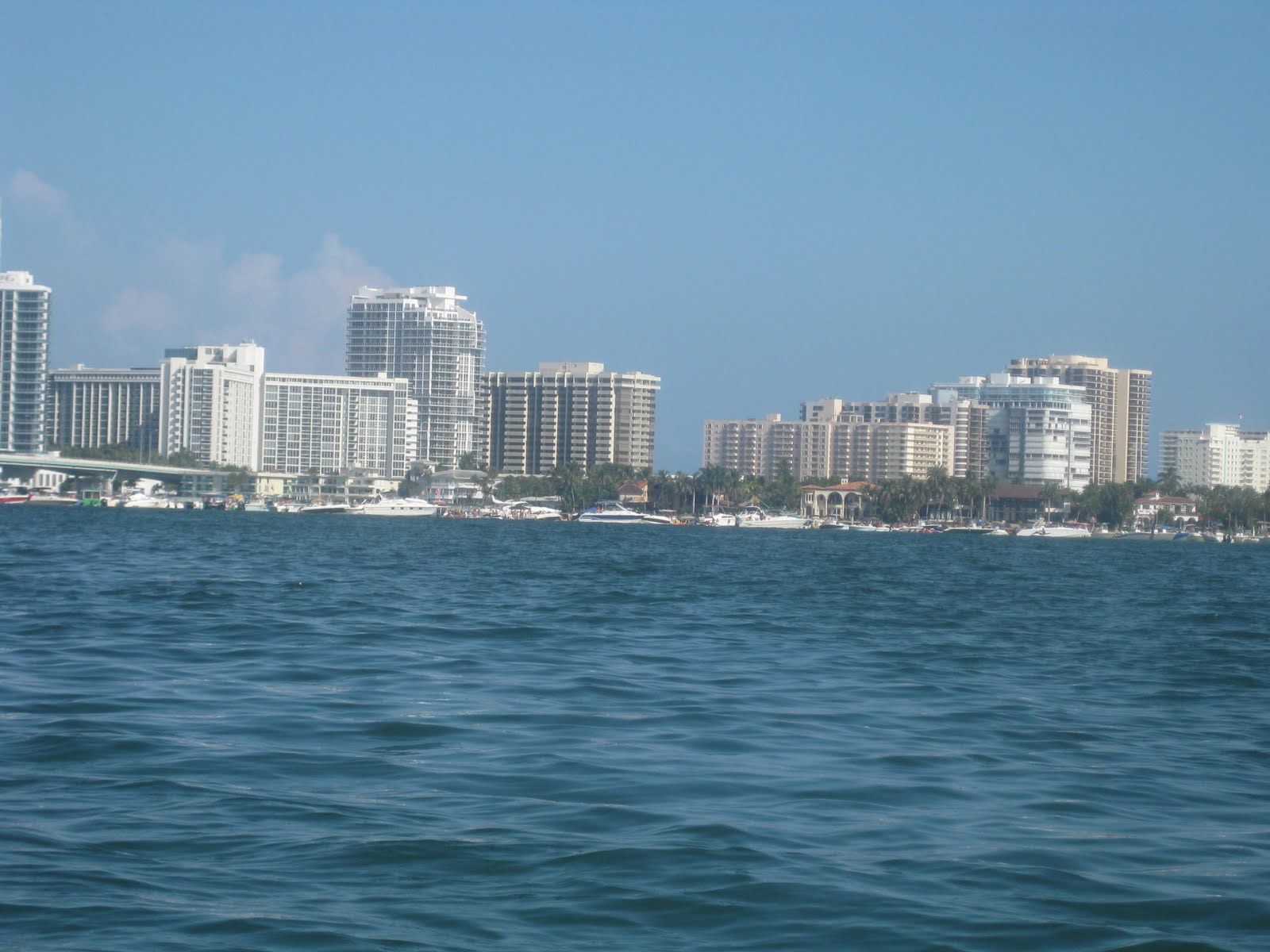
Great white heronThe first photo on this Tale, the buildings reflecting on Biscayne Bay, was taken from the mouth of the Oleta at 1:00.


As I paddled back along the west side of Biscayne Bay (where the Cuban gentlemen sleep all day) I saw the above great egret, osprey, and anhinga. Also saw pelicans and a great frigate bird. And rain clouds. Fortunately, there are several large picnic shelters along the shore. I waited out a shower under one of them. The rain passed, and I was back on the water. In the small bay, three dolphins were feeding. I saw one leap out of the water. I had several chances for tail shots, missed them all.

Dorsal fin. I stopped at the rental concession, having noticed on Monday they had hotdogs and empanadas. Turned out that was a weekend only thing. I inquired about the Fish House, and was told it, an outdoor venue, was closed due to weather. I got a couple mini Slim Jims and a granola bar to tide me over until I got back to the cabin. I landed at 3:10.
I think that's Cabin 10, closest to the landing area. Mine 12, is two beyond it. I had cold steak on a hotdog bun, then got on the new bike for the reason I bought it, trail riding. Oleta River State Park has 15 miles of trails. Well marked, novice, intermediate, and expert. A novice trail circles the cabins. I could have taken a short, steep, rocky, slope in front of the cabin to it, but chose the asphalt driveway instead. The cabin loop is wide and flat, very novice. I then got on some more challenging, tighter trails.
I wonder if I got off the novice trail, at one point the bumps got higher , turns sharper. This 5o year old was not quite ready for it and walked a few step parts. I saw just one other cyclists. If I was doing this on Monday, I may have got run over. I then road on some flat dirt roads and a paved path to the water. Also pedaled through water. Lots of puddles from the rain.
. Near the beach is a short trail called the "Chicanes" a series of sharp, roll ling, turns. Marked as novice, it gave me some confidence in my ability on more difficult terrain. I still have to learn the gears better to shift on the uphill sections. The ride lasted about an hour, 4 or 5 miles. Used different muscles than on the road bike.
It was now a little past 6 and I had a decision to make. I was in the Miami area to see the Brewers play the Marlins. I missed Monday's game due to holiday traffic. Had I not found Oleta River State Park, and stayed in a hotel, I probably would have gone to the game Tuesday. But, I thought, the rain has stopped, I want to check out some islands in the Bay, and instead of spending 50 bucks on parking, a ticket and a few beers, I'll have a good meal, and watch the game on TV. Now you know why the Marlins draw so few fans. Tampa Bay too. Floridians would rather be out on the water than in a football stadium to watch a baseball game. I was in the kayak at 5:50.I had a feeling some of the sailboats moored behind the cabins were "live aboards". That was confirmed the next morning when there were people showering in the bath house. No other cabin was occupied, at least there were no cars besides mine and the campground host's.


Back to the paddle. Into Biscayne Bay, looking into the Haulover Inlet, letting the Atlantic in.


Miami.


Sandspur Island. I'd paint the trash barrels green, to blend in. After circling the island, and checking out nearby, smaller, one I landed. But not before a jet skier speed by, close to the shore, landed, dove in, than took off. I would think a guy who is going to swim would think twice before speeding through a shallow, swimming area. Gasoline fumes must affect the brain. I snorkeled for a few minutes. Saw a puffer fish and small snapper.

I'm lazy, I floated with the current, then walked back along the beach.

Another early evening kayaker.
Sunset from the cabin.

Kayak, car, cabin and bike. I had dinner at Miller's Ale House, across 163rd St from the Park entrance. Not to be confused with the brew pub on the Milwaukee River. This is a Florida chain. They do not brew their own beer. Saw the last few innings of the Brewers losing to the Marlins.

Oleta River State Park

Memorial Day, Monday, May 31, 2010, I left Key West for Miami. Actually, North Miami, destination, Oleta River State Park. But first, a stop at Joe Robbie/Pro Player/ Dolphins/Landshark/Sunlife Stadium for a 1:10 Brewers v. Marlins ballgame. Left my sister's at 9:40, figuring 3.5 hours was plenty of time. Took a few pics out the car window as I drove the Overseas Highway. Old Bahia Honda Bridge


Pigeon Key, old Seven Mile Bridge.


The trip went well for the first 73 miles. That is the mile marker for a gas station in Islamorada, where I filled up. 11:15 am. Back on US 1, I went another 10 miles. In over an hour. No accident's that I saw, just holiday congestion. They only bright spot, I was behind a car, West Virginia plate. A kayak specialty plate. A photo taken through my dirty windshield did not turn out. Just as on Labor Day, the toll on Card Sound northbound was suspended. The ball game began as I was still had a long way to go. I decided to just listen to it on the radio and head straight to Oleta River State Park. So I reset the GPS. Which was cranky. It would not show the route to the park. But, I remembered the exit number, so I got off. Only it was the exit for the Stadium. I went into the parking lot, it was the seventh inning. Got the GPS working, and headed to Oleta River State Park, on the northwest side of Biscayne Bay. The Brewers lost. More heavy traffic as I approached the Park. Upon arrival, orange cones blocked the entrance, as the Park was full. I said I had a cabin reservation, the cones were removed, and I drove in. As I registered in the ranger office, a long line of cars rolled in. I asked it they were all in some large group with a reserved picnic area. No, just people coming in. Looks like the cones being removed for me opened the flood gates.
I got away from the crowd by heading on the road marked "Registered Cabins Only" There are only 14, I had cabin 12.


Bunks, a small double bed. Vinyl mattresses, bring your own sheets and pillow. A small, built in to the wall, desk/table. Two lights inside, six electrical outlets. Two windows, and widow air conditioner in the back wall. The AC worked fine. Not sure how it would be with a full house of four people in the small space. A lot more room outside.


Down a slope in front of the cabin is a little water, but not enough to paddle. So I drove to the main launch area at the rental concession. There a few narrow channels to explore, leading into a small bay, then into Biscayne Bay. Which, on the holiday was full of all manner of boats. Condo towers across the Bay. Miami skyline to the south. I expected to see Crockett and Tubbs. And I did. No longer on the Vice beat, but Marine Patrol. A patrol boat blew its horn and had two jetskiers speeding through a Manatee Zone come over for a chat.


As you can see, it was rough on Biscayne Bay, so I paddled back, past the Park beach, first photo in this Tale, into the sheltered smaller bay. Up one channel, which went past the other side of the cabins. Now I knew I could put in near my temporary home. Into another channel. Green heron and camouflage green iguana.


Oleta River must be a prime spot for dumbasses to leave exotic pets they no longer can handle. That's what you get for having a Park in the middle of a major metropolitan area. On the other hand, you also have a grocery store a few blocks form the Park entrance. I biked to a Winn Dixie. Picked up streak for the grill. Or, Carne, as it read below Meat. Another section Dairy, (Leche) Something to go with the steaks. Looking for beans in a pop top can. No opener. A customer speaking to an employee in Spanish. May as well go native myself. A can of Goya black beans. Biked back to the Park, roads wet, shower blew through as I shopped. Fired up the grill, had my steak and bean dinner. Then, watched the raccoons come out. And bugs, with green glowing eyes. I had no neighbors, other than the campground host. One, maybe two cabins on the other end of the cabin loop seemed to be occupied. No one in the bath house as I showered before bed. Day one at Oleta I learned the lay of the land. Day two I hoped to explore it more thoroughly.