A two for one to end 2011 and begin 2012. Above is my campsite at Potts Preserve. Photo taken this afternoon, Sunday, just before leaving. Potts Preserve is a Southwest Florida Water Management Area Recreation Area on the east bank of the Withlacoochee River. Across from the mouth of Gum Slough. Here's a
link. I've visited before, in conjunction with kayaking Gum Slough. On Wednesday night, thinking about what to do for New Year's (I work half a day, Monday) I thought I might as well see if I can reserve a site at Potts. Obviously, it was accepted. Can't beat the price. Free.
The reservation provides the combination to unlock the gate. Prior visits were by kayak and bicycle. Campsites are first come, first served. Two directly on the water were taken. As was a third, which I thought also was on the water. It is, but with a twist. More on that later. There are two more sites, or maybe one big one, as the stand up grill and fire ring are somewhat far apart. The empty site was the one with picnic table and fire ring. I parked, took the kayak off the roof. Did not set up camp, hoping by the time I got back, a better site would be available. A guy at one of the river front sites said the people on the site to his left were leaving in the afternoon. Cool. As were the temps at 8:30. And foggy. But, I knew it would warm up so I shoved off in normal yaking attire, swim suit and t-shirt.
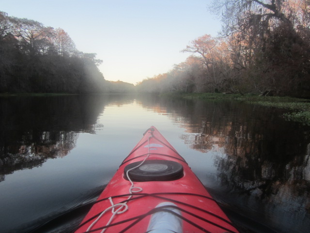
Underway at 8:50. Across the Withlacoochee to the mouth of Gum Slough.
Water level is low on Gum Slough. That does not rhyme, as its pronounced "Slew". I scraped over countless logs.
Scraped limestone too, had to get out and walk.
Had to get out and walk again, and kept walking. I was probably 50 yards or so from the two spring groups that are the source of Gum Slough. But, I wanted to paddle, not walk. And, I've see the springs before. So, I turned around. It was 11:30.
Two more springs, that I know of, are down stream.
I swam in this one my last visit. Today, I just hung the camera over the side. Was going to land, to have lunch, and maybe swim, but my paddle was stirring up loose sediment. So, instead of disembarking and clouding up the spring, and Slough, I stayed aboard. Another spring is just down stream.
Again did the camera over the side. This spring is close to the other one. So, you could get out at the first, which has a spot to land, swim downstream, and back.
There is one home on the Slough, downstream of the head springs area. I saw folks there for the first time.
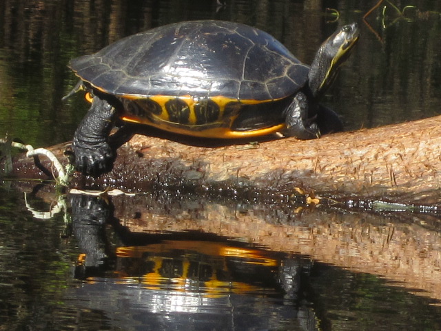
Saw an otter. Too quick for me to get a picture.
As usual on Gum Slough, I took a wrong channel for a while.
But then, I would not have got the above pic. But, anywhere on Gum Slough is scenic.
Other than the people at the house, just two kayakers on the Slough. First timers. I told one he should lift his rudder up. No need for it on the narrow waterway, and it would just get dinged on all the logs. While preparing for this trip, I saw there is a shell midden at Potts Preserve. I don't recall seeing it.
Wonder how I missed it before. Very obvious from the River. I'd say 18 feet high.
Landed at 3, in an area between the 2 river front campsites. What I thought was the third river front site was empty. I moved the car there. To see it is on the Withlacoochee, but the view is blocked by the shell mound. Which is ok by me. A wire fence separates the camp site from the shell mound. A hiking trail goes past the camp site. I checked it out. And saw I could walk up the north side of the mound. And more important, there was clear path to the River . Maybe 30 steps from the campsite.
Gum Slough on the other side.
Views of my site. Not sure if that's a laser beam or Native American spirits.
The rest of the camping area. This is crowded for me, I've only camped at places were no one else is. Buffalo Tram on the Wekiva River, and Moccasin Springs on Blackwater Creek in the Seminole State Forest. Fancy too. There's an outhouse. With ample TP and hand sanitizer.
Cacampsite situated, I went for a bike ride.
Just 3 miles, I wanted to get a sunset paddle in.
The sun was already behind the trees. Both sides of the Withlacoochee are public land. The Half Moon-Gum Slough Recreation Area on the west side of the River,
Potts Preserve on the east
A short paddle, thirty minutes. Landed, fired up the grill. And fire pit.
No sunset shots, but the Supervivid setting works well with fire. I turned in about ten. As usual when camping, I did not sleep well. I did sleep a bit, as I woke after two dreams. That gave me a chance to pull the hood on my Packer sweatshirt a bit tighter on by head. It was cold, low 40's.
The nice thing about sleeping in pants, socks and jacket, is you're ready to go in the morning. I left the tent maybe 7:30, started the grill, and went for a stroll.
Coffee wasn't close to perking, so I went for another walk.
A close up of one of many ground based spider webs.
This time the coffee was perking when I got back. Helped to lift the grill and put the pot on the coals. Steak and potatoes completed breakfast. The sun burned off the fog, I was back in swim trunks and T-shirt, and on the water at 9:55.
I wasn't sure how long I'd paddle. Thought maybe an hour down the Withlacoochee and back, then an hour on Gum Slough. Mile marker 33 on the Withlacoochee is a 1/4 mile, I'd guess, from Potts Preserve. The mile markers are very high up. Which is good as you can see them from a distance and pick the right channel.
Dead gator. I was not seeing much wildlife. At first.
I decided I was going to try to find Blue Spring. Yes, yet another "Blue" Spring.
There is not much info on this Blue Spring online. I thought I read someplace it was about 4.5 miles down River, on the right side.
Saw just one boater as I paddled. Downstream, headed north. Like the St. Johns, the Withlacoochee is a north flowing River.
This was my first time paddling this part of the Withlacoochee. I've paddled the section from the Highway 41 bridge at Dunnellon to the Rainbow River several times. That was where I launched my first kayak, in March, 2005. Paddled the section from Highway 50 to Nobleton, once. The section I paddled today is mostly wide, but does narrow in a few spots. As mentioned before, in several spots, it divides in two or more branches. That's where the tall mile markers are a nice aid to navigation.
After several miles, the banks are no longer public land. This was one of 4 cows in the cypress trees. Which reminded me of something I learned at Lake Kissimmee State Park, years ago. Florida cow hunters, don't call them cow"boys", don't use lassos. Useless in the cypress swamp. Whips cracking between the trees got the cattle where they needed to go.
The cattle were on my right. On my left, a few houses. Some man made canals. I did not see a spring. At mile marker 28, I decided it was time to turn back. I had paddled over 5 miles.
I also had passed some exposed limestone. Figured a spring had to be nearby.
I found Blue Spring. Or at least the run to it. It was on my "other right". Too shallow to paddle up the run, and with houses on either side, I did not want to get out and walk. One of the few reference I've found about this Blue Springs mentions airboats (boo !) get to it. I know they are shallow draft, but the run must be shallower than usual. Later on, some folks walking along the River said, "Wow, it sure is low"
Coming out of the run.
Limestone in the Withlacoochee.
I was glad the River was low, or there may not have been a spot to take a break.
I was not certain the run I was in came from Blue Spring. I entered another cove on my right, east bank, then a man-made looking canal. A concrete ramp at the end. Very clear water. Weedy. A gentleman was on the bank. I asked if this was Blue Spring. No, that's downstream. With a clear run, house on both sides, I asked. Yes. So I had found Blue Spring, or at least the run coming from it.
I shared the up River paddle with about 10 boats, including 3 airboats. I say airboat users should not be allowed to wear ear muffs. You make everyone else listen to your f$%*ing noise, you should to. Then maybe you'd get a muffler.
The Indian mound.
Landed at 3:10. The campground was empty. Surprising, as most people have Monday off. Maybe getting to cold to camp. Today, Monday, I saw a friend at Wekiwa Springs State Park who said a "Meetup" group was planning on going to Potts Preserve today but it was closed. I did a little searching on the internet. Found that group, from the comments it was last weekend the Preserve was closed, due to a wildfire. The were going to start camping on Dec. 30, but canceled. The Preserve website states, as it did all last week, that some trails may be closed due to wildfires. I saw that some trails did have signs up saying they were closed, due to wildfires. Not smelling smoke, I walked them, not far, anyway. Bottom line, I'm glad that meetup group canceled. As that opened up a spot for me.
I loaded the car, had a bite to eat. Thought of going for a bike ride, but was tired and sore, and had to work Monday morning. So I left.
Locking the gate behind me. Until my next visit.


7 comments:
Very nice, Dave. Did you make it to Blue Spring? I'm glad you saw some gators on the Withlacoochee, too, as I haven't seen any on my trips and the locals said they weren't sure what happened to them all but that their numbers seemed to have plummeted in recent years.
Oh, also, do you have a post on camping at Moccasin Springs? It's on my list of places I'd like to eventually go!
As you can see in the now completed Tale, I almost made it to Blue Spring.
I have 3 camping at Moccasin Springs Tales. Would have 4, but one time the site was flooded. My first choice this weekend, but was not available.
Hey Dave Did you see a marker 29 on the left side of the river? If you pull into the bank in that area walk about 10 to 15 ft. you'll be standing in Big Blue Spring. I never paddle up the run because it is so shallow.
I'm sure I did see it. The telephone pole markers are hard to miss. Thanks for the tip.
Happy new year, Dave!
Two dead gators recently on Wekiva downstream from Katie's. I looked at one freshly dead young gator and flipped him over, saw no wounds.
Happy New Year to you, Rick. And Mandy.
Joanne, I'd never even think of turning over a dead animal. But, I'm not a trained medical professional.
Post a Comment