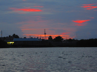
Labor Day on Cedar Key, began, not surprisingly, with the sunrise. First photo 6:52 am
I had some doubt that I’d see it.
But, the sun overpowered the thunder clouds
Storms and wind are the forecast. I’m composing this at 8:30 am and 2 or 3 storms have passed through. I’ll have to paddle between the rain drops in the inner waters of Cedar Key again today.
In the water at 9 am. The osprey is in a little cove just west of the channel side dock and launch area.
This photo looks southeast. Not the way I was heading. Too rough on the Gulf.
This is the prow of a boat that’s on the oyster bar. In yesterday’s Tale, much more was visible, with a cormorant on top. This showed me the water level was plenty high to explore a maze of islands on the east side of the channel.

I wondered where the rosette spoonbills I saw on the now submerged oyster bars were now that the tide was in. Paddled round a bend, there they were. 8 or so in a tree. Too bad I got greedy. Half a dozen snowy egrets were in a small cove near the spoonbills. And a tri colored heron. And a great blue heron. What a great spot. Too bad they all flew away. The spoonbills stayed. For a bit. I don’t think I was close enough to disturb them, perhaps I was, or maybe it was just time for them to move on. Two did linger.
I paddled through the islands, trying to recall which way I turned so I could find my way back. Which wasn’t necessary after I came into an expanse of open water and saw a distant bridge.
Was that the Number 3 Bridge?
I paddled towards it.
Yup. I approached from the opposite direction, east, than I had on Sunday.
Rain came. I paddled across a bay to Cemetery Point. There’s a shelter . But, the rain stopped when I arrived, so I stayed in the kayak.
Tombstones behind the boardwalk.
Water level still high, high tide had been at7:23 am, I was able to get closer to shore.
Too bad my camera was fogged, so I’m not posting pics of an osprey and a great egret. Problem resolved as I neared the marina.
Not the marina on the Gulf, the one near Bridge # 2. Where people who can’t make their boat payments scuttle there vessels. I can’t think of another reason why so many abandoned boats are in the area.
Now, a blue backdrop for the water tower.
First sail boat I’ve seen in the channel.
Not a good place for a sail at low tide, but high, I guess it’s ok. Wind is at his back, wonder how he dealt with it coming the other way.
Still deep enough to explore the east side islands. A single spoonie.
Alas, it got very dark and windy. Rained again. Stopped. I landed at 10:50.
The weather is schizophrenic. Rain came down in sheets as I began to record the morning paddle. Then it stopped. Windy as heck on the Gulf. Nice for this guy.
Blue sky too. At least looking from the balcony. Out the front door, dark skies. After lunch, I’m headed to the Shell Mound Unit. Protected waters, if too rough, there are a couple hiking trails. The wind will help keep the skeeters at bay.
I did not visit the Shell Mound Unit of the Lower Suwannee National Wildlife Refuge. Driving to the mainland, I saw half a dozen spoonbills on railing of a bridge/driveway intersecting with State Highway 24. Seeing a sign for the Number 4 Bridge Boat Ramp and Fishing Pier a few minutes later, I thought, whats the point of driving another 15 miles? I stopped, checked out the ramp, and water conditions. Blowing like a son of a gun. I figured I’d paddle into it. Besides,
I’ve never put a yak in here before.
It was hard labor paddling. I took refuge in a grassy area near shore, but it dead ended. Back into the wind, if I stopped paddling to take a photo, I moved backwards. I was in an open area, with nothing to stop the 23 mph wind (according to the Weather Channel) but some low grassy islands. Finally, more like soonly, I wasn’t out long, I had enough and turned around. But first, I wanted to investigate a wooded island across the way. That had white birds, too far to distinguish what type. So, across the channel I went, as the wind got stronger. Never got close to the birds, as increased winds on a day like today means another storm is coming. And come it did. Hard. Me thinking, this sucks, but not as bad as if one of these gusts tips me. Than, as quickly as it began, it was over.
I landed at 2:30. Only 30 minutes. I did see a trio of woodstorks, the first I’ve seen this weekend. Photos of those, and several others, did not turn out.
Stopped at the Railway Trestle Nature Trail on the way back.
Unlike the “Florida Keys” where the highway as built on the railroad right of way, in the Cedar Keys the modern road is a bit to the east of the highway. At least the last couple miles. The Nature Trail Section, which ends at waters edge. Pilings are visible in the water, crossing to the Nature’s Landing property, which has a short trail on the old RR bed.
Unlike last year, I did not lock my keys in the car
Late in the afternoon, I was ready to kayak again. Partly cloudy looking out from the balcony, over the Gulf. But out the door, dark skies on the side I’d be paddling. And it began to rain. At least I saw 4 magnificent frigate birds soar overhead.
The rain stopped, I just took some pics from the dock area.
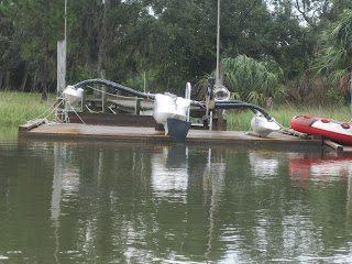
More of the boat was out of the water. A rosette spoonbill flew by.
The first time I paddled past this spot, I saw rosette spoonbills on the sandy bank where I’ve been launching my kayak. I thought, it would be nice to stay there some day. It is.
Also nice to go out to eat. To the same old place, the Pickled Pelican.
Weather info
Dock Street
The PP is the blue building with the orange trim. Upstairs.
I had clam chowder.
Gator bites
And clams
I liked the Sweetwater IPA, too. I think I’ve had it the Pickled Pelican before. Checked the May photos, Guinness. Of course, I could have had two beers. Photos from April and last Labor Day in Cedar Key aren’t on this computer. They are, of course, in the Yak Tales. Which I don’t have access to without the WWW in the condo. Just one beer this evening. In the restaurant that is. Needed my wits about me as I was thinking of seeing if I could catch the sunset from the kayak, Finished dinner about 10 past 7. Plenty of time.
The time stamp on the clams photo is 6:54. I finished the clams, and the bread, paid the bill, walked to the unit which is the farthest away from Dock Street of the 3 places I have stayed in on Cedar Key, changed, took the kayak of the car, and took this photo
at 7:36. I love Cedar Key.
The sunken boat was at the same depth it had been in the morning. When a spoonbill flew towards I had seen the group in the morning, I paddled that way. East, not west. Didn’t see any spoonies, so I went back into the channel. Which goes north, but depending on what channel you pick, turns west.
The RR line, Nature Trail on the right, Nature’s Landing condos on the left.
Gotta get in at least one animal photo.
As with spoonbills I was switching back and forth with the camera in the case, and out, so I could use the super vivid setting. Risky in the wind. Blew the paddle off the kayak, while I held the camera in one hand, I snatched the paddle with the other. Good thing I just had one beer with dinner.
It would have been nice to have seen the sunset over the Gulf, but that will have to wait for another visit.
Not to far from the condo fishing dock, I thought I heard a manatee exhale. Or was it just my arm rubbing against the PFD? But, even in the dark, the tell tale swirls were unmistakable along side my kayak. I heard it surface again, never saw it.
This visit continues tomorrow, the second annual National Kayaking Day. 50% chance of rain, 15-20 mph winds. Looks like I’ll be on the inner waters again, before checking out at 11:00.
After that, who knows? I’ll post a line or two and a pic when I get home. Chances are, I won’t have all the pics from this day posted until Thursday or Friday. Stay tuned.


No comments:
Post a Comment